The heat wave this past week produced several days above 100 degrees, but it was the humidity that really got us to the record books.
Through Aug. 25, ten days the temperatures have been above average, compared with 15 days of below-average readings.
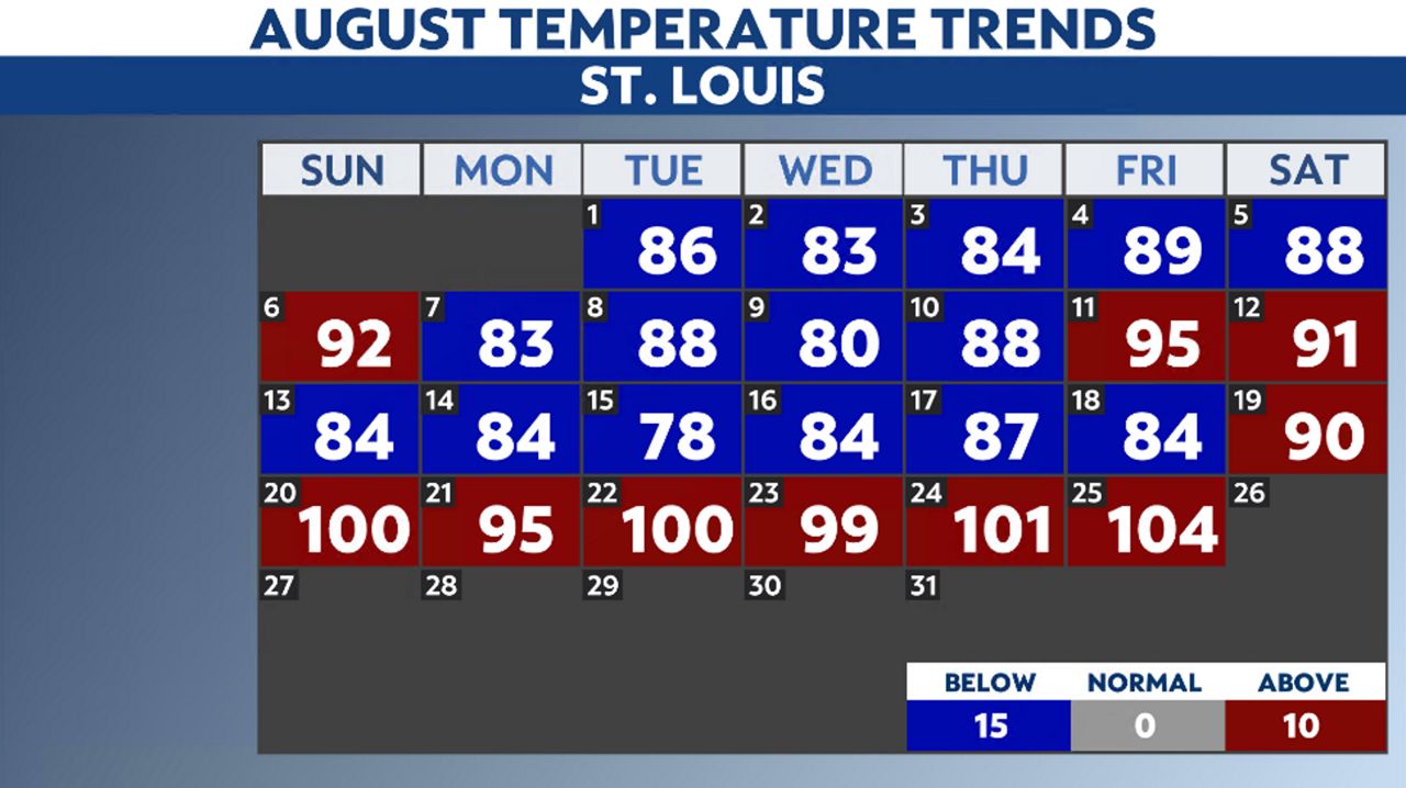
It was just one week ago when the temperature only reached a high of 78 degrees. It appears Mother Nature flipped a switch and decided August would not only see some heat but humidity as well.
On average, the St. Louis area sees seven 100-degree days during the year. So far, St. Louis Lambert International Airport has hit triple digits six times, twice in July and four times in August.
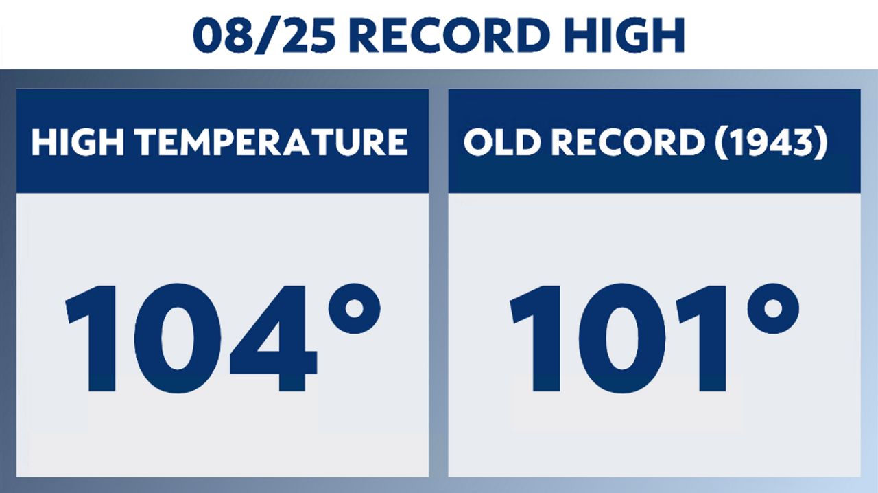
One day did break a record, Aug. 25 when the mercury soared to 104 degrees, breaking the old record of 101 degrees, set back in 1943. Other records include heat index values.
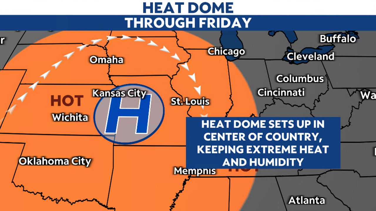
The reason for the heat and humidity is courtesy of the heat dome or ridge of high pressure system sitting over the center part of the country. The hot air from the southwest and the humid air from the south are transported north into our region.
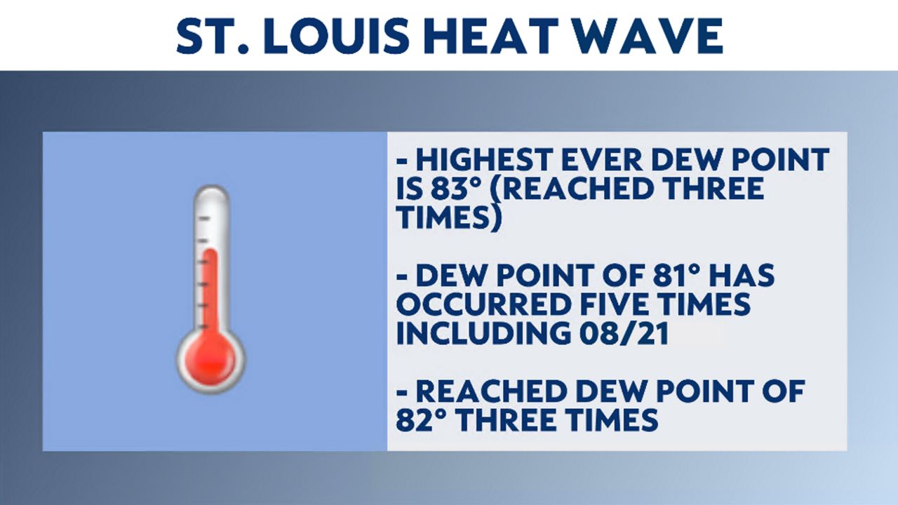
The dew point is a measure of the amount of moisture in the air. This relates to how humid it feels outside.
The relative humidity is the amount of moisture in the air to the amount of moisture the air can hold.
If the temperature and dew point are equal, relative humidity will be 100% and condensation will occur. We’ve seen this happen the past few mornings as pockets of fog have developed.
A typical dew point value for St. Louis in the summer is anywhere from the 50s to the 70s. The higher the value, the more humid it feels.
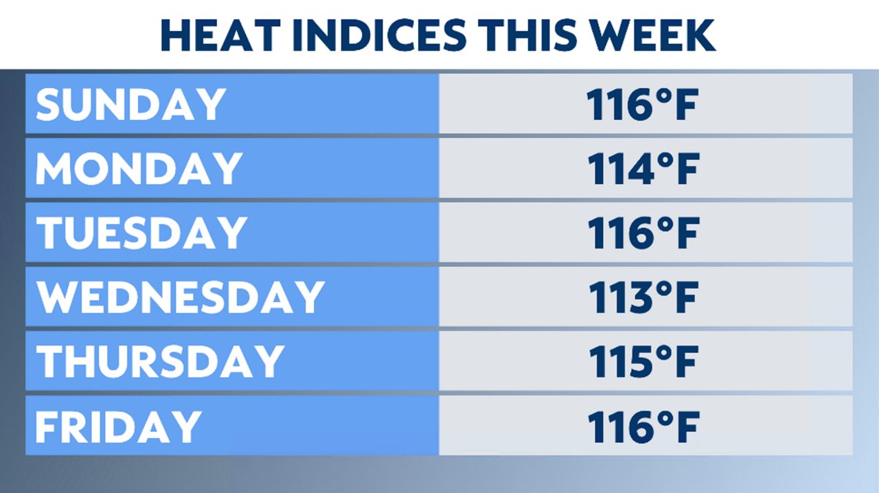
The heat index is the “feels like” temperature and is calculated from the temperature and relative humidity. With such high humidity in place this week, heat indices have soared.
On Aug. 20, the heat index peaked at 116 degrees despite the temperature *only* reaching 100 degrees. If this value sounds extreme, it’s because it is extreme. Aug. 22 the heat index reached 116 degrees with a temperature of 100 degrees.
The St. Louis area has only a 0.2% of seeing a heat index of 115 degrees or higher each summer. Since 1946, it has only happened in eight years, which now includes 2023.
The heat index reached 110 degrees or higer six days in a row. This ties the second-longest streak of 110+ heat indices for St. Louis.
The heat peaked on Friday with that 104 degree temperature. The good news is that cooler air will filter into place for the weekend and on into next week.
Our team of meteorologists dives deep into the science of weather and breaks down timely weather data and information. To view more weather and climate stories, check out our weather blogs section.