March begins a new meteorological season, meteorological spring. Before discussing the outlook for this season, let’s look back at meteorological winter.
Meteorological winter includes the months of December, January and February.
In late fall, the National Weather Service, along with the Climate Prediction Center, predicted winter 2022/2023 to be the third consecutive winter that La Niña would affect the United States.
La Niña is a seasonal climate pattern influenced by the ocean temperatures in the Pacific Ocean. The previous two La Niña winter seasons in the St. Louis area recorded decent snowfall totals with 12.1 inches for the 2020/2021 season and 11.2 inches for 2021/2022.
Both seasons accumulated the most snow during the month of February. With La Niña in control once again, snow enthusiasts rejoiced and were hopeful for a snowy winter.
However, that snow never really happened. In fact, by the end of meteorological winter, only 4.6 inches of snow had accumulated, or only about 35% of the seasonal total.
The overall storm pattern seemed to bring moisture first, followed by cold air, but getting the moisture and cold air to meet up happened rarely. This proves that La Niña does not show a clear climate signal in the St. Louis area.
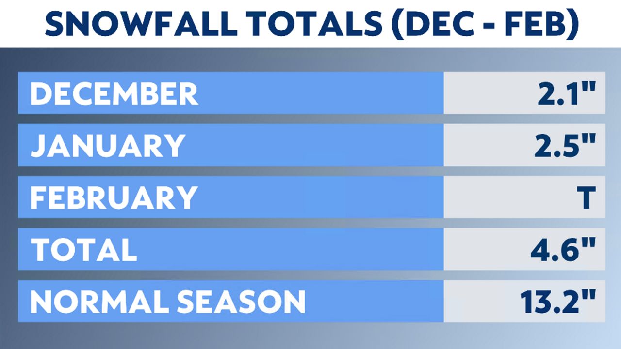
Only three snow events during the season produced more than a trace of accumulation. The region was either too warm and precipitation stayed rain or too cold, and the air became too dry, like what occurred right before Christmas.
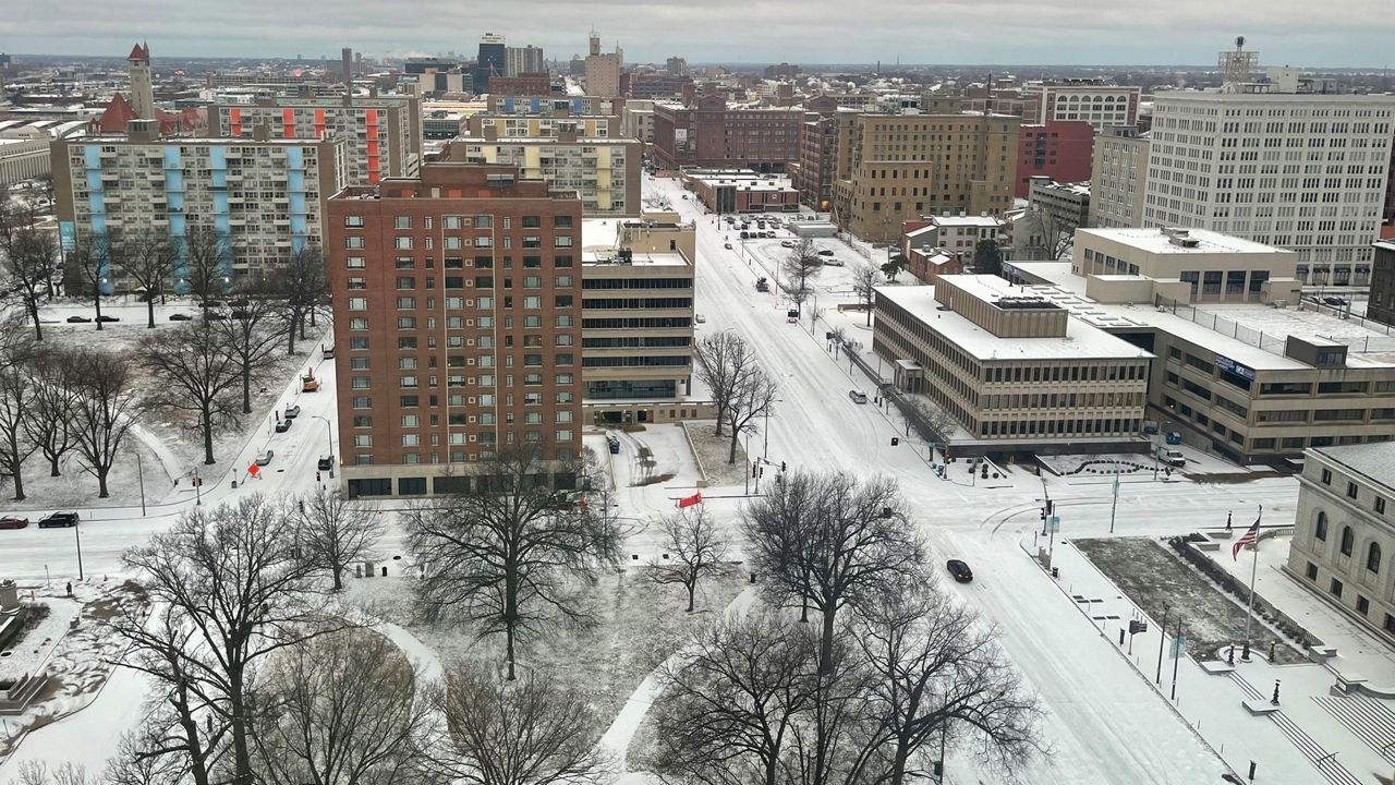
A potent storm brought cold air and moisture on Dec. 22, looking like our best chance at accumulating snow. The St. Louis Lambert International Airport did measure 1.8 inches of snow, but amounts could have been higher had the wind not become so strong.
As the layer of air cooled and rain became snow, the gusty winds dried out the air and blew the snowflakes apart before they could fall to the ground.
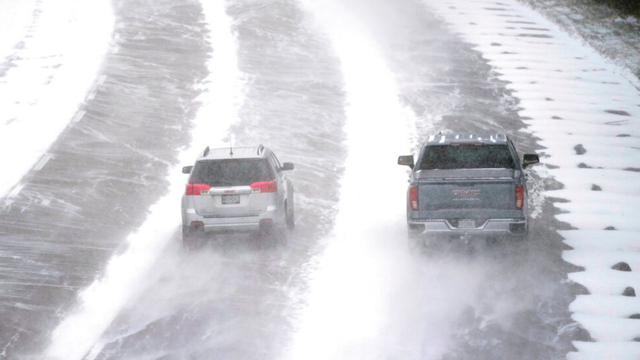
The coldest days of the month were Dec. 22-23, when temperatures dipped to -6 degrees. With gusty winds, wind chills reported around -30 degrees. Dec. 2022 ended as the ninth-coldest in St. Louis records.
2023 began on a warm note with highs in the 60s and 70s the first three days. No accumulating snow fell until Jan. 25. With temperatures in the mid-30s, precipitation began as rain. With colder air moving in, rain was forecasted to change to snow and stay as snow.
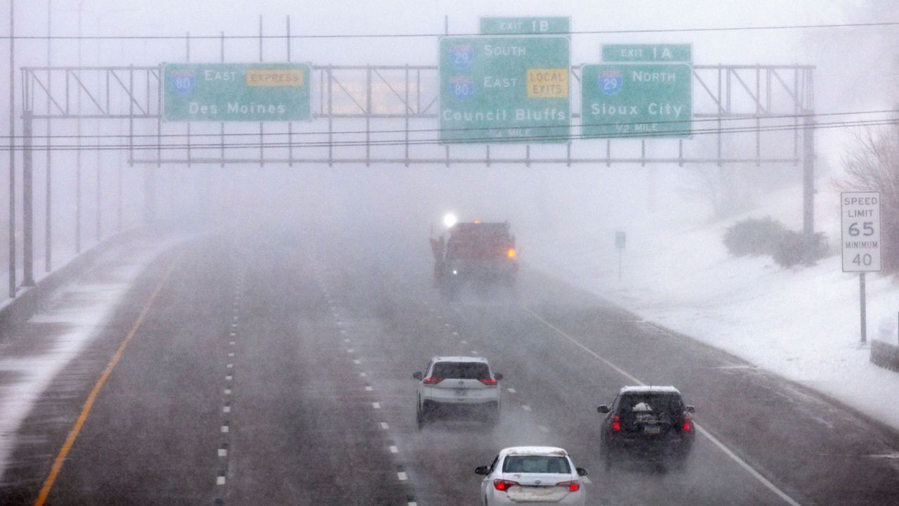
However, around the metro and regions north and west, some warmer air moved in and changed the snow back to rain, reducing totals. The precipitation ended as some light snow and Lambert measured 2.1 inches for that storm. Areas south of I-44 in Missouri saw closer to 6 inches.

January ended as the ninth-warmest on record with data going back to the 1800s.
February, usually a snowier month for St. Louis, was lackluster. A trace of snow fell at the airport on Feb. 16 and that was all for the month.
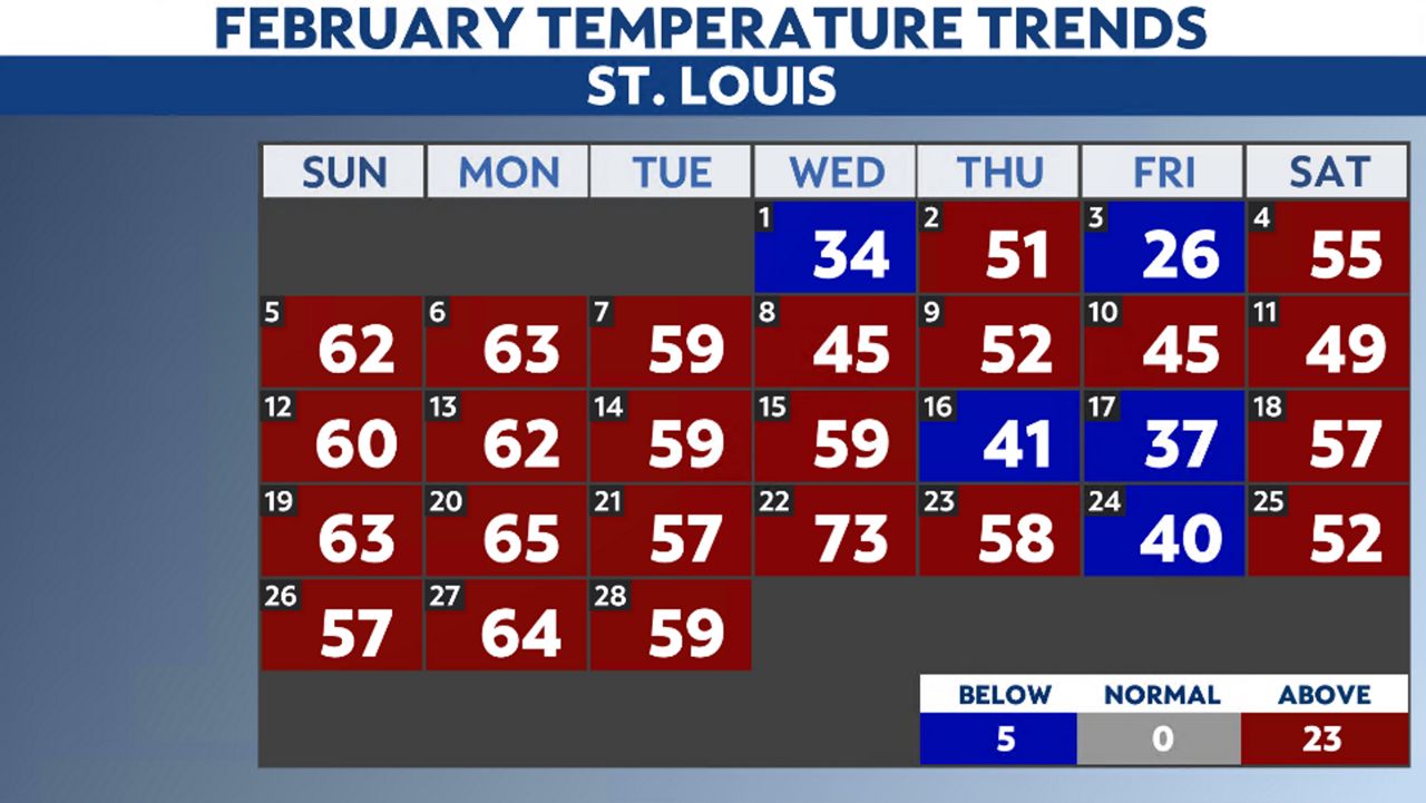
In fact, 23 out of the 28 days saw highs above average. The mercury reached 73 degrees on Feb. 22. With such warm weather, Feb. 2023 came out as the sixth-warmest on record.
Although it wasn’t a snowy winter, it wasn’t a dry winter by any means. In fact, precipitation totals for the season fell close to seasonal norms.
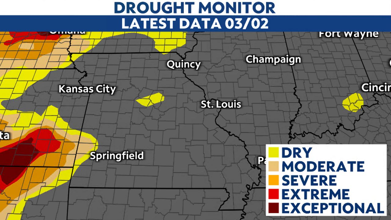
This helped keep our drought situation in check, which is good news, considering how bad the drought was last summer. We enter meteorological spring with 95% of the state in the “none” category for drought.
According to the Climate Prediction Center, the precipitation outlook for meteorological spring calls for wetter than normal conditions and close to seasonal values for temperatures.
Our team of meteorologists dives deep into the science of weather and breaks down timely weather data and information. To view more weather and climate stories, check out our weather blogs section.


