The month of November saw several extremes, from temperatures in the 80s and 30s, to a surprise snow event. Will a wonky weather November mean an equally extreme December?
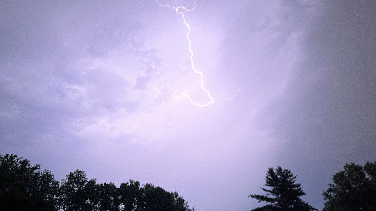
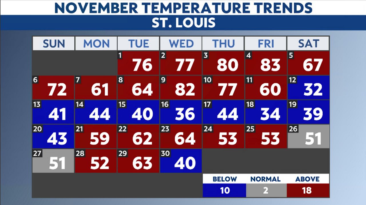
The month started on a warm note — in fact, the first 11 days recorded above-average readings. Nov. 4 hit 83 degrees, breaking the record set back in 1978. A cold front went through the area early on Nov. 11, dropping temperatures significantly.
As temperatures fell throughout the day, the forecast for that night called for a few snowflakes south and east of the St. Louis metro. With temperatures in the 70s just 48 hours prior, the thinking remained that even if a snowflake fell, the ground temperatures would stay well above freezing.
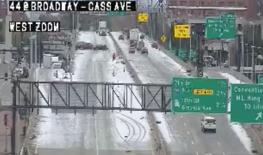
Overnight into the morning of Nov. 12, a low-pressure system moved northward, closer to the area than originally thought. This storm system contained a narrow band of intense snow. This snow band dropped anywhere from 3 to 6 inches of snow from near Farmington, Mo., to Effingham, Ill.
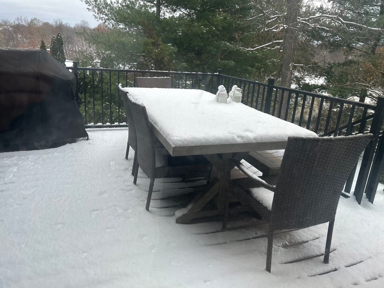
With such intense snowfall rates, residents of these locations woke up to several inches of snow-covered grounds and roads. Missouri Department of Transportation (MoDOT) reported several accidents on major bridges and roadways.
Snow flurries stuck around for much of the day as the high temperature only reached freezing. It was quite a contrast from earlier in the week.
The cold air settled into the region and for the entire middle part of the month (Nov. 12–20), temperatures stayed in the 30s and 40s for highs, well below the average in the mid-50s.
During this time, another snow event, thankfully, this one forecasted correctly, brought some light snow, around 0.5”–2” north and west of the region on Nov. 15. With ground temperatures above freezing, the snow didn’t stick to the roads and melted by noon. It was the best kind of snow, pretty to look at, but no impacts.

Thanksgiving week brought warm air into the region with temperatures in the 50s and 60s. Turkey Day itself remained cloudy, with only minimal showers and temperatures slightly above normal, in the mid-50s.
The end of the month saw temperatures range from the 60s to the 40s
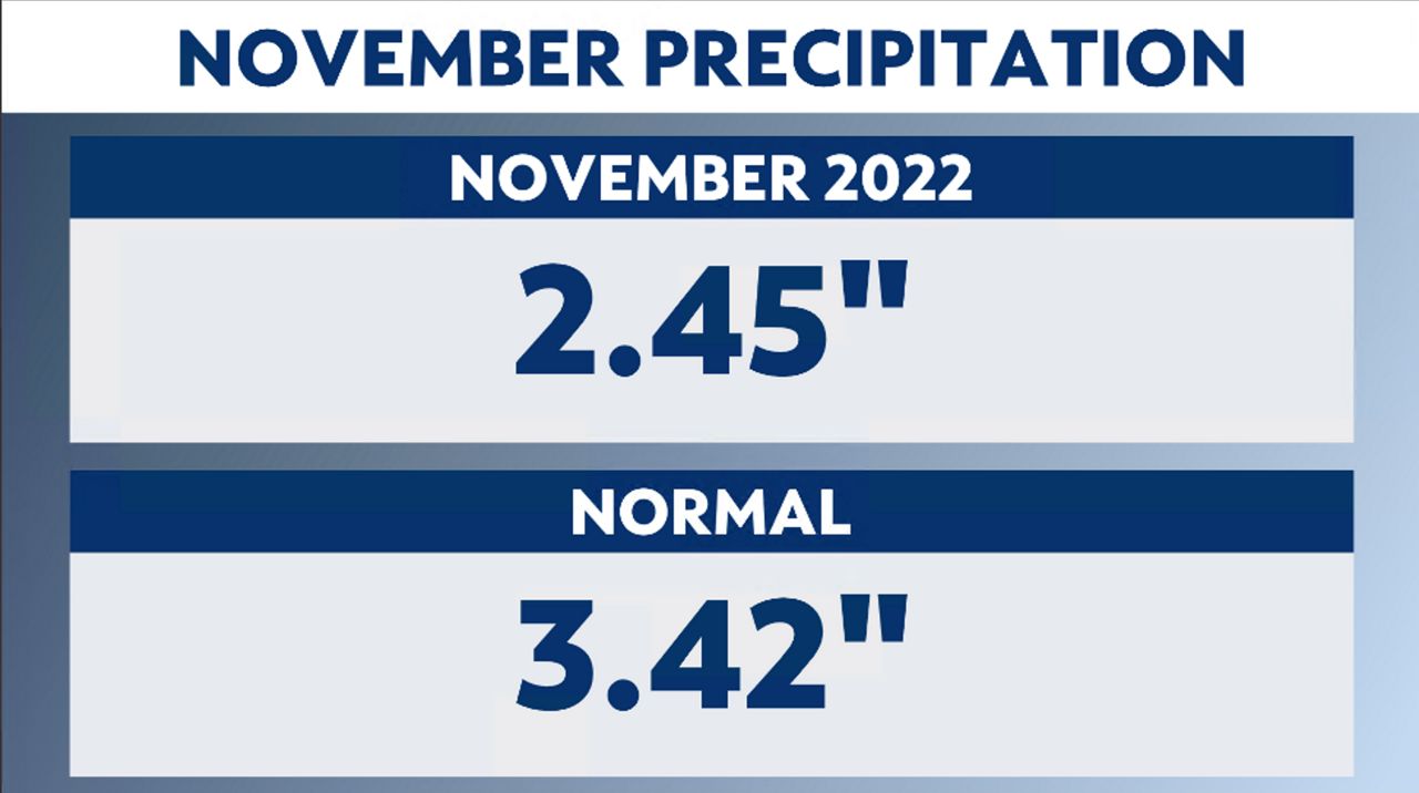
Precipitation lacked a bit during the month, ending with just shy of 2.50 inches of snow, giving us a deficit for the month of nearly an inch. Snowfall reached 0.9 inches of snow at the St. Louis Lambert International Airport, average for the month of November.
December averages 2.50 inches of precipitation, drier than November.
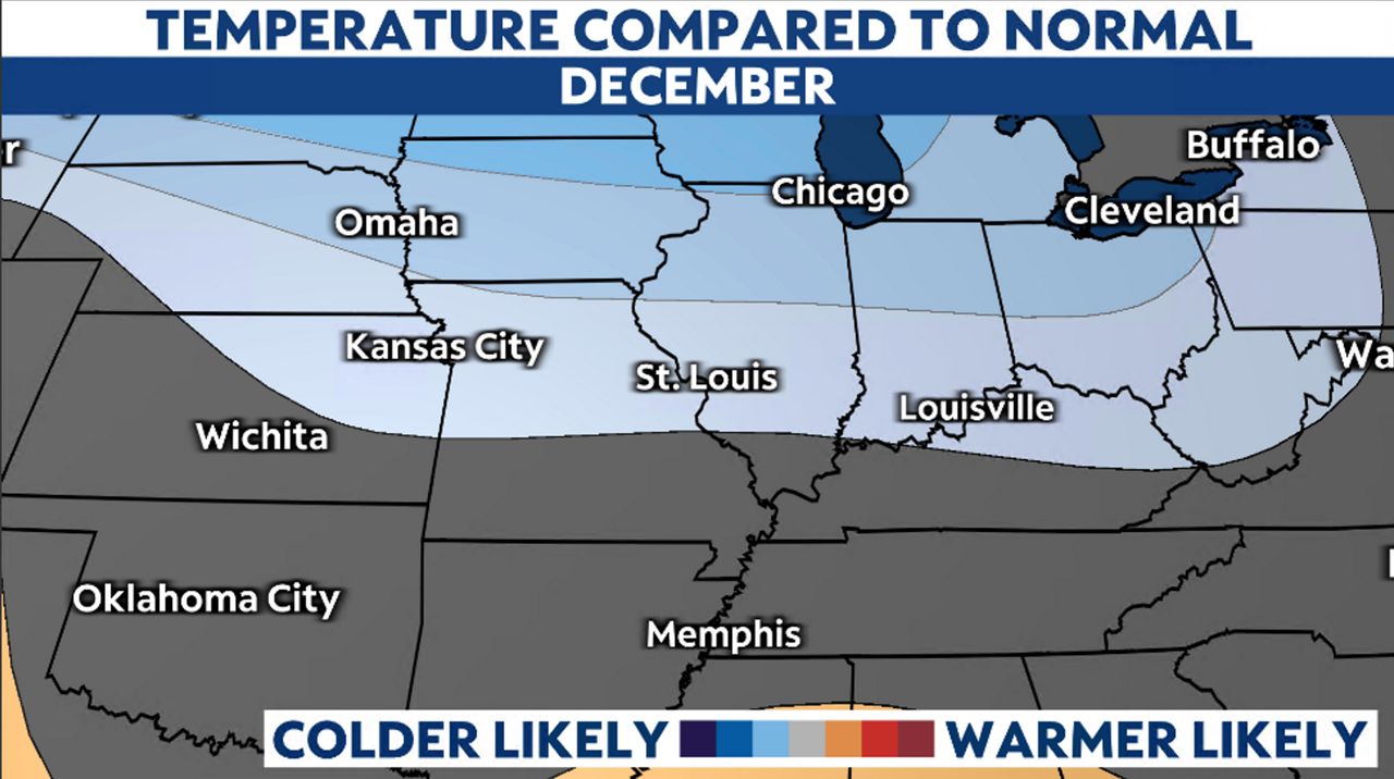
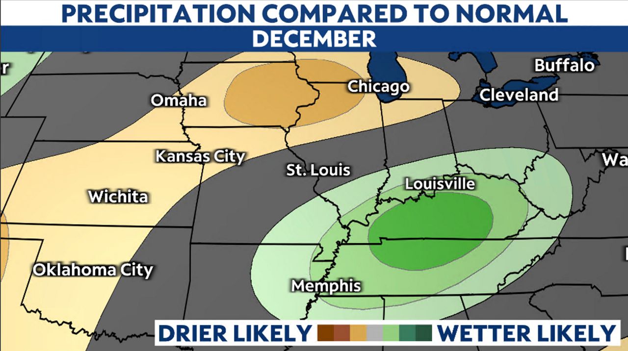
The Climate Prediction Center’s outlook shows a climate signal of colder than average in the region and close to average for precipitation for December.
One note to add, the Ohio River Valley, located southeast of St. Louis, shows a wetter than a normal signal for December. If that shifts northward, the region could see more precipitation.
Our team of meteorologists dives deep into the science of weather and breaks down timely weather data and information. To view more weather and climate stories, check out our weather blogs section.