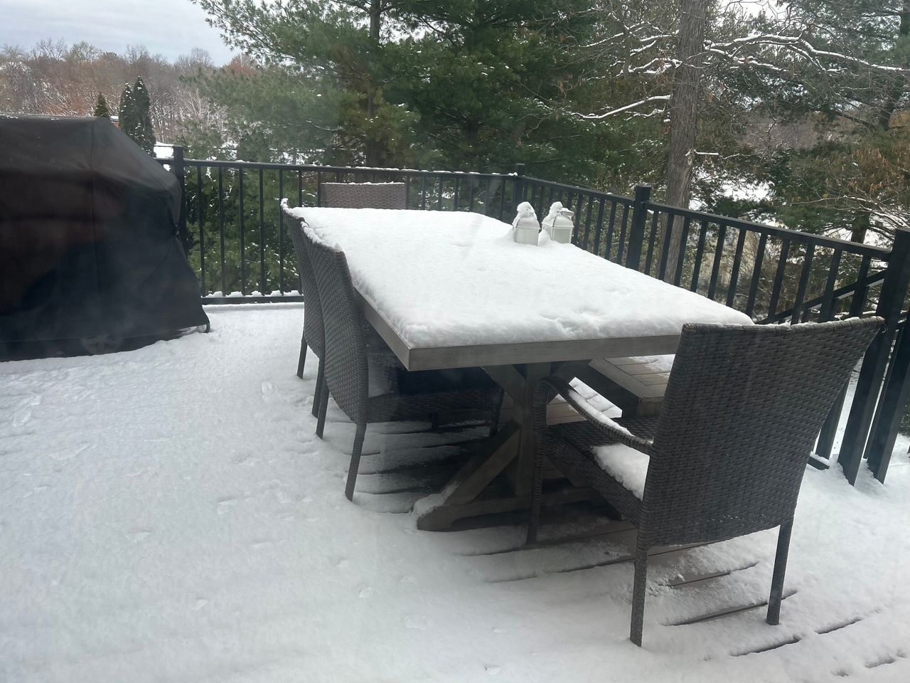
Now that the area has received its first and even second round of snow, let’s talk about the outlook for the actual winter season.
The National Weather Service in St. Louis recently held a Winter Climatology and Seasonal Outlook session to discuss what goes into making a snow forecast.
On average, the St. Louis area receives around 16” of snow per season, based on historical data from 1991 to 2020. Months that snow typically occurs in the region include November, December, January, February and March.
NWS meteorologist Jayson Gosselin used data over the past 40 years to explain trends. One interesting point about accumulating snow in the area involves a storm’s track.
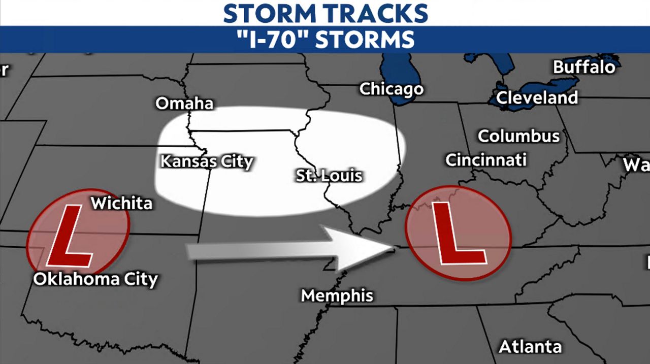
The best chance for accumulating snow in the St. Louis metro will come from a southern tracking storm, meaning a storm that tracks from the southwest to the northeast. Dubbed the “I-44 storms,” 58% of winter storms from 1980 to 2021 have followed this path.
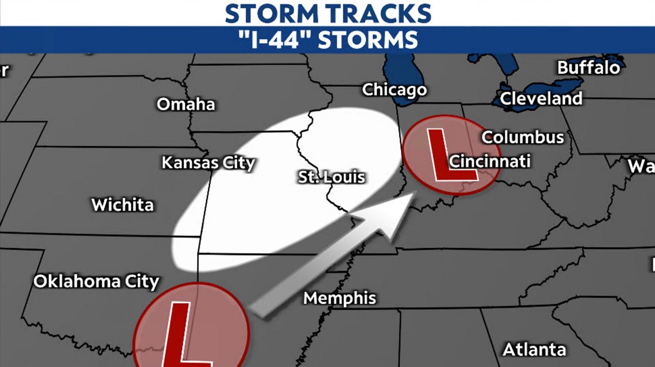
Compare these storms to the “I-70 storms,” or west-to-east tracking storms, which account for only about 33% of accumulating snow storms in the area.
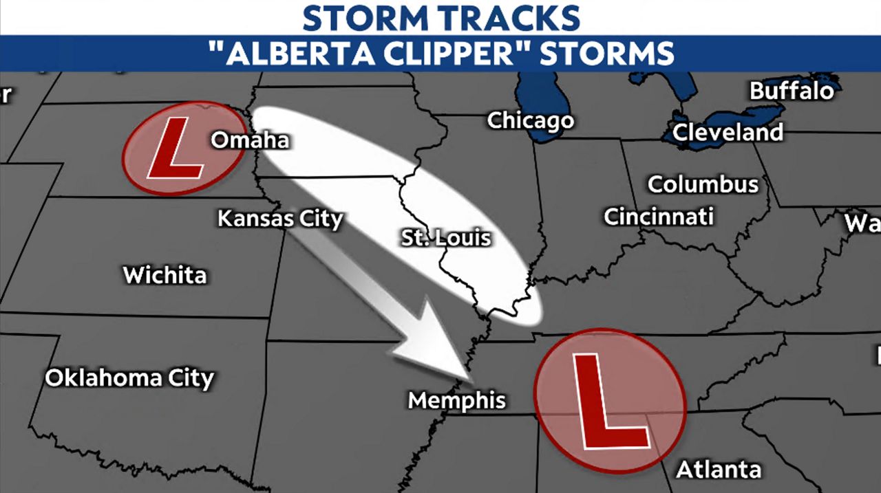
The least likely storms for snow accumulation in the area stem from “Alberta clippers,” named for the region in Canada where they originate. These storms travel from northwest to southeast across the area and account for about 3% of all accumulating storms and they produce only light snow.
As for ice storms (ice over 0.25”), the data analyzed included similar years from 1980 to 2020. The results showed that the St. Louis area can expect an ice storm every other year. The decade encompassing the 2000s saw an impressive eight ice storms. Last year recorded no ice storms.
Overall, January racks up the most ice events. Based on just this information, an ice event has a higher likelihood of occuring this upcoming season.
Gosselin explained that a heavy snow event (6” or more of snow) in the region typically happens annually, with two to three types of storms. However, over the past decade, the data has seen a decline in these “big” storms and over the past 40 years, storms of this intensity have decreased by 17%.
He mentioned that the big snows occur later in the season, and not to discount March. “We have seen some big snows in the month of March.” He added, “March tends to be snowier than November.”
When making a seasonal outlook, parameters included in a forecast include recent trends and ENSO patterns, like El Niño and La Niña. For the third straight winter, La Niña will influence our weather. Gosselin says that this is only the third time that there have been three straight La Niña seasons.
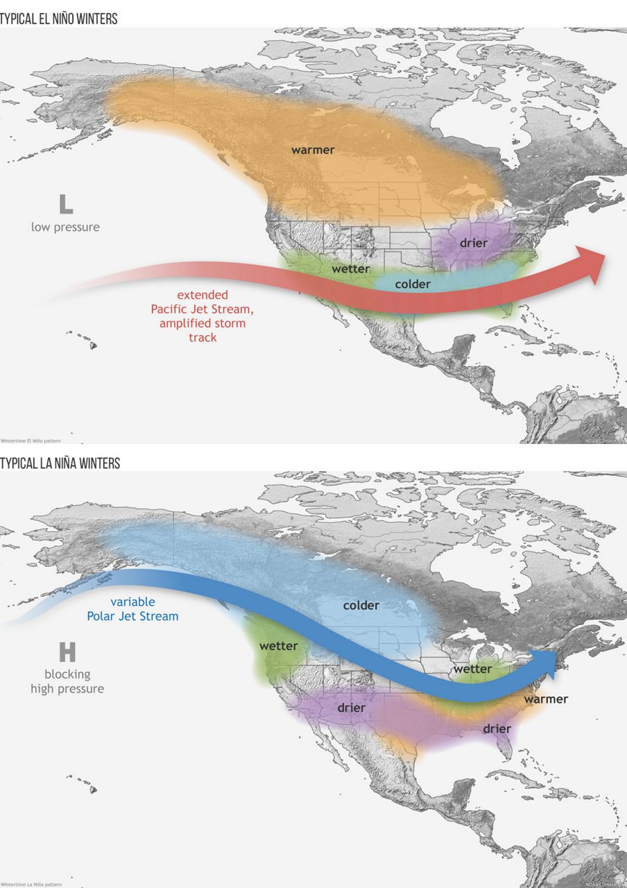
La Niña doesn’t show a climate signal one way or the other in the Mississippi Valley, meaning the area has equal chances of seeing a colder than average or warmer than average winter and a wetter or drier than average winter.
Whether a weak, neutral or strong La Niña would lean one way or the other for the region, the data shows highly variable conditions, meaning not enough of a signal to support more or less precipitation or colder or warmer temperatures.
Climatologically, January and February are the snowiest months of winter. However, Gosselin mentions that the climate models this year suggest wetter conditions later in winter, including March.
Last year’s winter saw 12” of snow overall, four inches below the seasonal normal. With recent snow events, the St. Louis Lambert International Airport has already accrued 0.9” of snow. Does this mean snow early in the season will equate to a snowy season overall? The short answer, no.
Gosselin and his team used historical trends and expected patterns to make their forecast. Based on this information, December and January will probably see near average precipitation, but warmer than normal temperatures. It's not looking like much winter weather.
As for February, Gosselin says “that month shows the best chance for winter storms and extreme cold.”
Our team of meteorologists dives deep into the science of weather and breaks down timely weather data and information. To view more weather and climate stories, check out our weather blogs section.