With September beginning, it’s also the start of a new season, Meteorological fall. How did Meteorological summer fare compared to the normal?
Meteorological summer comprises the entire months of June, July and August.
Jayson Gosselin, Climate Guru, at the St. Louis National Weather Service Office, explains that summer 2022 ranked high in terms of heat. “Summer 2022 ended with an average temperature of 80.6 degrees (+2.0F) and was tied for the 14th warmest on record (records date back to 1874).”
38 days saw the mercury rise to 90 degrees or warmer and seven days topped out in the triple digits. July 23, 2022, had the highest temperature of the summer, when the mercury rose to 105 degrees.
With heat like that, my son and I had attempted to use the sun to bake cookies on the dashboard of my car. See the fun video below.
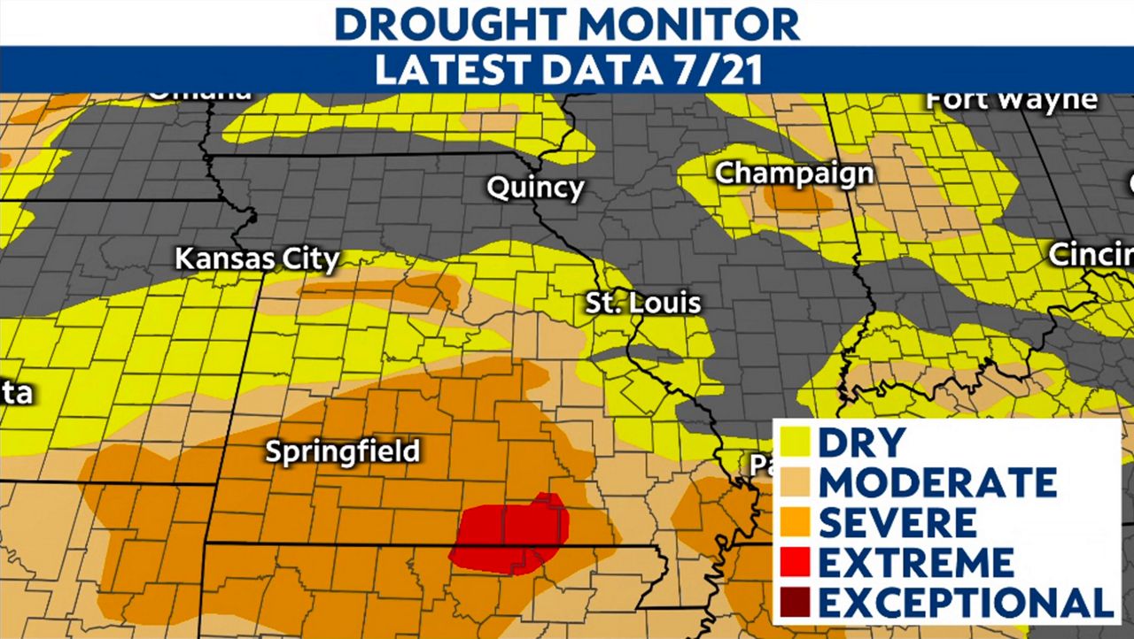
Summer was off to a dry start. June ended with a deficit of rainfall of 2.70 inches. July began on a dry note and concerns of drought arose by mid-month with the St. Louis region in the dry and moderate categories.
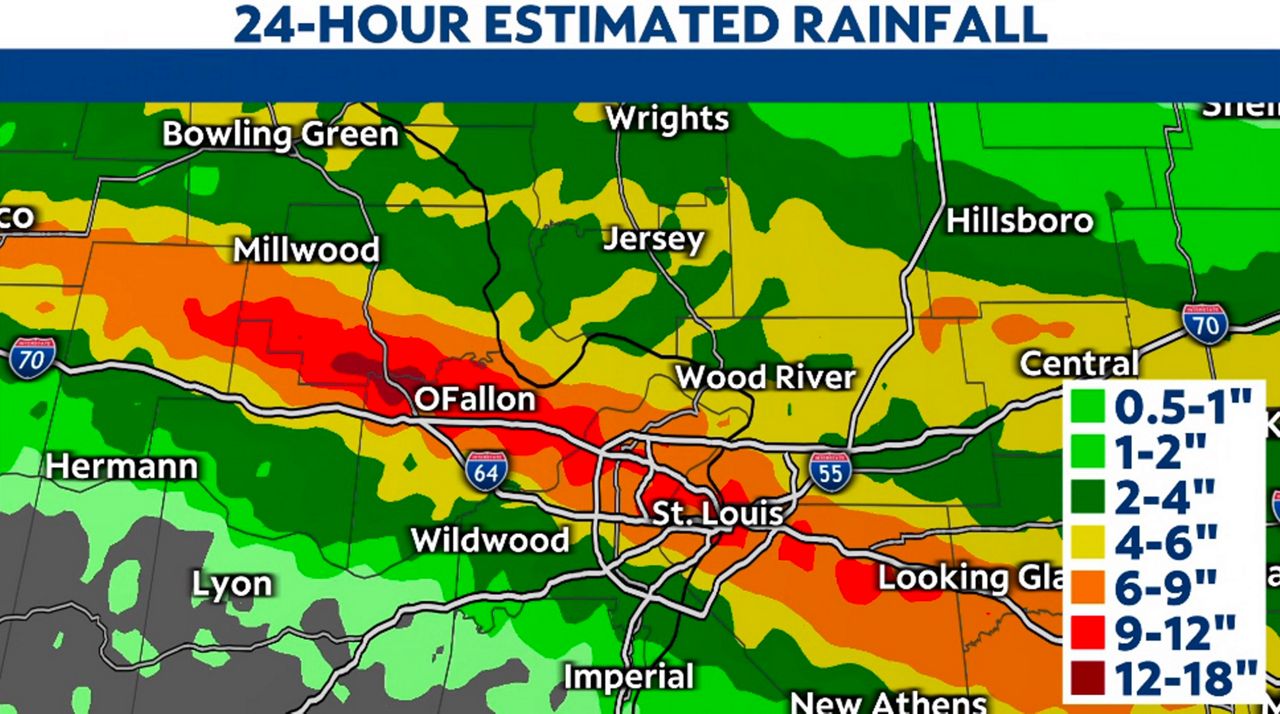
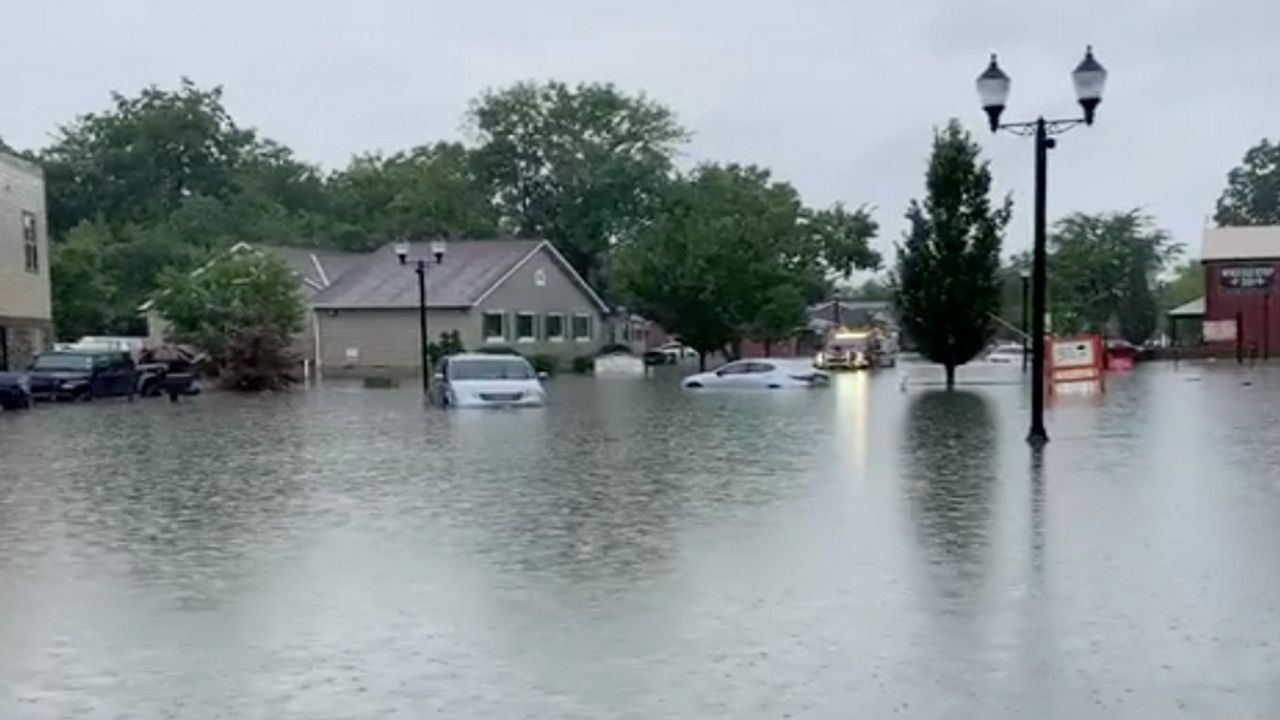
Then July 26, 2022 happened. A storm system brought thunderstorms to the region. 8-13+ inches of rain fell in the area over a time span of 12 hours. Creeks and rivers rose under these “training” thunderstorms, causing catastrophic conditions.
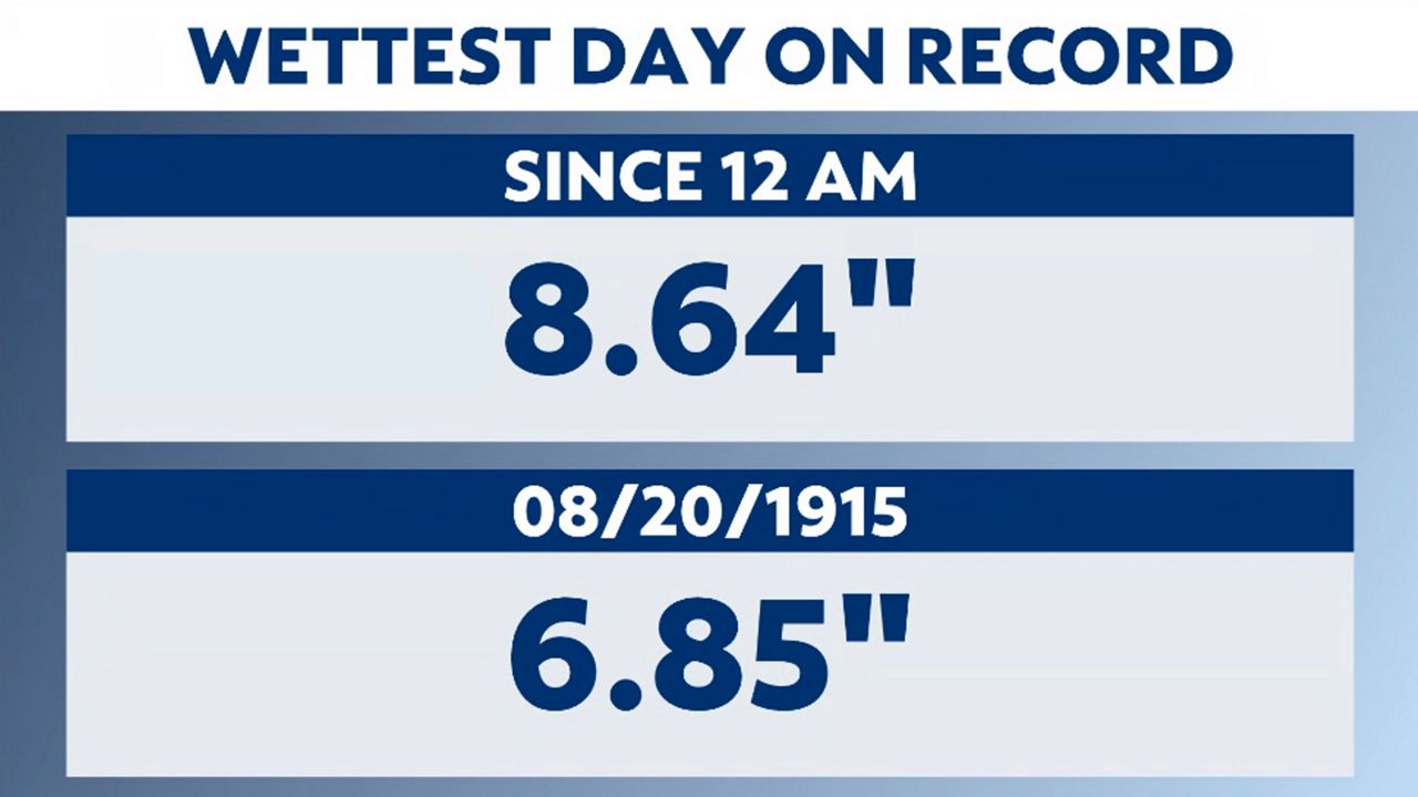
The St. Louis Lambert International Airport recorded their wettest day on record with 8.64 inches of rain. Flash flooding occurred all over the area, setting up a state of emergency. Water rescues in St. Peters and University City. Submerged cars and flooded basements had the counties of St. Louis and St. Charles declaring Federal Emergencies.
Two days later, another round of storms produced heavy rain, causing more flash flooding in areas still reeling from the previous 48 hours’ events. With this began the slow clean up and the anxiety of how many other storms would produce flash flooding events.
The next week saw another round of storms. This time rainfall totals were lower, 3-5 inches and thankfully the rain fell over a longer period, not producing any flooding. With all of this heavy rain, drought concerns were erased in the St. Louis region.
With such heavy rain events in July and August, meteorological summer concluded with 19.79 inches of rain, giving a surplus of nearly 8 inches for June, July and August combined.
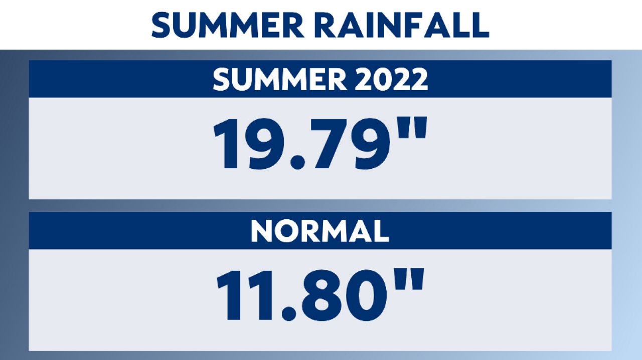
Summer, 2022, ranked as the 6th wettest on record for the region. What’s interesting to note is that while rainfall totals exceeded the norms during this period, only 30 out of the entire 92 days this summer recorded any precipitation (days with at least a trace of rain were included). This equates to 32% of the entire Meteorological summer saw rain.
“Does a hot summer equate to a cold and snowy winter?” I sought Gosselin’s expertise.
“There is little to no correlation from summer to winter, unfortunately. To help illustrate the point, 1901 had the hottest summer on record (82.7F). The following winter, it was quite cold. Meanwhile, the summer of 2011 was the 5th warmest summer, followed by the 7th warmest winter.”
The month of September leans slightly toward warmer than normal temperatures with equal chances for either above, near, or below normal precipitation. The normal precipitation for the month of September is 3.83 inches.
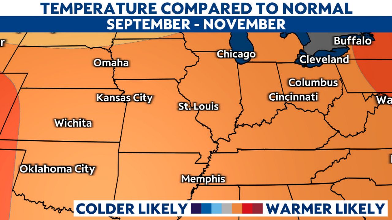
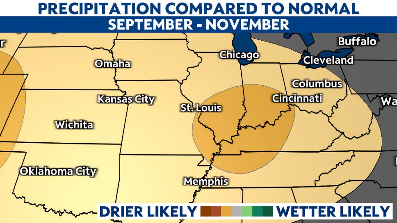
As for Meteorological Fall, Gosselin says the forecast “favors a warmer than normal meteorological fall (September - November) along with below normal precipitation.”