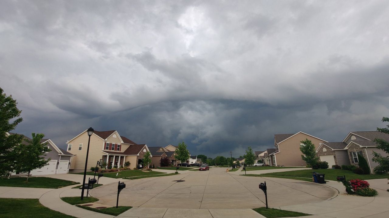
May 19, 2022, was an active weather day in the St. Louis region. Two waves of severe storms moved through the metro with hail, damaging winds and even weak tornadoes. Let’s recap the day.
Around noon on Thursday, severe storms moved through St. Louis County and St. Charles County, brushing by the city of St. Louis. Just south of Weldon Spring, there were wind gusts close to 60 mph. Plus, there were reports of trees down near Maryland Heights as well.
Viewers tweeted reports of pea-sized hail in St. Louis County.
The temperature at the Spirit of St. Louis Airport in Chesterfield, MO went from 76 degrees at 11:00 a.m. to 65 degrees at noon. Rainfall totals were around 0.5 inches. We also had storm observations to the north and west of these areas.
The thinking was, storms had affected the region around lunchtime, the instability would remain minimal by the time the second wave of storms would enter the area.
However, parts of the metro region, where that weren’t greatly impacted by the first set of storms, could overcome the instability and as the second waved came, there was enough fuel to keep the storms going.
This second set of storms were part of a large complex of storms that traversed the state of Kansas on Wednesday and then most of Missouri on Thursday.
What began in the morning near Springfield traveled north and east throughout the day, maintaining severe components. A Tornado Watch was then in effect for Jefferson County and areas south and west. Around 3:30 p.m., a Tornado Warning was in effect for Rolla in Phelps County.
The northern end of the thunderstorm complex showed rotating storms. The southern edge was bowing out, the telltale signs of strong winds.
Severe thunderstorm warnings and tornado warnings continued for Phelps, Franklin and Iron counties to our south and west. The thinking, closer to the St. Louis metro, was because of the severe storms that moved through hours earlier, there wouldn’t be enough instability to have as strong of an impact.
Cue, wave two just before 5:00 p.m. on the southwestern part of the metro. The southern part “bow echo” of the thunderstorm complex moved into Jefferson and southern St. Louis counties.
Swiping just east of Eureka, about 4:58 p.m., rotation occurred on the radar and the National Weather Service in St. Louis triggered a tornado warning for St. Louis and St. Charles counties until 5:30 pm.
The “tornadic” storm was moving north at 50 mph. Sirens went off in the area and people took shelter. However, 5:00 p.m. in St. Louis is rush hour, a lot of motorists were stuck on major highways.
A tornado signature was observed on the radar near Kirkwood just before 5:00 p.m. With tree debris reported in the region, the NWS sent survey crews to investigate the damage
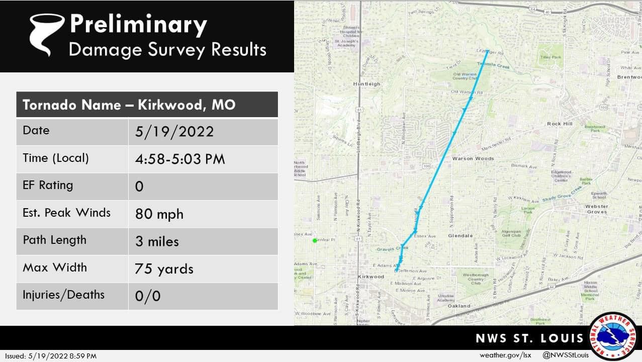
Survey crews estimated an EF-0 tornado in Kirkwood with winds of 80 mph based on the tree debris. The max width of the tornado was at 75 yards and was on the ground for about five minutes from 4:58 p.m.–5:03 p.m.
There was damage to trees along the path. The tornado lifted off the ground before moving east through the city of Ladue.
NWS sent survey crews to two other areas within St. Louis County, located not too far from Kirkwood. Their findings show an EF-0 tornado just northwest of Creve Coeur, around 5:07 p.m. and another EF-0 that touched down in Frontenac, MO and lifted near Chaminade High School around the same time.
Thunderstorm wind damage was also reported in St. Louis County.
About 5:30 p.m. tornado warnings expired for St. Louis and St. Charles County. The rotating storm moved northeast into Illinois, prompting warnings for St. Clair and Madison counties. There were two tornado reports in Illinois.
The southern part of the thunderstorm complex containing heavy rain and wind caused flash flooding on major roadways, I-55 south and Loughborough and in portions of the city.
Remember, if you ever encounter a flooded roadway, turn around and find a different route.
While these storms produced severe weather and damage from trees was noted, there have been no reports of injuries directly related to the storms.
This is good news and means people heeded the warnings. Do you know what to do when the sirens go off in your area? Do you have your plan in place for when you are home and out?
We received many pictures from viewers with amazing cloud images. Some may have appeared as a tornado or funnel cloud. A lot of the pictures received show a shelf or roll cloud. Let me explain all the differences.
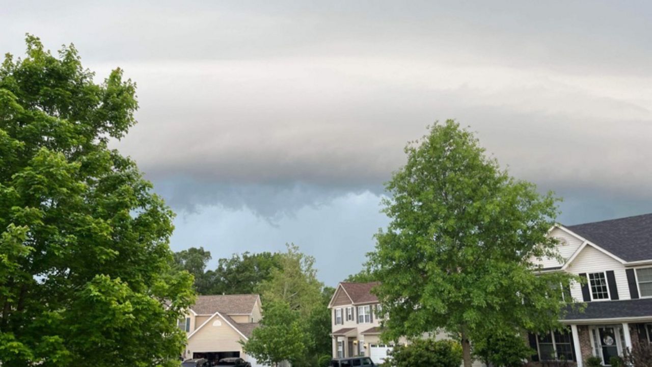
The first picture is from Julia in St. Charles. This shows a roll cloud. The cloud is the leading edge of the larger thunderstorm cloud (cumulonimbus) and the air that rushed into the cloud and is spreading out horizontally, looks like it is rolling along upon the horizontal.
This part of the cloud or storm contains gusty winds and is associated with the gust front. When you see this type of cloud, note that it will become windy. The storm went just to the east of St. Charles. A shelf cloud appears at the leading edge of the storm.
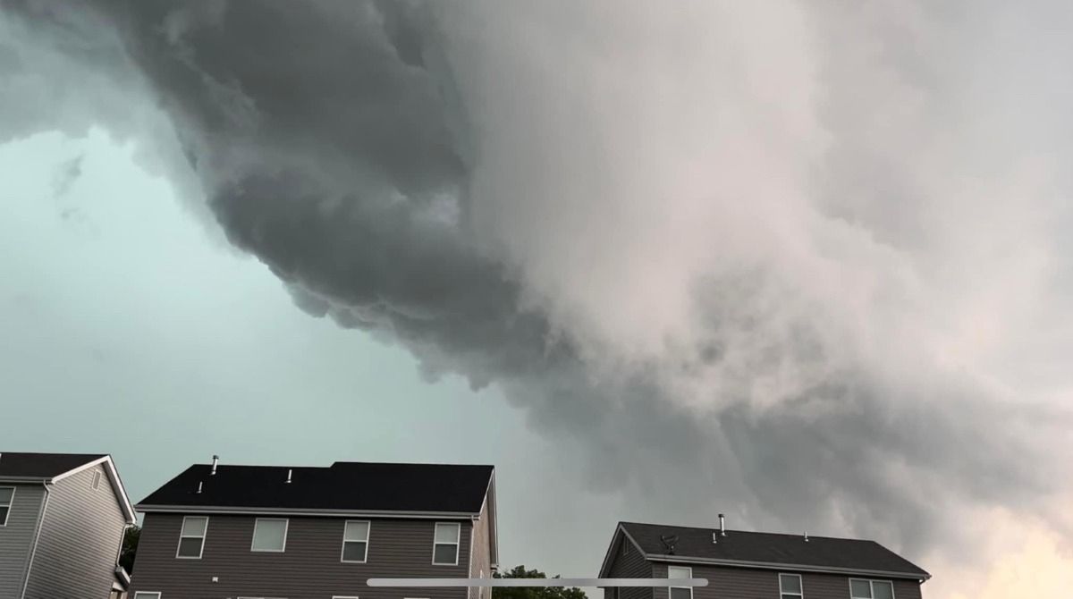
The second picture is of a rotating wall cloud. How to tell the difference is that it has a rain free base and it appears to be rotating on the vertical as air rushes up into the cloud. This is likely what triggered the tornado warning in Chesterfield Valley.
The radar picked up on rotation in the cloud. A wall cloud usually appears at the back end of the storm. A rotating wall cloud can turn into a funnel cloud and then, when it contacts the ground, becomes a tornado.
I had a lot of viewers send me pictures of clouds that they thought were funnel clouds, but in actuality, were rotating wall clouds. This happens frequently. The biggest difference is that with a funnel cloud, you will have rotation at the ground, not just in the sky.
A tornado forms from a rotating thunderstorm. Air rises in a thunderstorm and can spin when there is wind shear (wind blowing different speeds and directions in the atmosphere above the ground).
As air rises and is influenced by this shear, it spins. This creates a horizontal column of rotating air. In order for a tornado to develop, there also needs to be air rotating on the ground, something that was lacking in most places yesterday.
This occurs when air in a thunderstorm is cooler and sinks and spreads out on the ground. The warmer air (updraft) rises into the storm, while the cooler air (downdraft) sinks as it blows across the ground.
With enough rising and sinking air, the air on the surface spins. The spinning air on the ground speeds up and is drawn into the storm. The spinning horizontally moving air across the land can then be tilted vertically by the force of the rising, rotating air. This process allows a tornado to form.
Conditions need to be ideal for a tornado to form. Most tornadoes form from Supercell thunderstorms, but not all Supercell thunderstorms produce tornadoes. The reason is that of the rotating air near the ground.
It needs to rotate fast enough to be forced into the storm. Also, if the ground air rotating is cold, it will spread away from the storm and a tornado cannot form.


