A potent weather system brought an end to the dry stretch of weather in the St. Louis area. It began raining on Sunday and continued through midday on Tuesday.
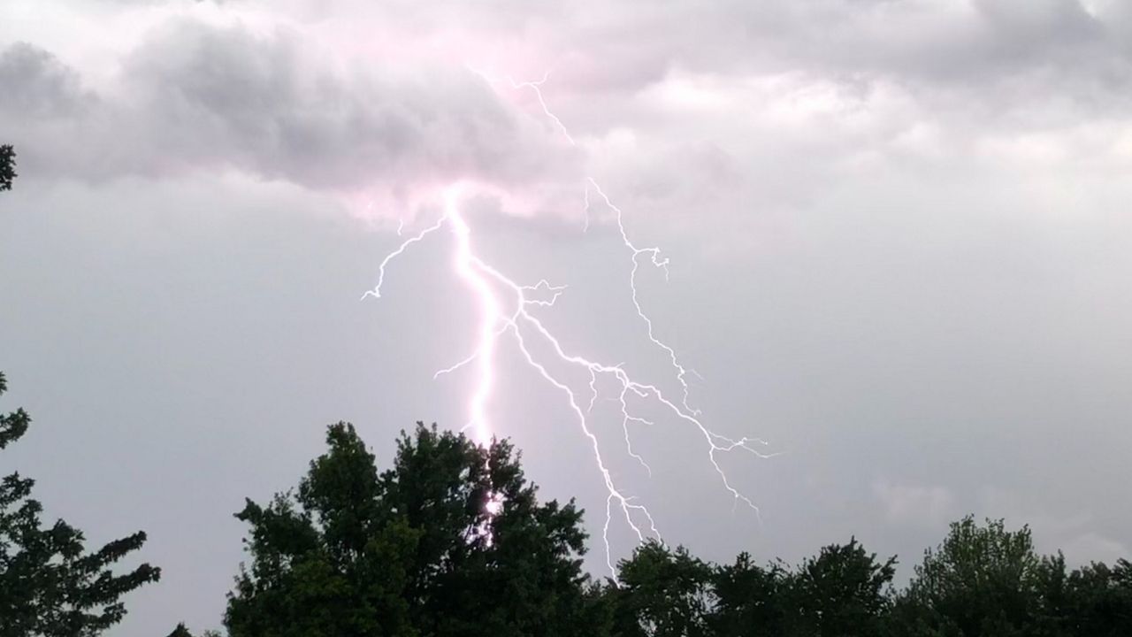
One round of rain and storms produced severe weather, including an EF0 tornado causing damage to a pole barn and several trees. Another round caused flash flooding, leaving vehicles stranded and highways shut down.
St. Louis is used to rain and storms, but after such a dry September and October, chances of a soggy November seemed slim. However, the synoptic scale weather pattern that set up over the weekend renewed hope for wet weather.
A storm system entered the United States from the West Coast over the weekend, moving across the Desert Southwest. As it pushed eastward, moisture from the Gulf of Mexico was drawn into and streamed north into the St. Louis area.
Rain began falling on Sunday, becoming steadier throughout the day and by evening, moderate showers were widespread across the metro. The storm system moved slowly, as a warm front lifted north across most of Missouri.
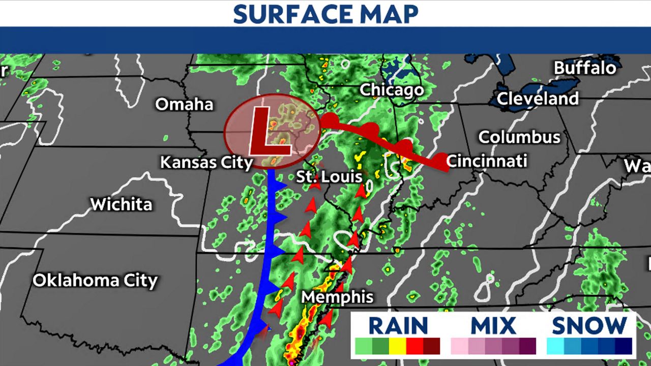
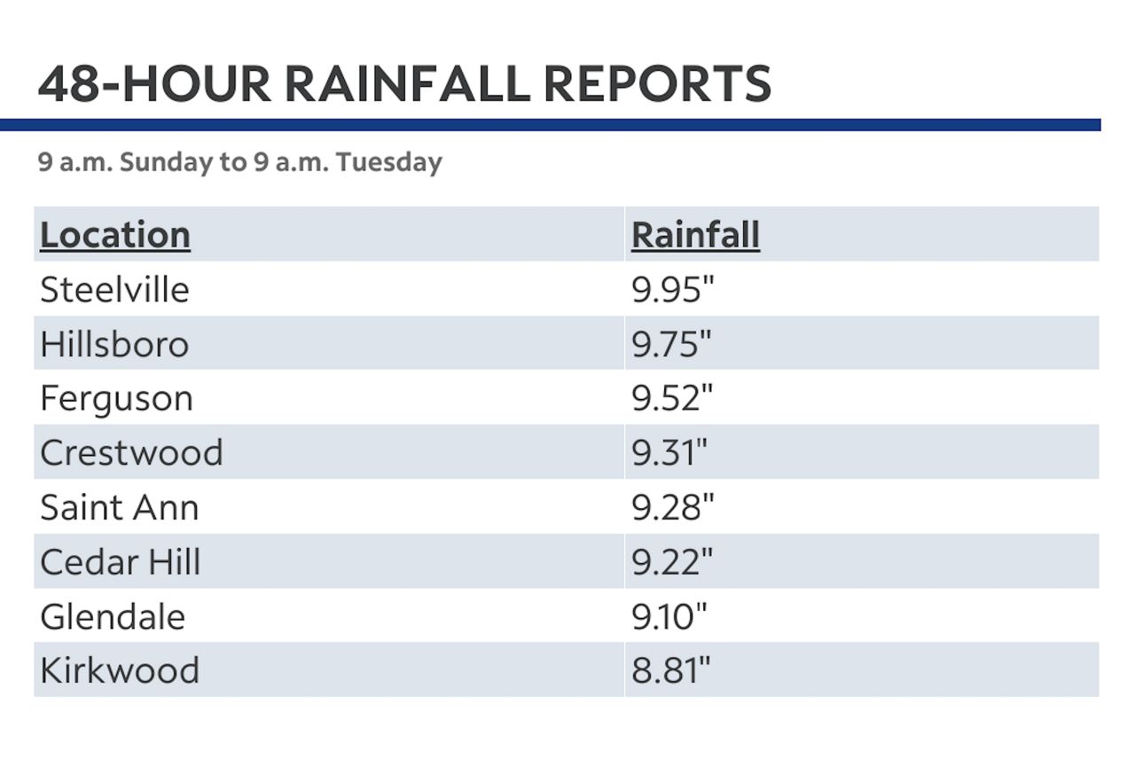
This front acted to enhance the moisture streaming in from the south, and by Monday, rain with embedded thunderstorms fell throughout the day. The heaviest rain remained south of St. Louis, with St. Francois, Iron and Ste. Genevieve counties collecting over seven inches of rain.
Flash flooding was prevalent across the region, causing officials to evacuate a community near the Iron Mountain Creek levee. With so much rain, the levee was at risk of failing.
Ahead of the cold front, storms merged into a QLCS and surged eastward Monday evening toward the western part of the metro. Even though it had rained almost the entire day, instability still existed, and it was this instability that caused rotation in a storm in the northwestern part of St. Charles County.
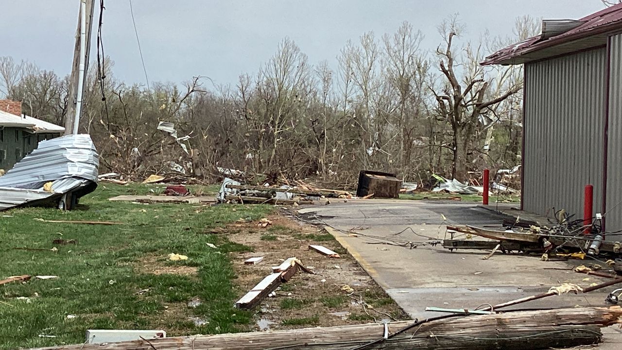
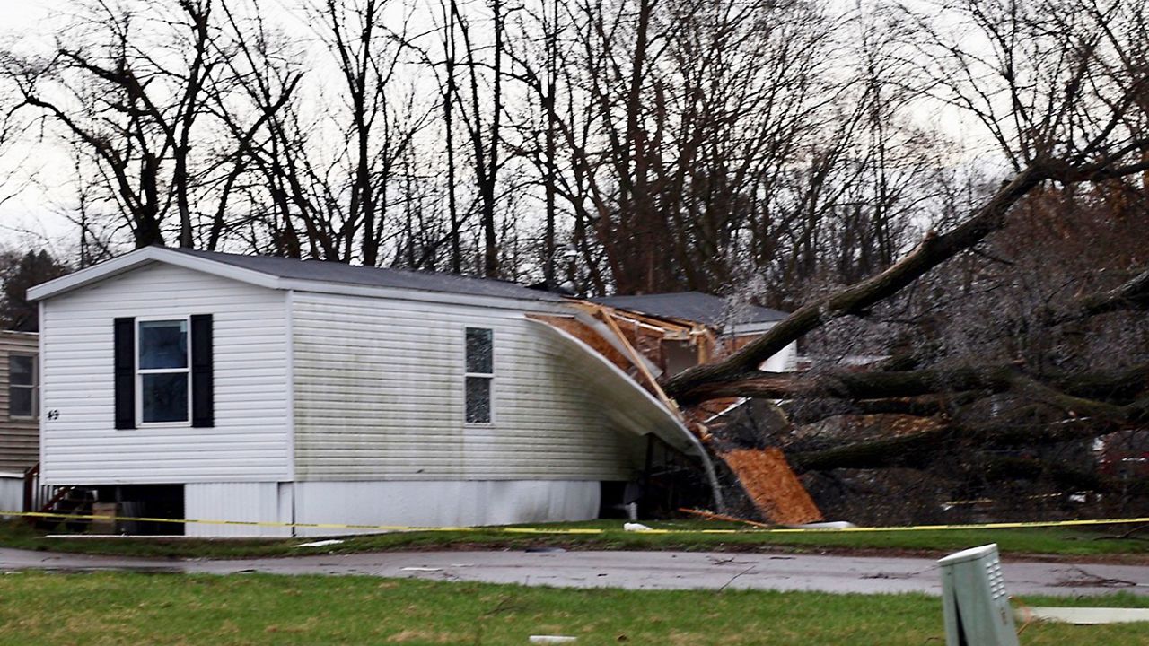
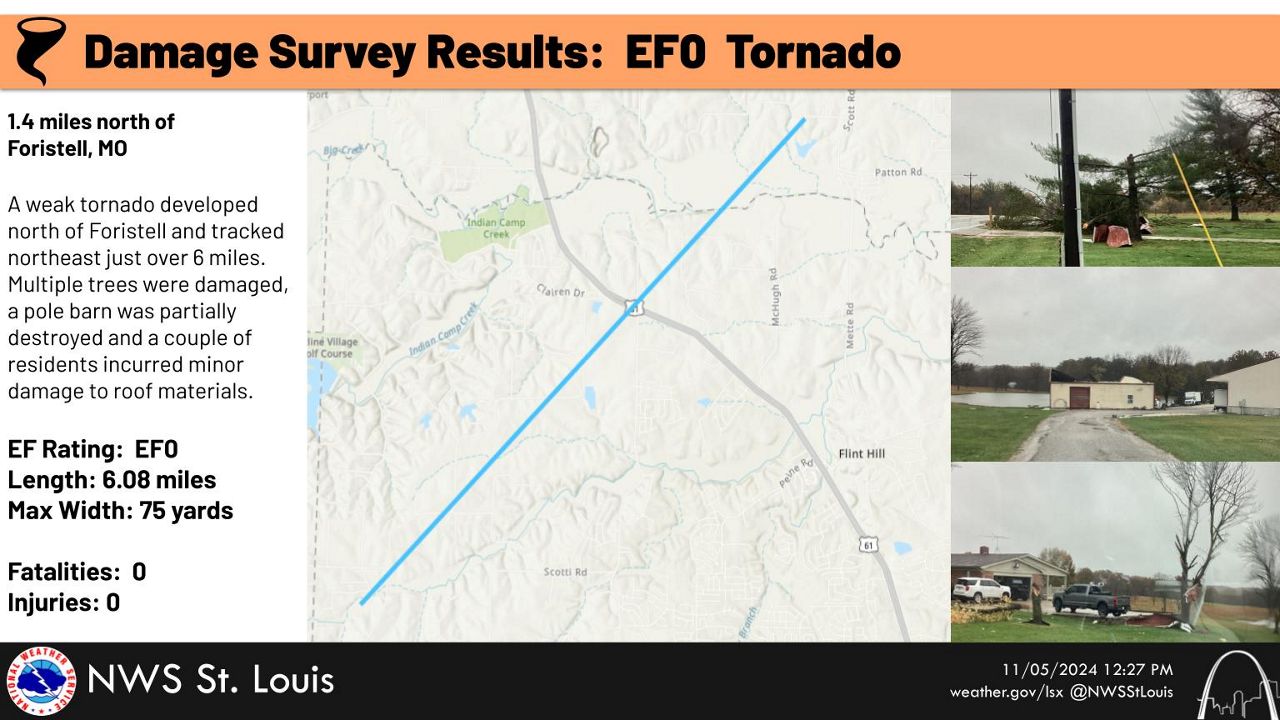
Around 9:40 p.m., a tornado warning was issued for this location in St. Charles County and southern Lincoln County. National Weather Service survey crews found evidence of an EF0 tornado that touched down 1.4 miles north of Foristell, Mo.
The tornado was on the ground for nearly 10 minutes and tracked just over six miles. Winds were estimated at 75 mph and damage was confined to trees, a pole barn and some minor damage to homes. No injuries or fatalities were reported.
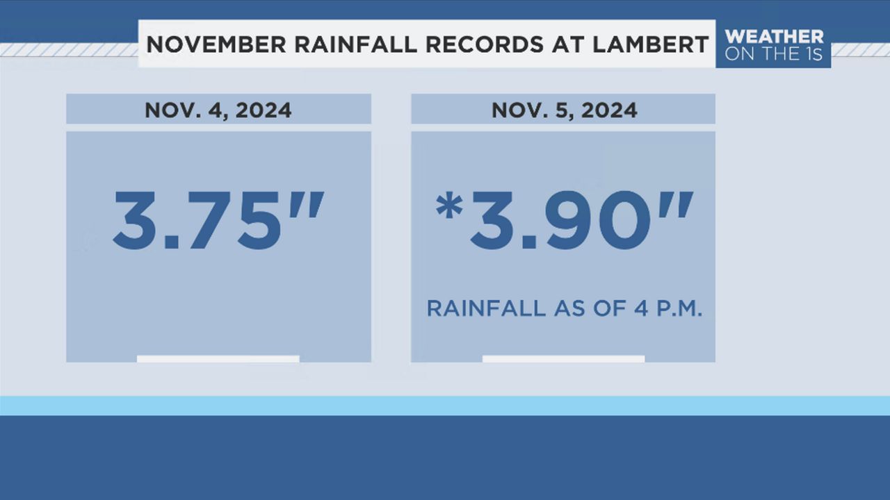
The heavy rain amounted to the wettest Nov. day on record for St. Louis on Monday, Nov. 4, where 3.75 inches of rain fell at St. Louis Lambert International Airport.
Rain and storms persisted overnight into Tuesday morning, with rainfall rates exceeding one inch per hour. By 10 a.m. Tuesday morning, that record was already broken after 3.78 inches fell. Heavy rain falling on already saturated grounds and nearly full creeks and rivers led to flash flooding.
Interstate 55 was shut down near Bayless during Tuesday’s morning commute due to flood waters. The water became extremely deep, causing vehicles to become submerged. Unfortunately, when the waters receded, one person was found dead inside one of those submerged cars.
Flash flooding closed down several other roads across St. Louis Tuesday morning, including Hanley Rd. and Laclede Rd., an intersection near Maplewood. One couple tells Spectrum News they’ve lived at that intersection for a year and a half and have never seen it flood that badly.
The couple said the water was about five feet high in their garage and basement. They said three cars were damaged as well as many tools and other possessions.
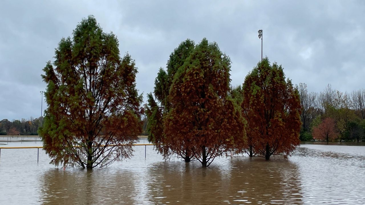
The flooded creek also filled a nearby park and shopping center. There were traffic back-ups in the area and cars had to navigate the closure.
Other creeks and rivers across the region became full and overspilled their banks. Flood warnings for the Dardenne Creek and Meremac River will continue through late week.
Our team of meteorologists dives deep into the science of weather and breaks down timely weather data and information. To view more weather and climate stories, check out our weather blogs section.


