


Heavy rainfall and flash flooding are possible across the eastern end of the state through the rest of Tuesday.
A slow-moving cold front just east of Oahu continues to bring breezy south to southwest winds today, pulling in deep tropical moisture. Showers, storms and periods of heavy rainfall remain possible over the eastern islands through Tuesday night.
Flood Watches remain in effect for the eastern islands through Tuesday afternoon.

Rainfall totals could exceed a few inches through midweek.
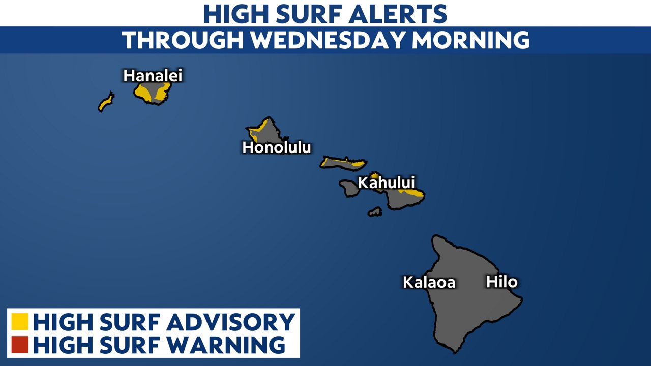
High Surf Advisories are also in effect for the north and west-facing shores of the smaller islands through Wednesday morning. Expect surf up to 18 to 22 feet along north-facing shores and up to 12 to 16 feet along west-facing shores.
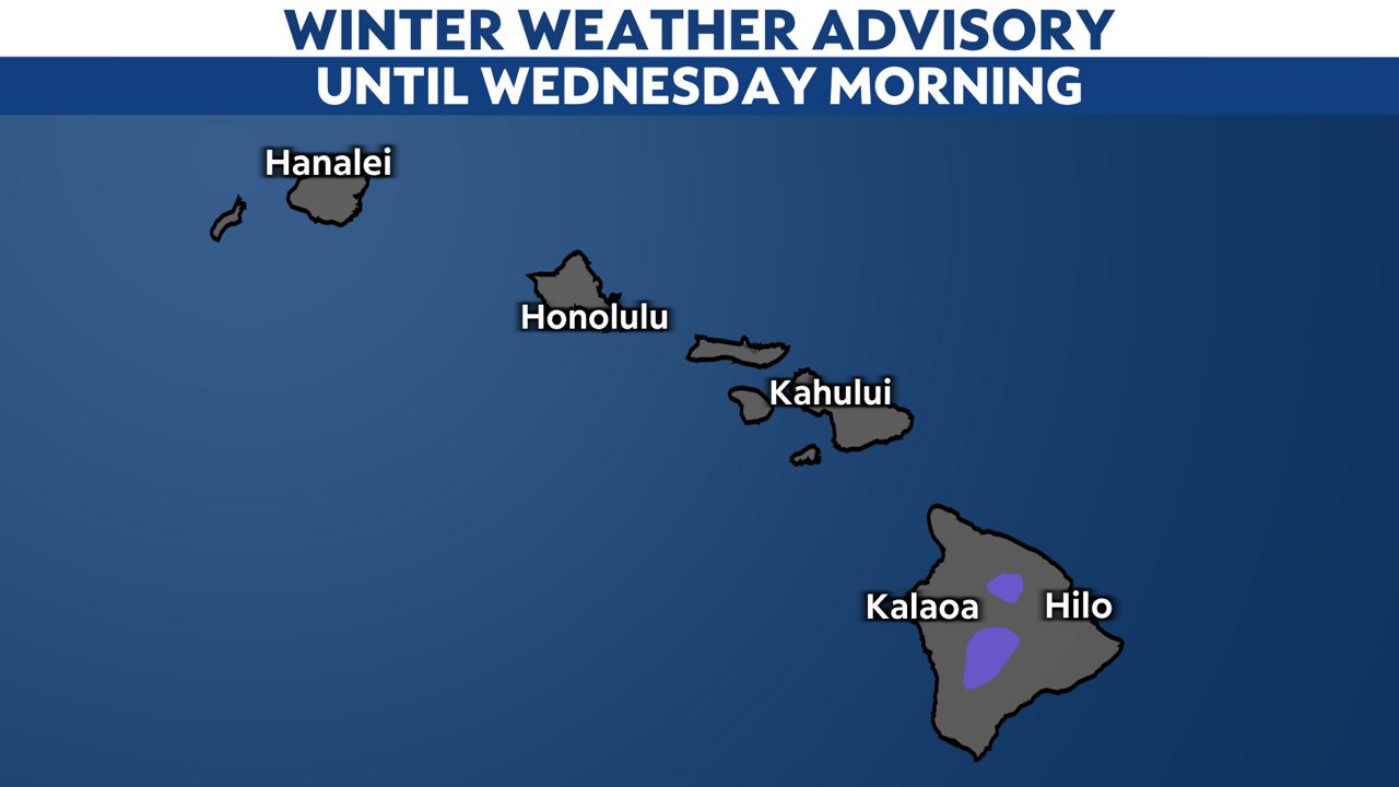
Big Island peaks are under Winter Weather Advisory until Wednesday morning as this cold front pushes through. Snowfall totals could climb up to 5 inches.
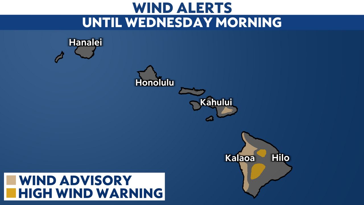
Winds will pick up for the Big Island as the front pushes through, as well. Wind Advisories and High Wind Warnings are in effect. Southwest winds will reach up to 50 to 60 mph with localized gusts to 75 mph.
Our team of meteorologists dives deep into the science of weather and breaks down timely weather data and information. To view more weather and climate stories, check out our weather blogs section.