

HAWAII VOLCANOES NATIONAL PARK, Hawaii — The latest activity notice at 9:17 a.m. from the USGS Hawaiian Volcano Observatory reports a significant decrease in localized earthquakes and ground deformation rates in Kilauea’s upper East Rift Zone after a burst of intense activity at about 3:30 a.m. Tuesday.
Accordingly, HVO has lowered the Volcano Alert Level for ground-based hazards back down to Advisory from Watch, and the Aviation Color Code from Orange to Yellow.
HVO explained in the update that over 100 events occurred between 3 a.m. and 9 a.m. Tuesday roughly 0.6 to 1.8 miles below the earth’s surface. Most were smaller than magnitude-3, but there were eight larger events; the largest was a magnitude-3.4. These were accompanied by an abrupt change in ground deformation patterns in the upper East Rift Zone.
The early morning activity on Tuesday was similar in intensity to what was seen preceding Kilauea summit eruptions of the past few years. The strong cluster of earthquakes together with the change in ground deformation suggest that an intrusion of magma began at 3:30 a.m.
HVO will continue to monitor the situation.
An early morning update from the USGS Hawaiian Volcano Observatory states Kilauea is not erupting, but noted an increase in earthquake activity and ground deformation at Kilauea’s upper East Rift Zone at roughly 3:30 a.m. Tuesday that indicates magma likely moving below the surface.
As a result, HVO has raised the Volcano Alert Level for ground-based hazards from Advisory to Watch and the Aviation Color Code from Yellow to Orange.
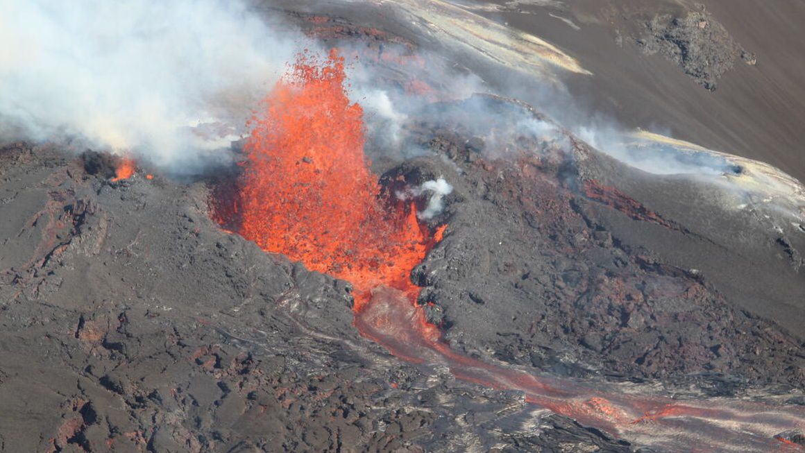
The activity is centered near Pauahi Crater.
Scientists say the situation is changing quickly and it’s not possible to say whether the activity will lead to an eruption or remain underground.
They say an eruption in Kilauea’s upper East Rift Zone within Hawaii Volcanoes National Park is one potential outcome.
HVO continues to monitor the situation and remains in close contact with Hawaii Volcanoes National Park officials.
Kilauea Volcano is experiencing increased earthquake activity and ground deformation. As a result, Hawaii Volcanoes National Park closed Chain of Craters Road and several other areas.
Starting on Monday at 11 a.m., Kilauea’s upper East Rift Zone experienced about 40 earthquakes within an hour, with the largest a magnitude-3.1.
The Hawaiian Volcano Observatory emphasized there are no signs of an imminent eruption. However, the situation could change quickly.
HVNP said it closed several parts of the park to ensure the safety of visitors and staff if the volcano erupts.
The temporary closures include:
- Chain of Craters Road from the intersection at Devastation parking lot to the coast.
- Kulanaokuaiki Campground.
- Crater Rim Trail south of Nāhuku lava tube.
- Coastal backcountry areas and Nāpau sites.
- Escape Road from Nāhuku to Maunaulu.
“It is never an easy decision to close areas, but it is the right thing to do. Safety is always our top priority,” said Park Superintendent Rhonda Loh in a statement. “We remain in constant communication with scientists at the USGS Hawaiian Volcano Observatory and will continue to notify the public of any changes.”
Park officials said the risks include the uncertainty of where the eruption might start, elevated volcanic gases, dangerous lava flows, damaging earthquakes and lava-ignited wildfires.
Editor’s note: The article has been updated with lowered ground-based and aviation alert levels. (June 23, 2024)