


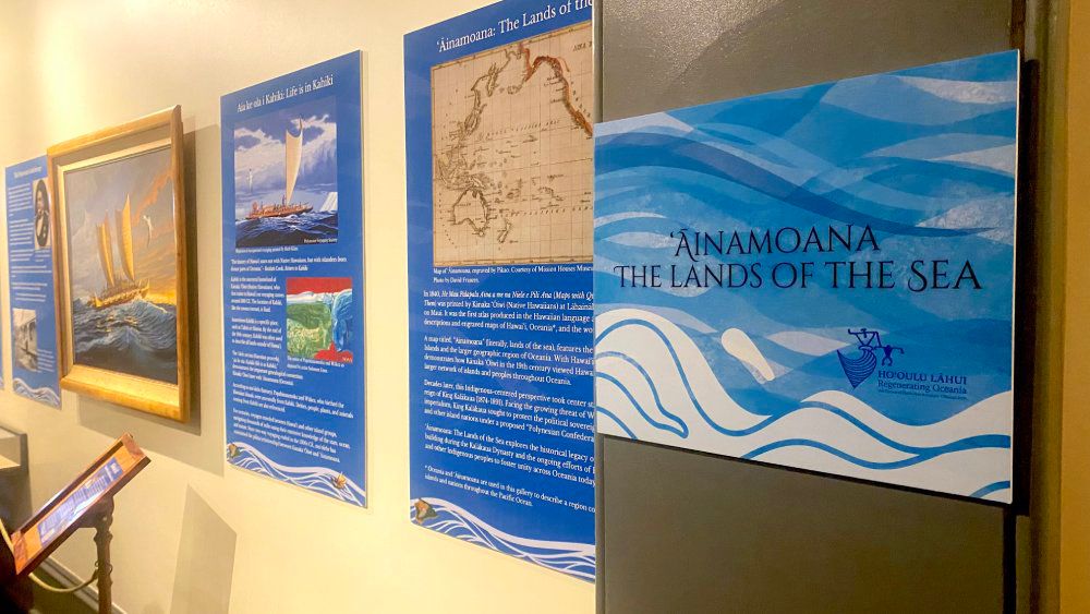
HONOLULU — “ʻĀinamoana: The Lands of the Sea” is the newest exhibit at Iolani Palace, centering around a unique map of the same name, “Ainamoana,” that reflects a Kānaka ʻŌiwi (Native Hawaiian) perspective.
First produced in ʻŌlelo Hawaiʻi (Hawaiian language), the map comes from the atlas, “He Mau Palapala Aina a me na Niele e Pili Ana” that was printed at Lahainaluna Seminary.
Translated as “The Lands of the Sea,” ʻĀinamoana reflects an Indigenous perspective of place and belonging in Oceania by positioning Hawaii within a wider network of islands and peoples all connected by the ocean, genealogy and a legacy of voyaging, according to a release.
During King David Kalākaua’s reign from 1874 to 1891, this Indigenous-centered perspective was an important framework in his mission to Hoʻoulu Lāhui, to increase the nation, at home and abroad.
In 1887, as Western imperialism threatened the political sovereignty of Hawaii and other island nations throughout Oceania, Kalākaua proposed a first-of-its-kind alliance, the Polynesian Confederation. Its aim was to resist Western colonialism and protect the independence of nations throughout Oceania.
The exhibit honors the legacy of solidarity-building during Kalākaua’s reign and the continuing efforts of Kānaka ʻŌiwi to foster political unity and further promote cultural resurgence.
Additional items in the exhibit include royal orders, artwork, historical maps and other items.
“ʻĀinamoana: The Lands of the Sea” is in the Bartels Gallery and is open to the public 9:30 a.m. to 4 p.m. Tuesday through Saturday.