This is the third weekend in a row for wintry weather in North Carolina.
The first winter storm produced more snow in western North Carolina, while last weekend's storm produced more snow and ice in eastern parts of the state.
At the start of this weekend, light snow fell from Friday night through early Saturday morning.
Related story: Live Updates: N.C. sees more winter weather
Much heavier snow is now falling north of us across the northeastern United States as a strong area of low pressure moves up the East Coast.
That powerful nor'easter is making for a blustery day in North Carolina.
Wind gusts up to 30 to 35 mph are likely in much of the state. Gusts may reach up to 40 or 50 mph in the mountains and along the coast at the Outer Banks.
The gusty winds will make it feel colder than the actual temperature all day.
In fact, the wind chills will be dangerously cold around the mountains. The Boone area has experienced below 0 wind chills this morning.
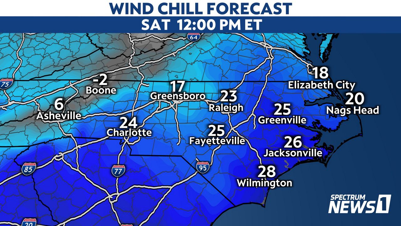
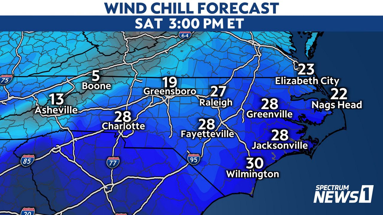
Around western North Carolina, you should limit anytime outside Saturday due to the dangerously cold conditions. If you have to be outside for even a short time, wear gloves, a hat, and anything to cover your skin. Frostbite could develop in less than 30 minutes.
The windy conditions may also create some problems along the Outer Banks due to soundside flooding.
Sand and water may get blown on to N.C. Highway 12, affecting travel between Oregon Inlet and Hatteras.
The NCDOT also says ferry operations along the coast are being effected by the blustery conditions.