


Behind Wednesday's cold front, we'll get to enjoy beautiful late Fall conditions through the end of the workweek as cool, dry air moves in from the north. Friday morning will likely feature to coolest air we've seen this season!
After a cooler start Thursday morning, temperatures will only manage to reach into the low to upper 60s along the coast under a cooling northeasterly flow. With high pressure shifting towards North Carolina, we'll look for a day of clear skies and sunshine that will transition into a clear and chilly evening ahead.
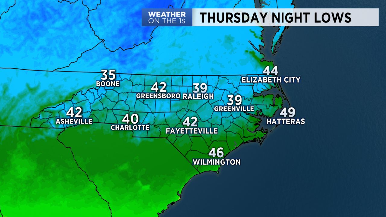
Lows are expected to drop into the 40s for many by Friday morning, making for the coldest morning we've seen since the spring season across the coast! Friday will feature another day of below average highs, with temperatures warming into 60s to low 70s.
A second cold front is set to quickly pass through the area Friday night into Saturday, giving us our next opportunity for showers by early Saturday morning into Saturday afternoon. Behind this front, expect an even stronger push of cold air. On Sunday, while sunshine will return, highs will only top off in the upper low to mid 60s -- a good 10 to 15 degrees below average. Sunday night will be cold, as lows should bottom out to near 40 for some Monday morning. Temperatures are set to stay below average into the start of next week.