


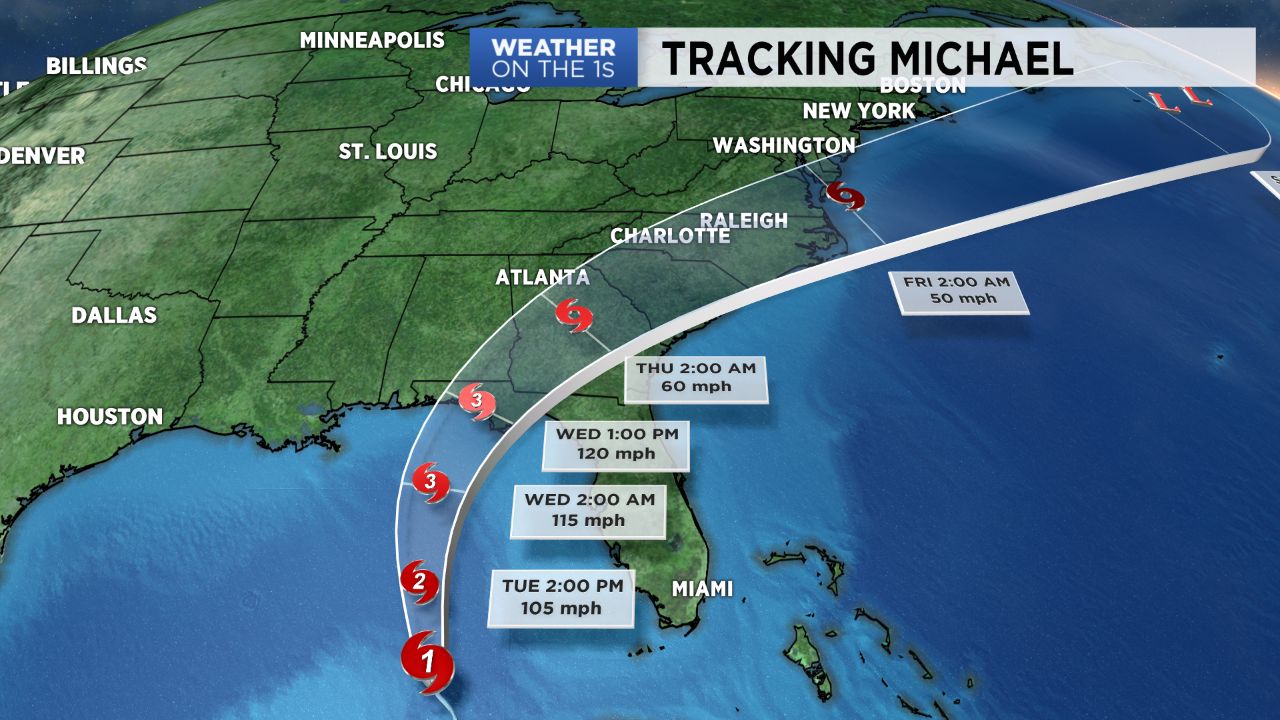
CHARLOTTE, NORTH CAROLINA -- Michael is set to strengthen into a major hurricane by Tuesday night where it will thereafter make landfall along the panhandle of Florida sometime Wednesday. North Carolina will begin to feel impacts as early as Wednesday which are expected to persist into early Friday.
- The state will begin to feel impacts from Michael as early as Wednesday.
- The impacts will persist into Friday.
- Tuesday will be a bit cooler than Monday.
Tuesday will feature a day similar to Monday, but a bit cooler. Expect scattered showers and afternoon storms to move from east to west with highs topping off in the low 80s across the Piedmont.
Bands of light to moderate rain will begin moving on Wednesday along with a few thunderstorms possible. The heaviest of the rain associated with Michael is set to move in Thursday along with some stronger winds. While the threat for tropical storm force winds has lessened across the Piedmont, we still will have the potential to see gusts near 40 to 45 mph, which may lead to power outages thanks to the already very saturated soils. Rainfall amounts should range from 2" to 5" but could change if the track changes. We'll also have to watch for tropical tornadoes developing Wednesday night into Thursday, though that threat remains low for now.
By early Friday morning, Michael is already set to be working offshore according to the latest National Hurricane Center track with beautiful fall-like and dry conditions filing in behind it. Expect the sunshine to return across western North Carolina by early Friday afternoon with gorgeous Autumn weather settling in for the weekend!