


CHARLOTTE, N.C. -- The heat, high humidity, and afternoon chances for scattered storms continue through the remainder of the weekend. A brief cool down is in store for the middle of the work week after the passage of a cold front.
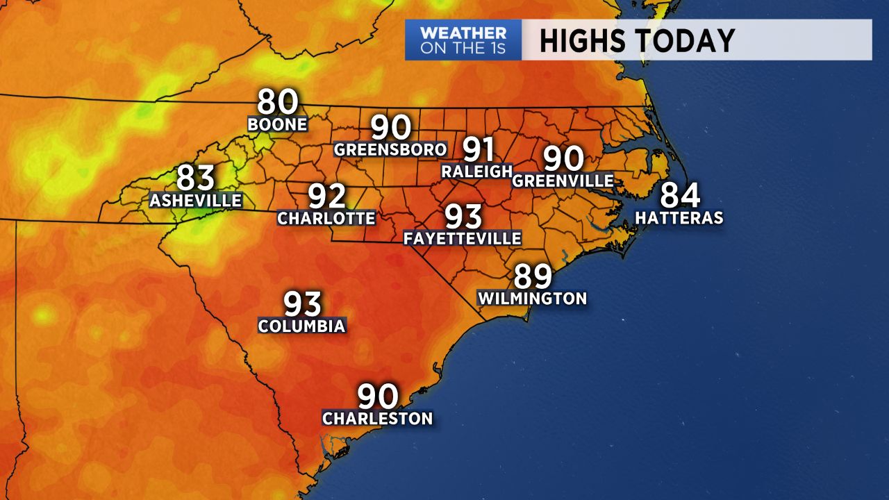
- Mother Nature will bring the heat Sunday as highs soar into the low 90s
- Scattered showers and storms will return to the region Sunday afternoon and evening
- Expect a better chance for storm activity Monday afternoon
Mother Nature will bring the heat Sunday as highs soar into the low 90s for many coupled with dew points in the upper 60s and low 70s.
Scattered showers and storms will return to the region Sunday afternoon and evening, but should remain rather "hit-and-miss". Expect a better chance for storm activity Monday afternoon as a cold front pushes southward across North Carolina.
With a "Marginal" threat for severe weather in place encompassing the mountains, foothills, Piedmont, and Triad, some storms may become severe and pack heavy downpours of rain, damaging winds, and large hail.
Behind the front, winds out of the northeast will yield a slightly cooler -- but still unsettled day -- on Tuesday. Temperatures will be at or a bit below average with highs in the upper 70s to low/mid 80s.
This won't last long, however, as temperatures will quickly make a rebound by Wednesday into the end of the work week, with highs back in the upper 80s and low 90s coupled with a daily chance for showers and storms.