


A slow moving system will continue to bring showers across the region Tuesday before a general drying trend commences Tuesday night into Wednesday.
- On and off showers present through the day.
- Possible thunderstorms along and east of I-77.
- The next system will arrive late Thursday afternoon.
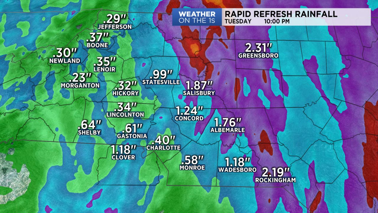
The upper level low pressure system that brought us a day of heavy rain Monday continues to lift slowly to the north Tuesday, bringing, at least, the bulk of the heavier rain along with it. Expect on and off showers throughout the day with abundant cloud cover. An additional 0.20" to 0.75" of rain will be possible through Tuesday on top of all the rainfall we received Monday. Temperatures will be warmer too, with highs expected to top off in the mid 60s to low 70s with 50s in the mountains. Enough instability will be present this afternoon into early this evening to perhaps produce a few weak thunderstorms along and east of I-77.
The atmosphere will gradually dry out Tuesday night into Wednesday, with the best chance for rain confined to the mountains through Wednesday afternoon. Other than a few spot showers, the Piedmont should be mainly dry under mostly cloudy skies as a reinforcing cold front passes through Wednesday afternoon.
Our next system will arrive late Thursday afternoon, bringing additional chances for rain back into the forecast into the first half of Friday before high pressure builds back in just in time for the weekend!