


After an active night of weather, featuring both heavy rain and embedded thunderstorms across the mountains and Piedmont, another round of showers and a few storms will move in Tuesday evening with much cooler air moving in overnight.
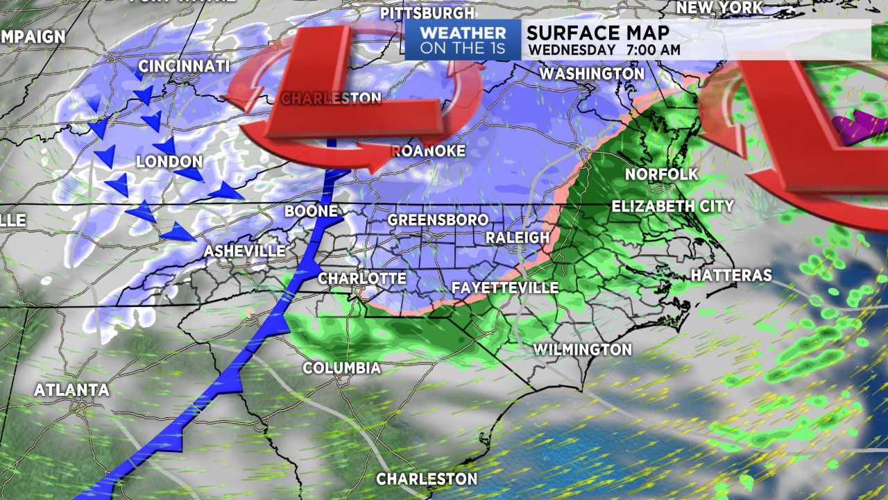
Mountains will look for accumulating snow through Wednesday with a dusting of snow possible across parts of the Piedmont.
With the passage of Monday night's strong system, drier air moving in Tuesday morning will largely put an end to shower activity during the day, leaving us with mostly cloudy skies and highs in the 60s to low 70s.
A system pushing into the Appalachians will drag a secondary cold front through the region Tuesday evening, allowing for another round of showers by late this afternoon into Tuesday across the region, where a few thunderstorms will be possible across the southern tier of the Piedmont.
Much cooler air moving in behind this front will result in the transition from rain to snow in the mountains overnight, where Winter Storm Warnings will kick in for Ashe, Watauga and Avery counties for the potential to see between 3" to 7" of snow.
A few snow showers may even break containment and push into the Piedmont Wednesday morning, where, if we do see any snow at all, only a dusting will be possible.