


Wednesday brought another day of record breaking temperatures across western and central North Carolina, with daytime highs warming into the low 80s for several areas across the Piedmont.
Temperatures Thursday into the weekend will stay at near or over record levels as unseasonably warm air continues to flow into the region.
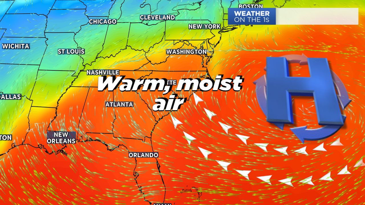
High pressure off the southeast coast will continue to push warm, moist air in across the eastern half of the United States, making for a stretch of very warm days.
Highs Thursday will likely break yet another record, with the record high in Charlotte currently at 74 degrees and a forecasted high of 80.
Friday into the first half of the weekend will feature the same weather pattern: unseasonable warmth, small chances for light showers, and mainly cloudy skies.
Sunday will finally bring a change to the forecast. A cold front expected to move through Sunday afternoon will first bring increasing chances for showers Saturday night into the last half of the weekend before cooler and drier air moves in.
Expect lingering showers into Monday, where temperatures will cool back into the 60s. High pressure building in by Tuesday will dry the forecast out -- briefly-- and allow for the return of sunshine.
Get the latest news, sports and weather delivered straight to your inbox. Click here to sign up for email and text alerts.