


Our next storm system is approaching our area, and clouds will be in the increase this afternoon. However, we will remain precipitation-free through this evening.
Snow will develop tonight, likely in the midnight-2 a.m. time-frame, and then that band of snow will slowly pivot through the region, exiting by 9-10 a.m. Wednesday. The ground is cold, and ground temperatures should remain cold enough to effectively accumulate what snow can fall.
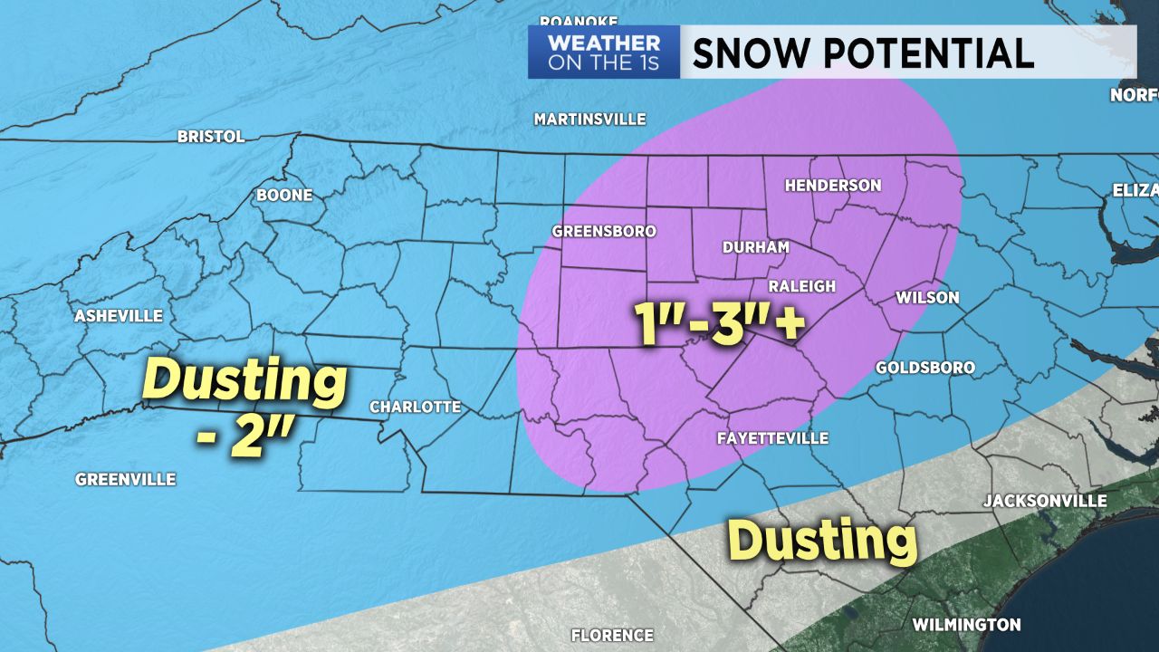
I am most uncertain about our foothill areas. Due to the nature of this band of snow redeveloping on our side of the mountains, it's possible some foothill areas could get skipped over by a large portion of the snow. But for the piedmont, most areas should be fair game to pick up a dusting -2" of snow.
I believe the heaviest snow totals with this system will occur from the eastern sections of our viewing area eastward through the Triangle region. In this zone, I am going with 1"-3" with a couple of locally higher amounts possible.
Due to the redeveloping nature of this snow band, uncertainyy remains with snow amounts, and some variability, as always, will occur.
Travel will likely become pretty tricky late tonight through Wednesday morning, especially on the untreated roads as well as bridges and overpasses.
Please see today's video.... a picture is worth a thousand words.
Follow Matthew East on Twitter and Facebook.
Get the latest news, sports and weather delivered straight to your inbox. Click here to sign up for email and text alerts.