Sunday brought yet another day of highs in the upper 60s across the Piedmont under plenty of sun. Monday will feature a similarly mild day before a shift in the weather pattern brings big changes late in the week.
High pressure still building down the East Coast for one more day will result in another day of mild temperatures and mostly sunny skies for Monday.
While temperatures won't be quite as warm as Sunday's, highs should still have no problem warming into upper 50s to mid 60s across the Piedmont under a decent amount of sunshine.
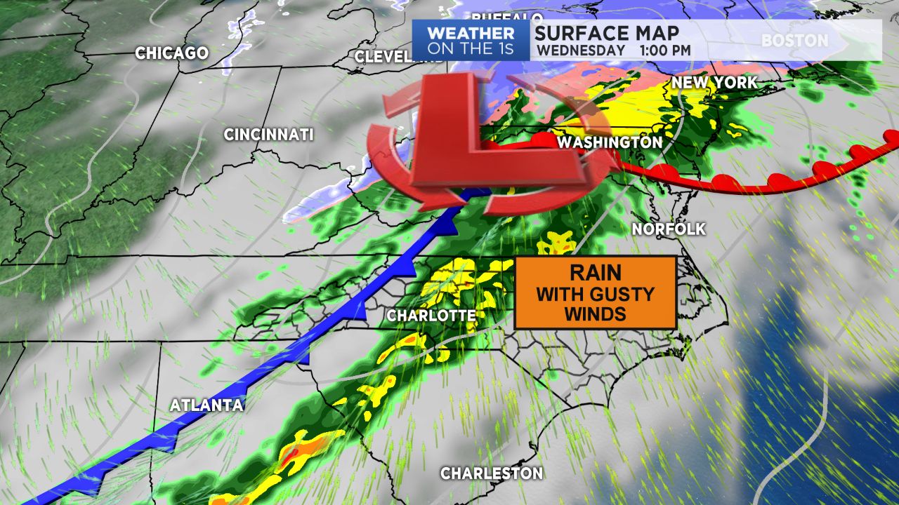
Changes will begin to arrive by Monday night as a cold front approaches from the west. Clouds will continue to thicken through the overnight hours, becoming overcast by Tuesday morning with spotty areas of drizzle possible.
Rain chances will increase drastically by Tuesday night as the cold front pushes through, likely producing anywhere between a few tenths to near a half an inch of rain across the region with light snow showers possible across the high terrain by early Wednesday morning.
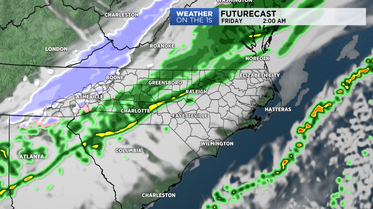
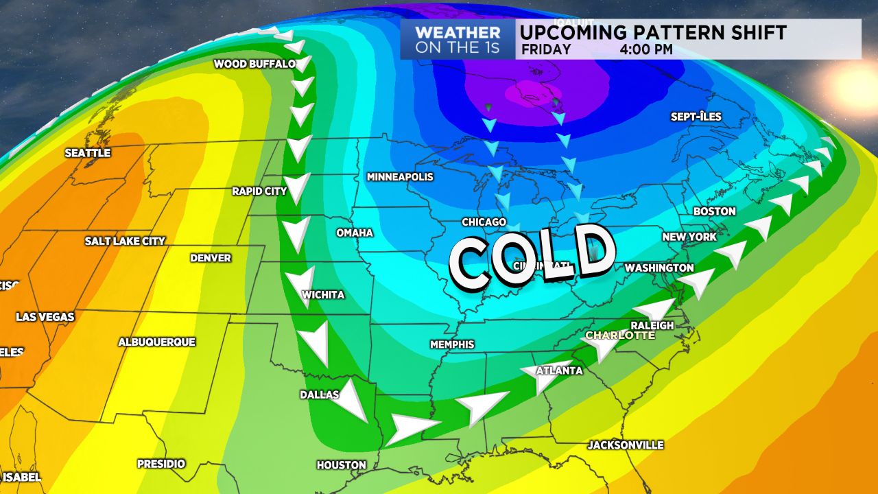
With the front well to the east of the area by Wednesday, rain will end but cold air will begin moving in. Highs will drop a good 10 degrees from Tuesday's and continue to cool through the remainder of the week. By Friday and the weekend, temperatures across the Piedmont will only top off in the 40s for with low to mid 30s in the mountains!
As cold air continues to lock into the eastern half of the country, a system moving in from the south could produce a light wintry mix for those across the Piedmont Friday into Saturday morning, though this still has a great amount of model uncertainty associated with it. Details will continued to be nailed down into the middle of the week, so stay tuned!