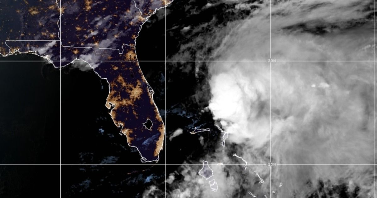
While Potential Tropical Cyclone One remains disorganized, the system has moved out of Florida. The system is bringing flooding rains and strong winds over parts of the Northwestern Bahamas.
Potential Tropical Cyclone One is still expected to become the first tropical storm of the Atlantic hurricane season as it tracks through the Bahamas. The center of the system is showing better signs of development since the last update.
The center of Potential Tropical Cyclone One has left Florida and is in the Bahamas. Heavy rain is diminishing across southeastern Florida and The Keys. The system trace its origins to Hurricane Agatha, a Pacific storm that made landfall in southern Mexico on Monday afternoon.
Even though not much has changed in regards to strengthening or weakening over the last couple of hours, this system is expected to accelerate its forward motion towards the east-northeast later through tonight and early Sunday.
As it does this, the center of this disturbance is expected to re-form as it moves off the east coast of Florida, where it is expected to regain organization and become a tropical storm by tonight or early Sunday.
While combating both wind shear and drier aloft has led to its digression, the system continues to impact parts of South Florida with heavy rain and gusty winds. Flash flooding remains a big concern, especially after receiving significant rainfall earlier in the week.
Even though this system is not a tropical storm yet, it will still bring tropical storm-like characteristics across the Bahamas, where Tropical Storm Warnings remain in effect.
Potential Tropical Cyclone One will still face obstacles regarding its fate becoming a tropical storm this weekend. Although model data seems to suggest that this system could restrengthen as it moves east into the Atlantic tonight into Monday.
Provided this happens, this disturbance could become the first tropical storm of the Atlantic hurricane season. If it does, it will be named Alex.
Computer forecast models show that the center of its path will move across southern Florida.

Spaghetti models or plots show a series of individual computer forecast models together on one map. They are useful to give insight into whether or not multiple models agree on the path of the storm, but they do not address the storm’s forecast intensity, winds, flooding and storm surge potential or other data. Tap here for more details on how to best use these models.
This part of the Atlantic basin is where storms tend to develop early in the hurricane season.
As we saw in recent weeks, social media posts sometimes will show a single computer model forecast that may be unreliable. Find out why that’s not a wise thing to follow and the things you should look out for.


