


There are times when thunderstorms are in our forecast and they don’t turn severe.
All the ingredients can be present in our atmosphere to support strong or severe storms, but if a strong ‘cap’ is in place, severe storms are just not likely.
The ‘cap’ is a layer of warm, stable air between 3-7,000 feet above us that works to suppress thunderstorm development. There are a few ways a cap is developed, but more likely than not, in the Deep South, this layer of air moves in from the northern plateaus of Mexico.
In a standard environment, as the sun heats the Earth, warm air rises and cools. This forms warm updrafts. Assuming the air that is rising continues to cool with height, air will continue to rise.
As it does that, clouds will form. If the warm updrafts reach the ‘cap’ and can’t break through it, clouds and rain can form, but it will suppress thunderstorm development.
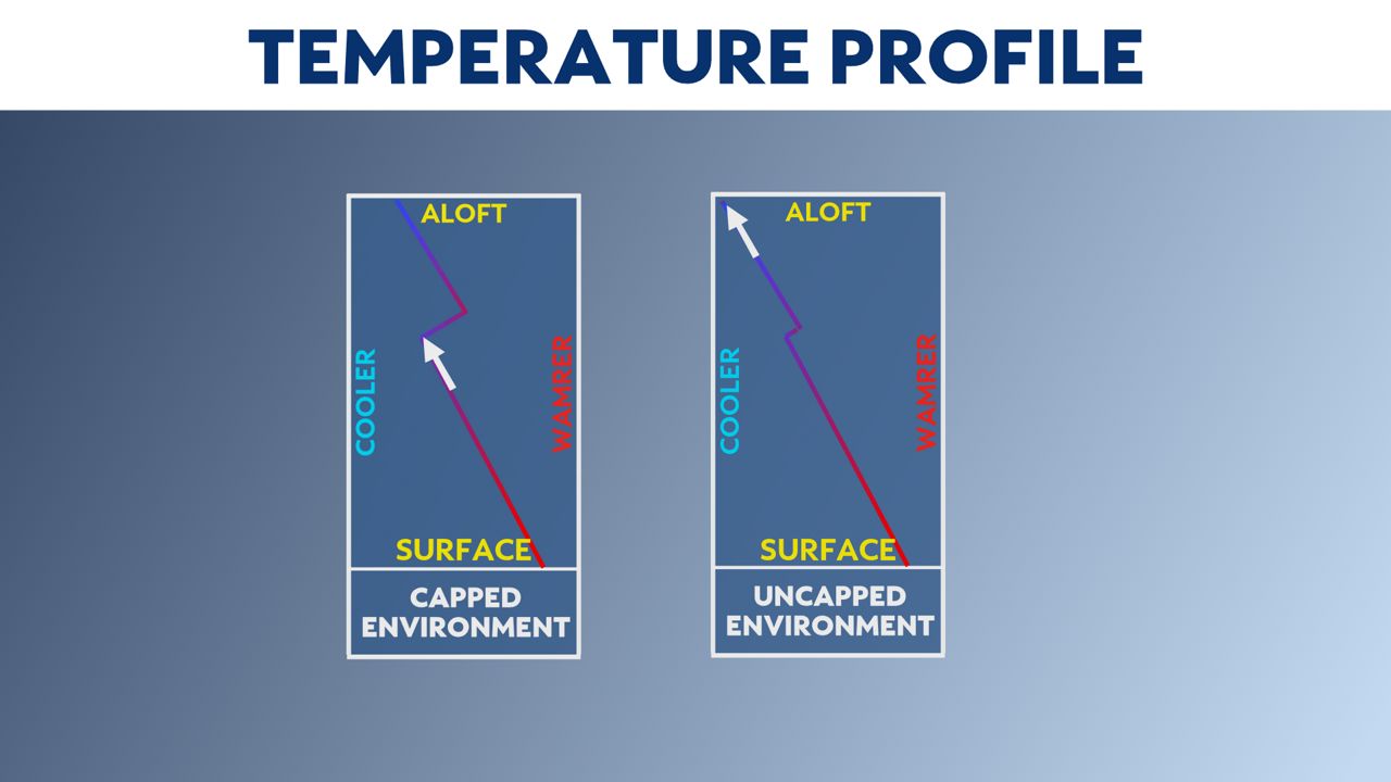
There are ways that the environment can weaken the cap, but if a strong cap is in place, the threat for severe weather diminishes greatly.
In an ‘uncapped’ environment, the same processes take place, but if there is enough heating meeting a weak cap, thunderstorms can really develop and flourish leading to gusty winds, large hail and even tornadoes.
Thunderstorms can develop at all times of the year, but it’s very important to have a severe weather plan and a severe weather kit in place now as Texas heads into peak severe weather season.