While the vernal equinox marks the traditional start of the spring season – March 20 this year – meteorological spring begins March 1. It’s the month that begins the transition to warmer average temperatures and an increase in rainfall potential by early April.
What You Need To Know
- Average highs are around 70 and lows near 50 at the beginning of the month
- Average highs trend to near 80 and lows near 60 by the end of the month
- March is historically drier in some areas, wetter in others
For north Texas, average temperatures are slightly lower with highs near 70 and lows near 40. By April, average temperatures trend upward to the upper 70s and low 50s. For Dallas and Fort Worth, March is among the wetter months with a historical average of about three-and-a-half inches.
For central and south Texas, temperatures rise a bit more quickly. But in contrast, March is typically one of the drier months of the year. Austin sees about two inches for the month and San Antonio less than two inches. But for both cities, April marks the beginning of a much wetter period through early summer.
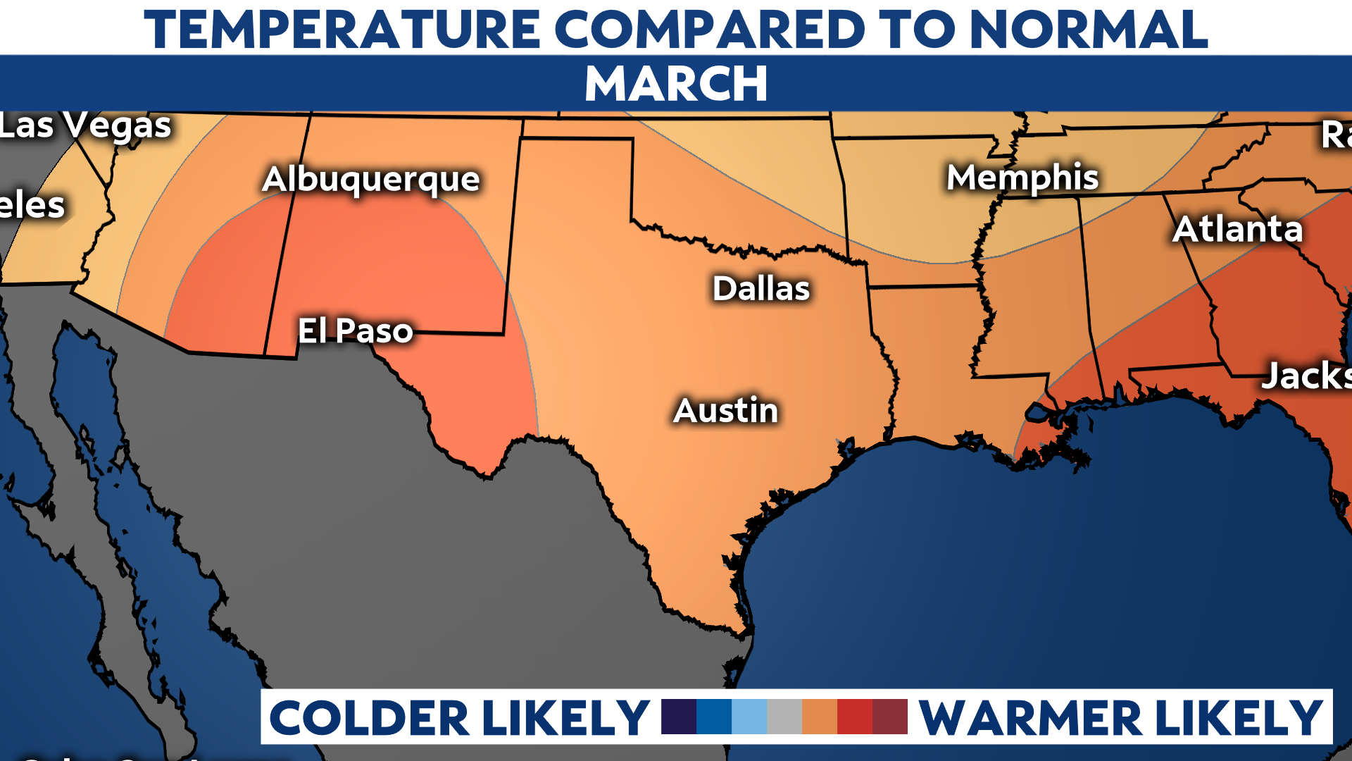
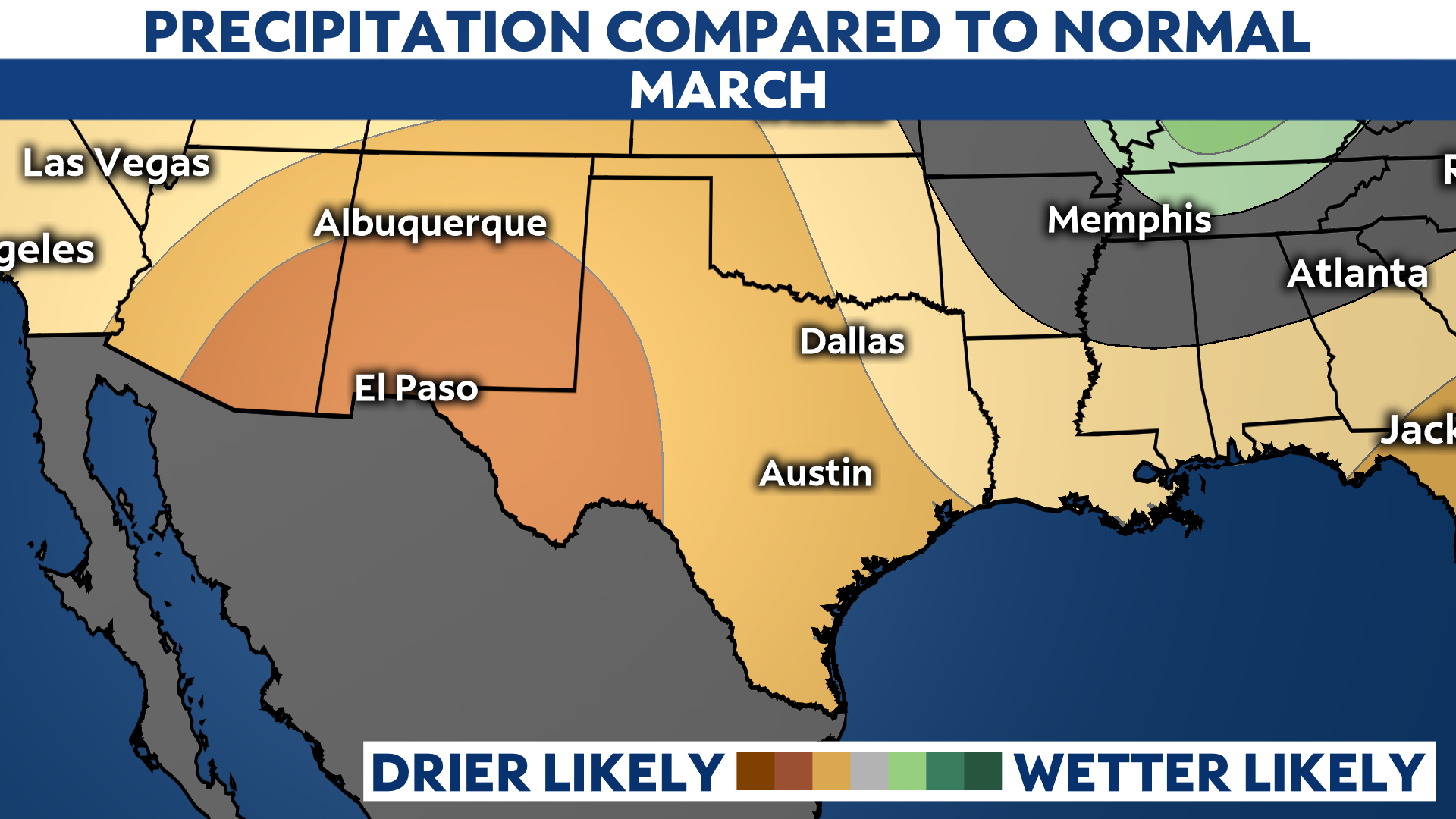
The Climate Prediction Center has issued new outlooks for the month of March. They show that the La Niña pattern – below-normal sea surface temperatures in the equatorial Pacific that influence global circulation patterns – is likely to continue in the short term. But, there’s a 60% chance that the pattern returns to neutral.

Nonetheless, for most of Texas the upcoming month of March looks to be warmer than average and drier than average. If the trends of the El Niño-Southern Oscillation (its official meteorological designation) go as predicted, spring rains should be plentiful and blunt the state’s drought conditions in time for the dry months of summer.


