


It is not the first time severe weather has threatened North Texas in December, so we can expect days like today and tomorrow.
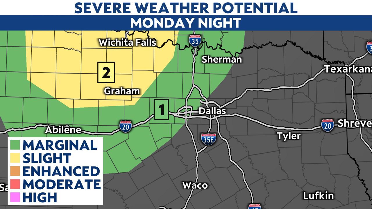
The Storm Prediction Center (SPC) has highlighted parts of the region for severe storms developing tonight and lasting into Tuesday morning.
Numerous showers and thunderstorms will develop around midnight. The best thunderstorm chances and potential for severe weather will be on Tuesday, thanks to lift from a cold front.
The SPC includes a marginal risk for severe storms for areas to the northwest of the metroplex proper. This includes Fort Worth in Tarrant County.
The threat then shifts to the east where the SPC has highlighted a level three, moderate risk, for parts of east Texas and much of Louisiana. This is where the tornado threat is the greatest.

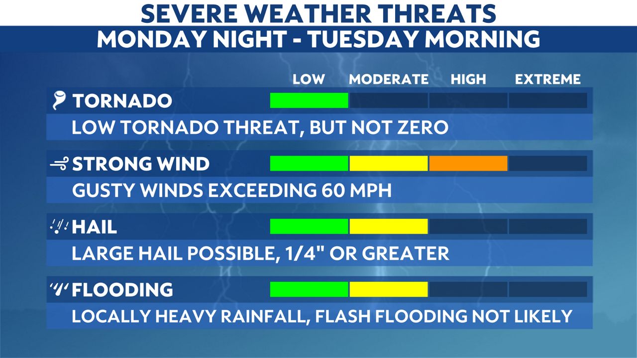
While all modes of severe weather are possible, strong gusty winds and large hail are the biggest threats during the forecast period. The tornado threat is low, but it is not zero, so an isolated tornado is possible.
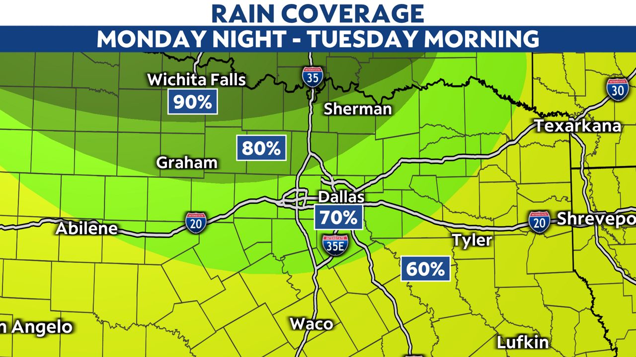
Whether or not you see severe weather, we expect widespread rainfall as the low moves out and the front passes through the state.
Make sure to have a way to receive weather alerts just in case strong storms pass through your area.