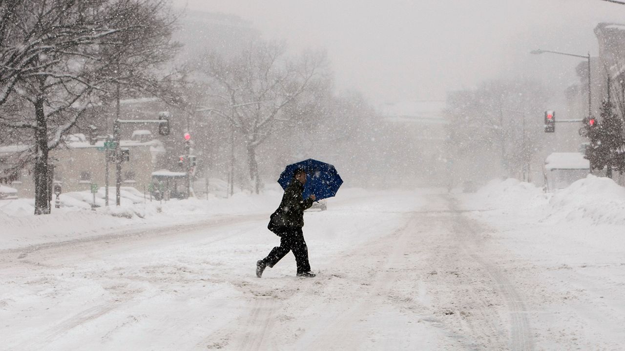
Most of us were skating through a relatively easy winter until February came around.
Although parts of the Northeast had a couple of big snowstorms, up until mid-February much of the winter wasn’t anything to write home about.
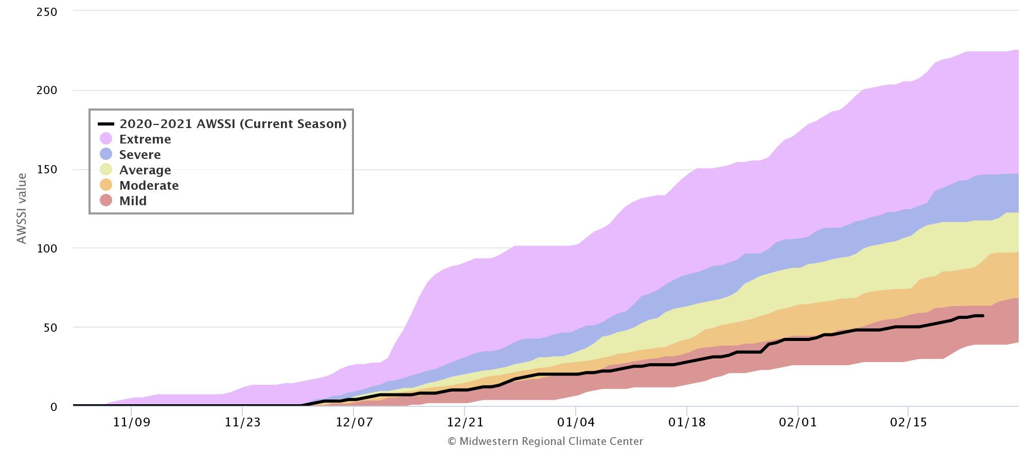
The Accumulated Winter Season Severity Index, or AWSSI (pronounced “aw-see”), pulls together temperature, snowfall, and snow depth information for dozens of cities and compares it to other years. Its categories, from least severe to most, are mild, moderate, average, severe, and extreme.
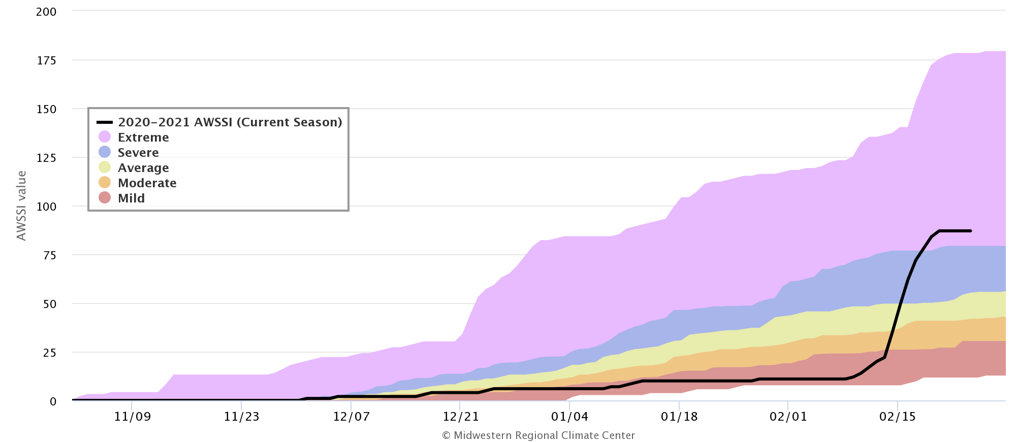
The historic arctic blast in early February made a big difference in the middle of the country. On February 8, Dallas had one of its lowest AWSSI scores on record, deep within the “mild” category. Just ten days later, it skyrocketed to “extreme.”
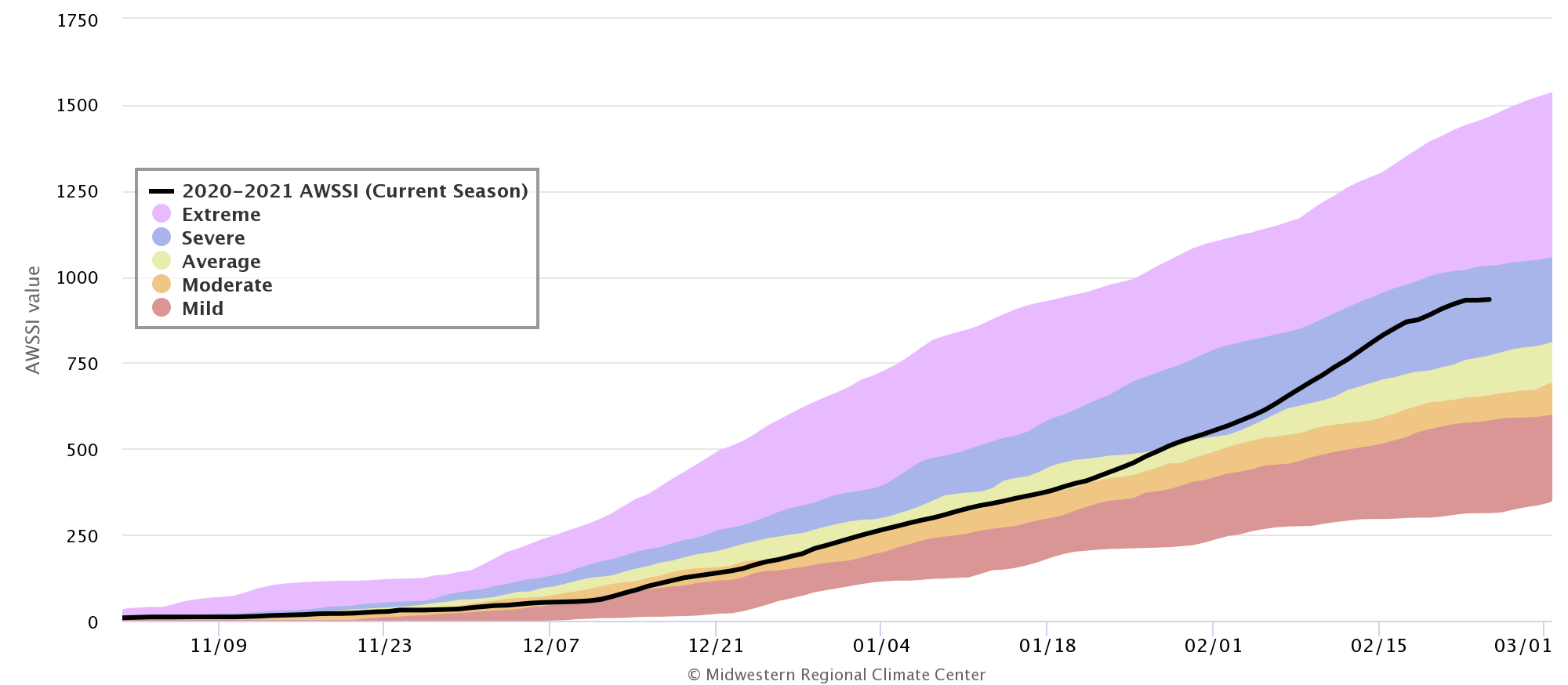
Farther north, the change was steadier since the cold air arrived sooner, creeping in at the end of January. Madison, Wisconsin was straddling the line between an average to moderate winter, but persistent cold and occasional snow sent the city far into “severe” status.
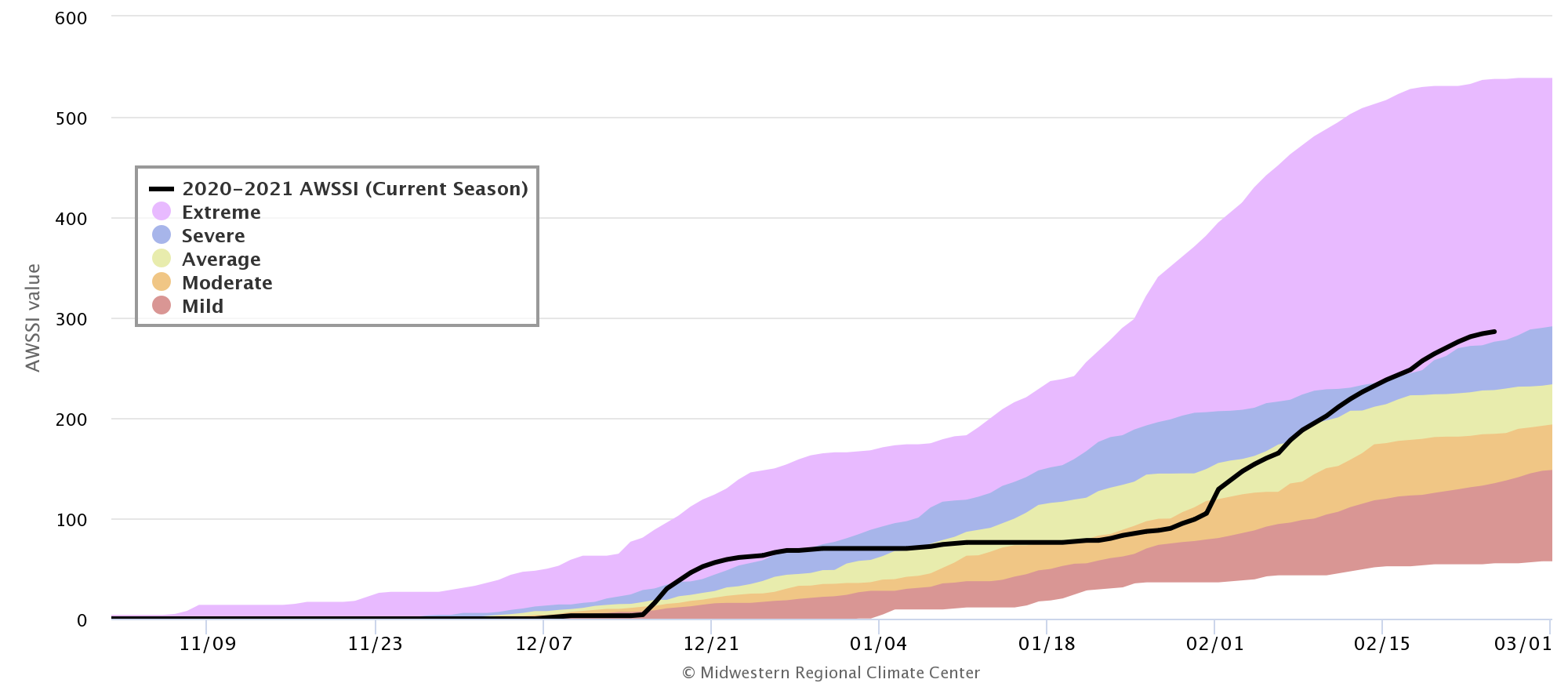
In the Northeast, the situation is more complicated. New York City made a big jump to “extreme” in mid-December thanks to the winter storm that dropped about 10 inches of snow, then leveled off for about six weeks, enough to improve to a moderate winter. Then a powerhouse nor’easter dropped more than a foot of snow and chillier-than-normal temperatures followed – meaning a return, just barely, to a severe winter.
Other areas have managed to escape much cold or snow. One such place is Raleigh, North Carolina, which has spent much of the season in either the moderate or mild category.
Even though meteorological spring begins March 1, winter weather won’t end for a while. The worst, however, is almost certainly behind us.


