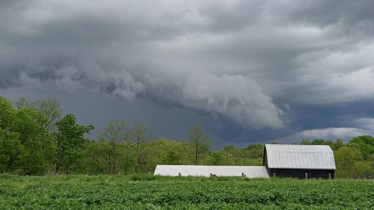
KENTUCKY — It will be a stormy end to the week, with strong to severe storms developing late in the day.
We will keep a close eye on storms popping up today. We will start off early in the day with a couple of stronger storms. A few of those storms could contain damaging wind gusts.
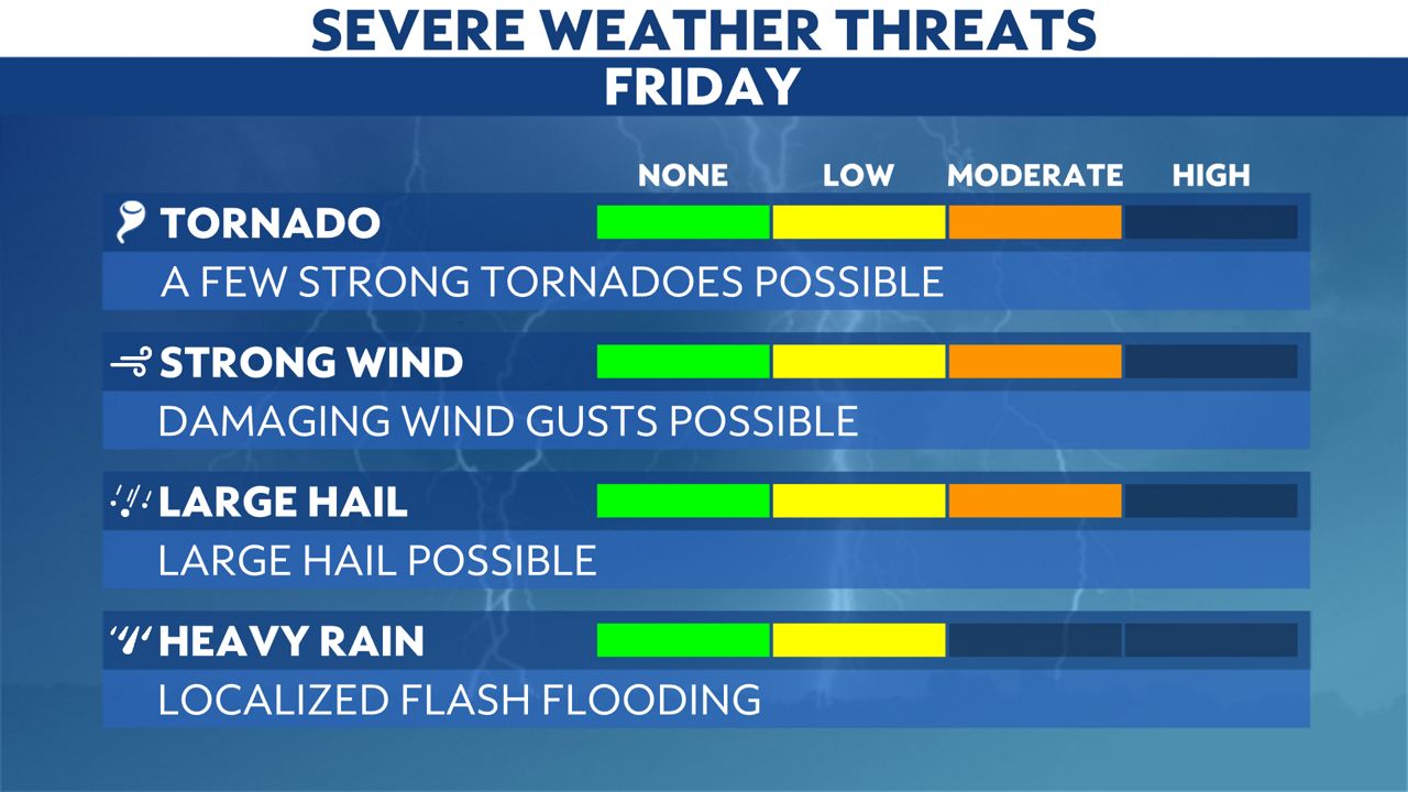
The Storm Prediction Center has the area under an Enhanced risk for the afternoon into the evening. All modes of severe weather are on the table, which include damaging winds, large hail and even a couple of stronger tornadoes.
)
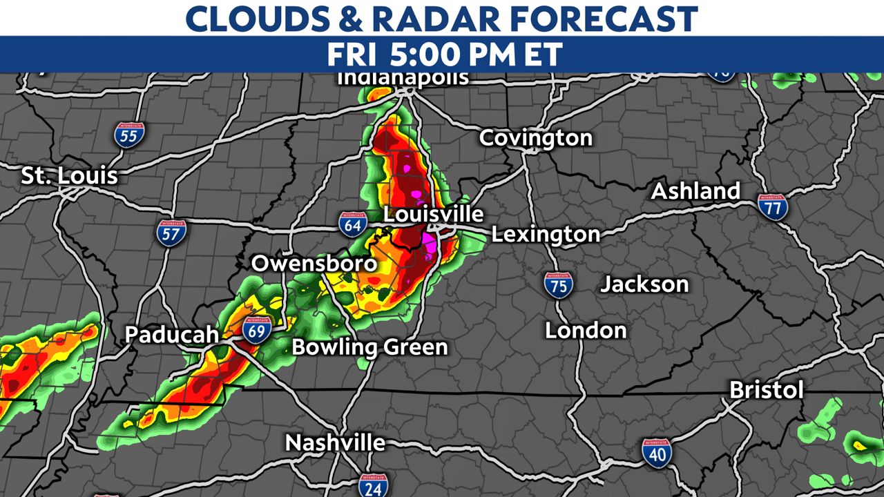
We dry out with sunshine returning late morning into the early afternoon. That will allow for the atmosphere to charge back up with a bunch of instability. A line of storms will likely fire up out to the west first and then move across the area. This could affect the afternoon commute.
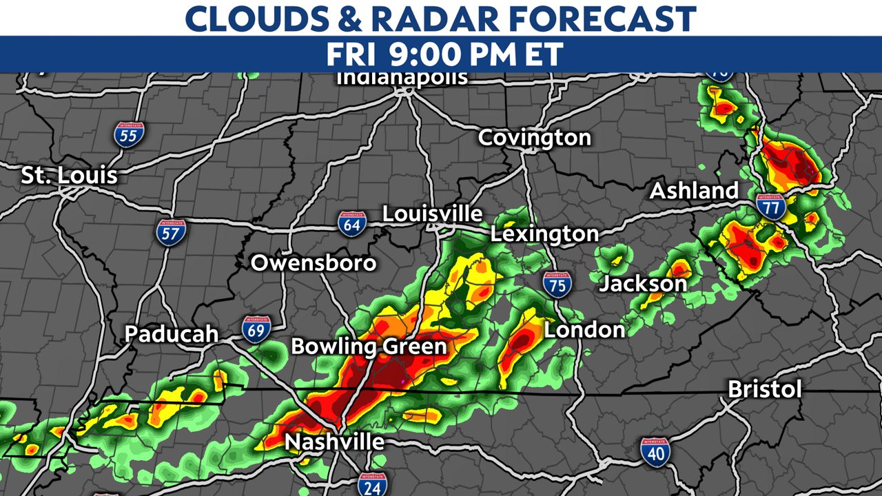
Strong storms could linger through early Friday night. Most of the severe storms will head out after midnight.
We will finally quiet down for the weekend, with cooler but seasonable temperatures returning.
Our team of meteorologists dives deep into the science of weather and breaks down timely weather data and information. To view more weather and climate stories, check out our weather blogs section.