


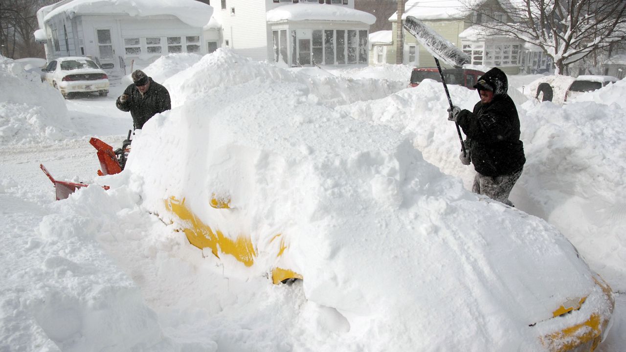
On one side of Buffalo, New York, you could have maybe an inch or two of snow.
On the other side of the same city, you could have three feet - or more - of snow from the same storm.
That fascinating discrepancy is all thanks to one of nature's biggest winter weather wonders: Lake-effect snow.
Cleveland, Ohio sees about 50 inches of snow per year, on average.
Ninety miles northeast of Cleveland, however, Erie, Pennsylvania sees nearly double that. Erie gets about 85 inches of snow per year mostly because of Lake Erie.
That's all thanks to the hyper-local nature of cold winds going over warm water and producing prolific amounts of highly-concentrated snowfall.
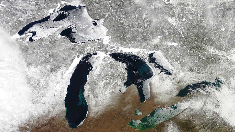
This just in: It gets cold every winter across the Great Lakes.
Sure, that's slightly tongue in cheek, but it's also actually the basic science behind lake-effect snow.
Each winter, cold winds from the north usher in our winter chill. If you're reading this from Buffalo or Cleveland, you know that a lake sits just to your north and/or west. So when it gets cold, the winds pulling in that chilly air have to pass directly over those lakes.
Meanwhile, water's high specific heat means that it takes far longer for the Great Lakes to cool down, even if it's well below freezing outside. In other words, it takes way more energy and time to warm water than land.
And there you have the basics of lake-effect snow.
The cold air flowing above the lakes clashes with the (relatively) mild water temperatures, and that, in turn, creates instability. The temperature-driven instability forces the air to rapidly rise, condensing into lake-effect snow.
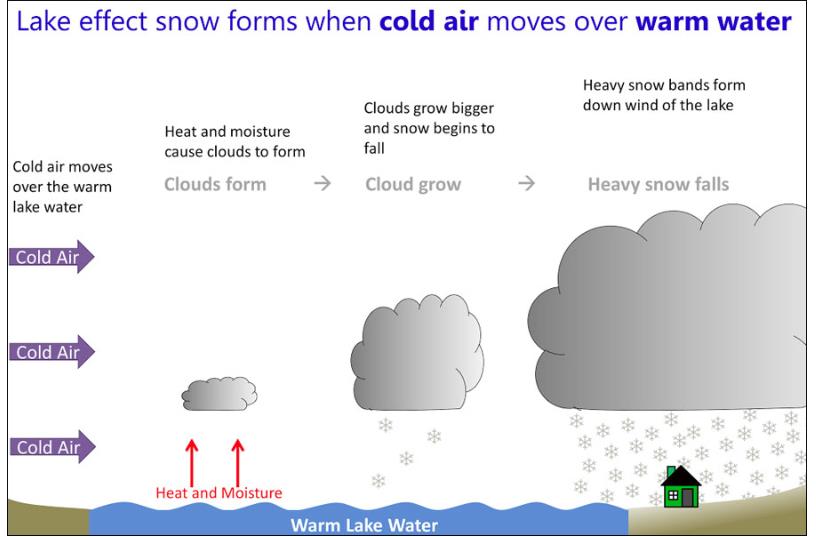
During the late fall and through the winter, that temperature difference can lead to feet upon feet of snow before the lake-effect season comes to a close, usually in February or March.
It's not until the lakes freeze over that the so-called lake-effect 'machine' fully shuts down, as the temperature differential between the frozen water and the chilly air above it isn't big enough to generate instability.
If you're a football fan, you'll probably appreciate this. If not, it'll still make sense to you.
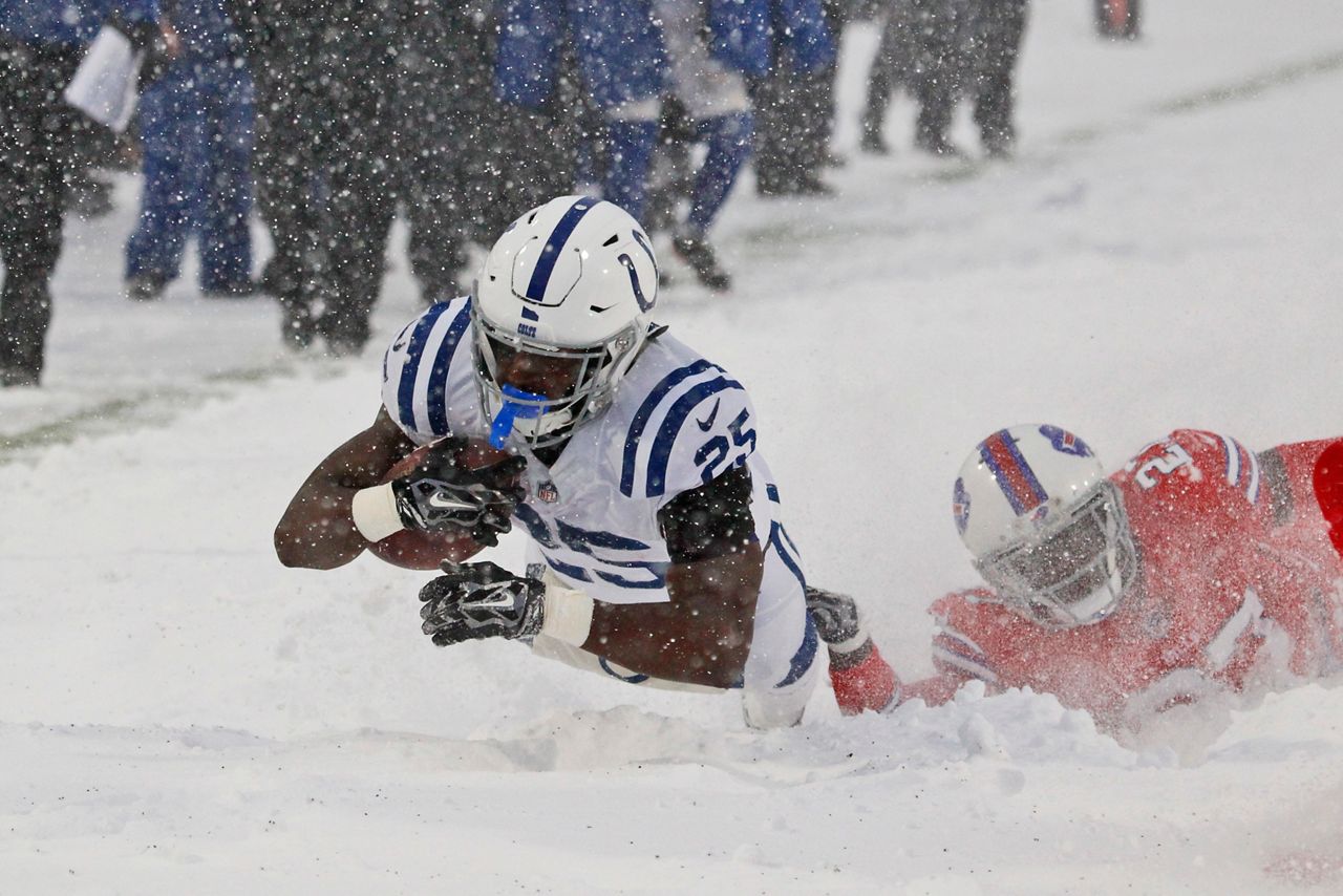
If you've ever watched a Buffalo Bills football game, you've almost for sure seen lake-effect snow in full action. The Bills play in the suburb of Orchard Park, which sits just 10 miles south of downtown Buffalo.
Orchard Park is in the Buffalo area's snowbelt, an area known for typically taking the brunt of lake-effect snow events.
That often means that Buffalo Bills games in Orchard Park, can turn into, well.. take a look at the picture below.
That's all thanks to the exact wind direction coming off of Lake Erie, at least in Buffalo's case.
Buffalo sits in the northeastern corner of cucumber-shaped Lake Erie. That means a westerly, northerly, or northwesterly wind will favor Buffalo's so-called Southtowns like Orchard Park, because that wind direction goes directly over the long but narrow lake.
That means areas just south of Buffalo (depending on the exact wind direction) can see feet of snow from a particular lake-effect event, while downtown Buffalo or points north may wind up with only a few inches - or nothing at all.
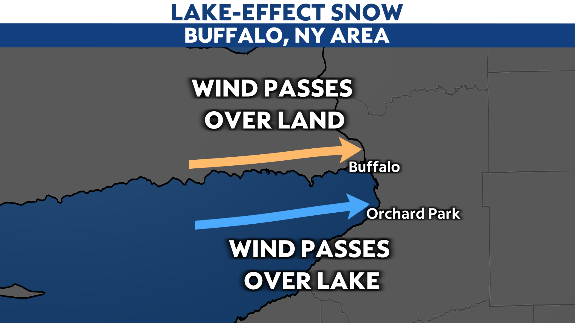
The result is a narrow band of extremely strong snowfall. And if you're reading this from Buffalo, Cleveland, or many parts of upstate New York, western Pennsylvania, northern Indiana, and Ohio or Michigan, you probably know exactly what we're talking about.
And if you're not in any of those cases, you now know the power of lake-effect snow, and why it batters the same places again and again each winter.