

If you like weather, you’ve probably heard of the GFS and the European computer forecast models.
But there are probably lots of things that you might not know about the two main computer forecast models, and that information could help you better understand the difficulty of creating an accurate weather forecast.
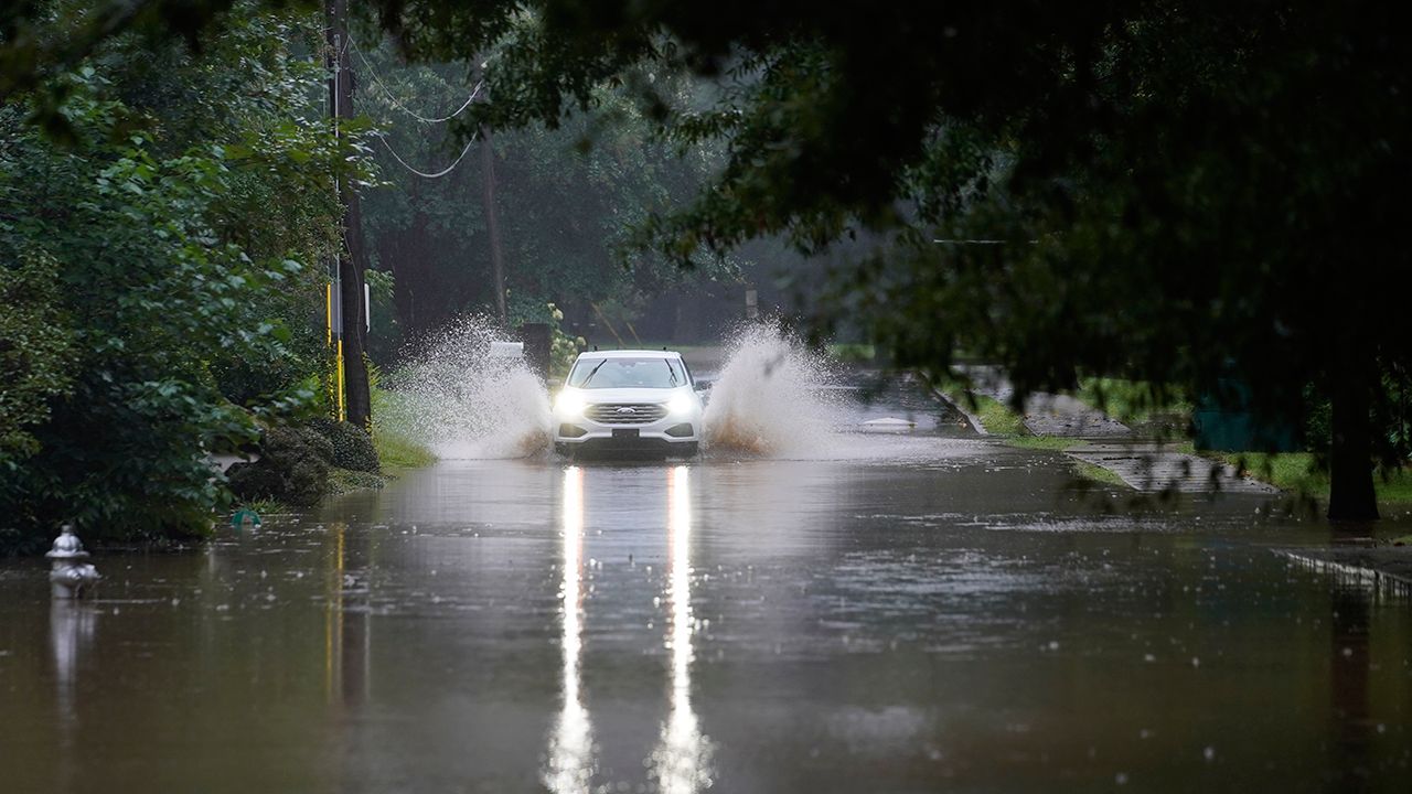
One of the primary tools meteorologists have at their disposal are computer forecast models, which issue weather forecasts based on trillions of calculations to quantify the atmosphere and how it might behave going forward.
Several of the world’s most powerful computers are dedicated to solving the complicated and ever-changing riddle of the atmosphere.
While there is a slew of dozens of different computer forecast models out there, there are two primary ones most forecasters use on a day-to-day basis: the American Global Forecast System model (known as the GFS) and The European Centre for Medium-Range Weather Forecast’s model, known as either the ECMWF or “the Euro”.
While both models have their specialties, as you’ll see, it’s the Euro that’s generally regarded as the best overall weather computer model.
But that doesn’t necessarily mean that it’s the only computer model that meteorologists could or should consider using – and far from it.
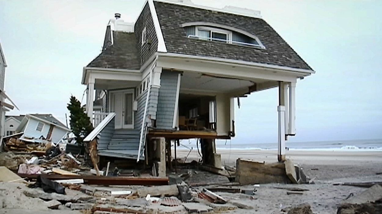
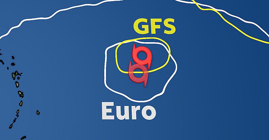
The European computer forecast model truly vaulted into meteorological fame during one of the most unique storms in recent memory: Superstorm Sandy.
The 2012 storm traveled north out of the Caribbean Sea, moving roughly parallel to the U.S. Eastern Seaboard as it went north before its fateful sharp turn to the west.
Eight days before the storm’s devastating and unusual landfall on the New York City area, though, the Euro was the only model to correctly predict the storm’s eventual path: an unusual hard-left turn, straight into the New York City metropolitan area.
This one-of-a-kind forecast is very well-known in weather circles, and the European model is, in general, highly regarded for its handling of tropical system tracks. That reputation moved fully into the public spotlight with its handling of Sandy in 2012.
“Sandy definitely put the Euro on the map, and everyday people were now talking about the European model,” said John Davitt, Spectrum News Chief Meteorologist based in New York City. “To this day, when there's an important forecast, people ask ‘what does the European say?’
“Before (Sandy), they'd simply ask what the forecast was going to be.”
Sandy, though, is far from the only recent tropical system that the Euro correctly forecast.
“I remember the Euro very correctly predicting (Hurricane) Irma (in 2017),” recalled Spectrum News Chief Meteorologist Mike Clay, who is based in Tampa. “(The Euro) even got the wind fields correct 162 hours out.”
When fans of the American model tout its success, the same argument comes up 'But the Euro is better at forecasting the tropics'.
While it's true the European largely built its top-of-the-line reputation for correctly predicting high-profile tropical systems, the GFS has its specialties and victories as well.
For instance, each computer model puts out a series of ensemble members. Those are different versions of the same computer forecast model run with slightly varying initial calculations, providing a suite of different scenarios.
Those different scenarios are overlayed on a common map, and they can help show a certain model’s confidence level.
“Although it's only 20 members, you can view the output of all the members individually or simultaneously, which has great value added here in southern California where you can have such variability due to microclimates,” said Spectrum News meteorologist Jacqueline Bennett, who is based in Los Angeles. “I love having a range of potential outcomes in the winter season, instead of just the median outcome.”
“I check the GEFS (Global Ensemble Forecast System) every single day in the winter season. Not only does it help me estimate rainfall totals, it also helps me estimate the probability of precipitation with more accuracy.”
Even in the tropics where the Euro etched its name, the GFS has had its notable share of wins.
In August 2020, it was the GFS that correctly predicted Category 4 Hurricane Laura’s eventual path over southwestern Louisiana. Meanwhile, the European model showed a more ominous path directly over Houston, Texas that didn’t come to fruition.
Some forecasters also pick the GFS over the Euro in varying snowfall, precipitation, and temperature scenarios. Those are often highly-localized and based on a forecaster's understanding of both computer forecast models and local meteorological nuances.
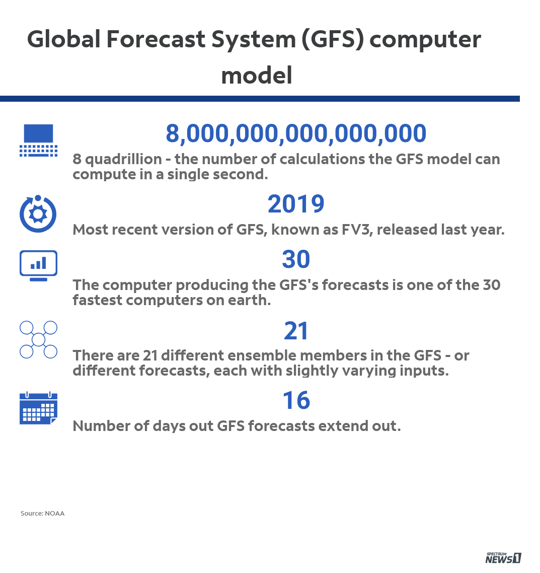
In 2019, NOAA released an updated version of the GFS, known as FV3, that increased the GFS’s computing power and resolution.
Forecasters are already starting to notice some of the GFS’s improvements, and using the American model more in their day-to-day forecasting.
“Recent upgrades to the (GFS) appear to have allowed for some significant improvements,” said Spectrum News Chief Meteorologist Eric Elwell, who is based in Columbus, Ohio. “I think (the GFS) may not be given enough credit for the improvements made.”
While the European model is generally held in higher regard in meteorological circles, the Euro is just one computer model, and models are just one tool a forecaster has at their disposal to predict what might happen.
Clearly, relying on one single weather forecast model isn't the way to go, or even close to it. Both the GFS and Euro have had their share of hits and misses, but taking in all the data the different models have to offer is very important for meteorologists to give the most accurate forecast possible at all times.