
The first snowstorm in weeks will make its way into the Northeast this week. Even though areas south of New York State will be hit hardest, snow is still expected to impact parts of our area late Monday night into Tuesday.
The National Weather Service in Binghamton has issued a Winter Storm Watch and Winter Storm Warning for parts of the region where heavy, accumulating snow is expected Monday night into Tuesday.
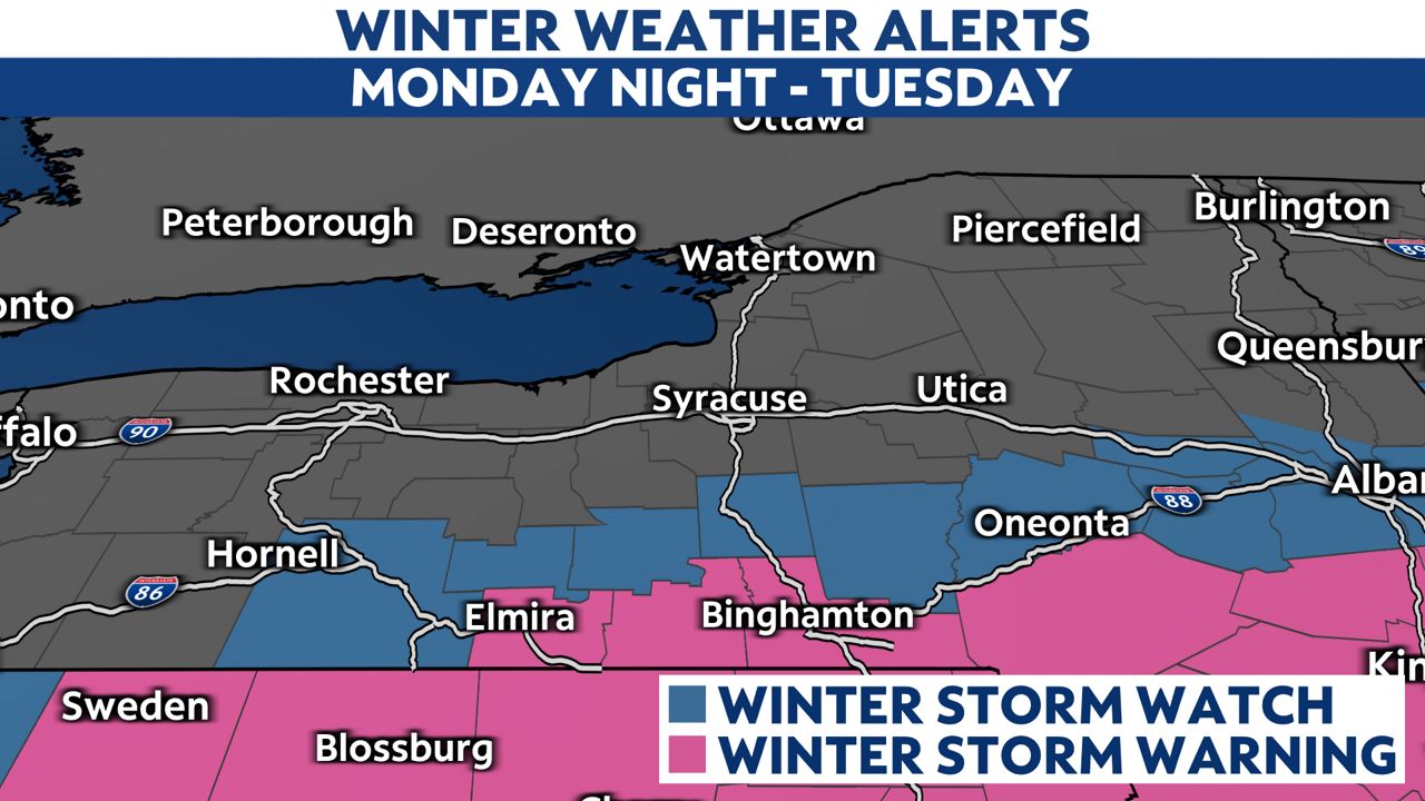
The Southern Tier and Catskills are expected to get the most snow this week. These areas currently stand the best chance of getting at least 6 inches of snow by Tuesday afternoon.
Snow impacts will vary greatly from south to north with this storm. While the Southern Tier and Catskills and will have high impacts, less snow across Central New York and the Mohawk Valley will lead to lower impacts.
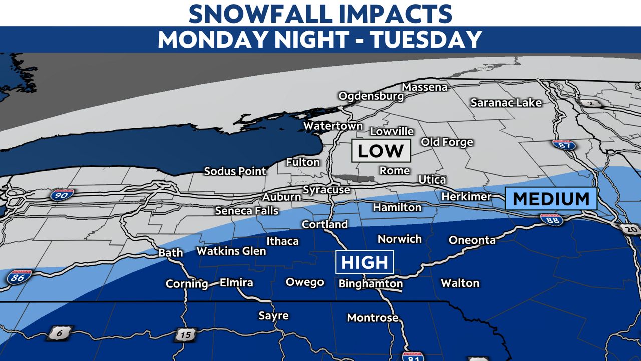
Impacts will be minimal, if at all, for most of the Adirondacks and North Country since the snow is not expected to move far enough north to produce accumulations.
There remains uncertainty with this storm so keep checking back for updates to the forecast as a shift in path of 50 to 100 north or south could lead to major changes to who sees the highest snow totals.
Our team of meteorologists dives deep into the science of weather and breaks down timely weather data and information. To view more weather and climate stories, check out our weather blogs section.