A potent, yet short-lived storm will bring several hazards to the state later on Tuesday into Wednesday.
Snow will continue to spread across the state from the southwest to northeast, with pockets of a wintry mix.
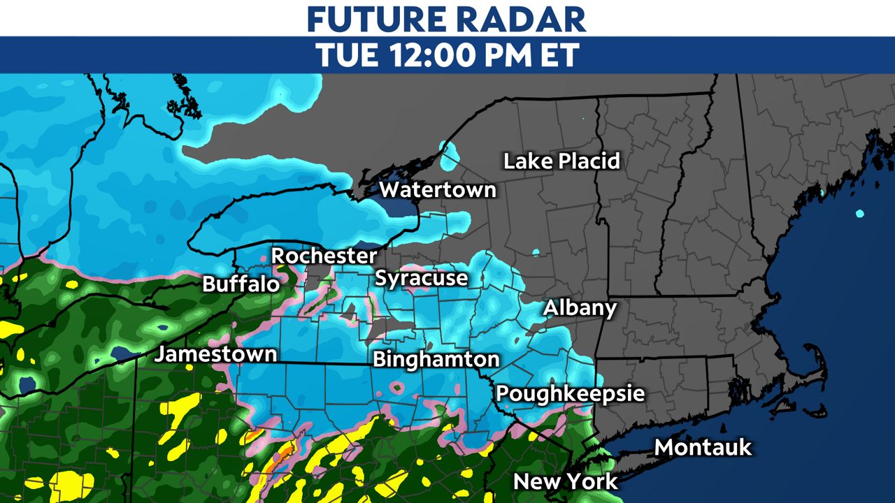
West New York will be the first to see snow transition to an icy mix and rain, while the hills and mountains across Central and East New York hold on to wet snow the longest.
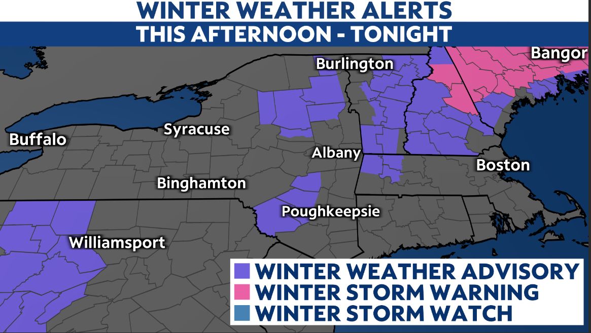
A Winter Weather Advisory remains in effect through Tuesday night for parts of East New York.
Expect the evening commute to be sluggish across most of the state, with areas of widespread rain, which could be heavy at times.
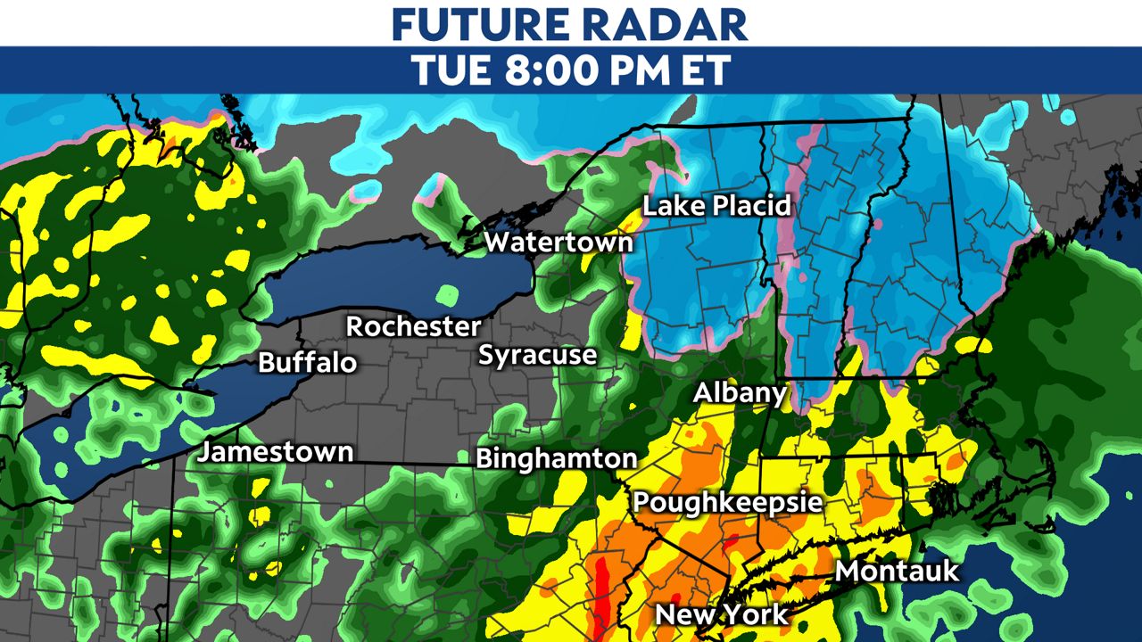
Moderate to heavy rain combined with snowmelt could lead to some localized flooding across parts of Central and East New York Tuesday night into Wednesday morning.
Flood Watches are in effect through Wednesday afternoon.
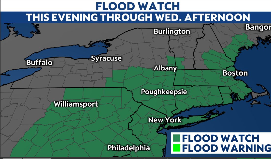
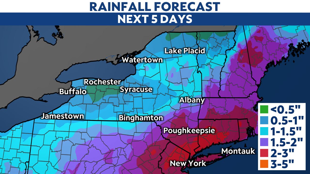
Rainfall totals could exceed a few inches, especially for the Capital Region and areas south across the Hudson Valley. The highest rain totals are expected in the Lower Hudson Valley as rain combined with snowmelt will cause waterways to rise.
Wind alerts stretch across the entire state through Wednesday morning today.
High Wind Warnings are in effect across parts of the state, where the strongest gusts could reach 60 to 70 mph. Wind Advisories are in effect for other parts of the region, where gusts up to 50 mph are still possible.
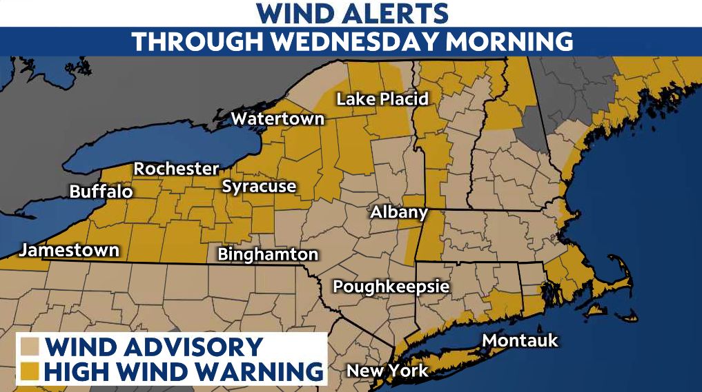
Strong winds will hit West New York the earliest, but will intensify overnight into Wednesday morning across the rest of the region.
The combination of strong, southeasterly winds and a saturated ground will make it easier to take down trees and power lines in some areas. With that, widespread power outages are likely.
You can get ahead of this by charging your devices now and making sure you have a flashlight ready to go in the event we lose power for an extended period.
Because of the abnormally strong winds, all empty tractor trailers and tandem trucks will be restricted from traveling on I-90 from exit 36 (I-81 in Syracuse) to the Pennsylvania border, and I-190 to exit 22 (Route 62), beginning at 10 a.m. Tuesday, until further notice.
Wednesday will be a windy day, however compared to Tuesday, winds will be less intense. We'll see both scattered rain showers and breaks of sun from west to east on Wednesday as temperatures fall.
Our team of meteorologists dives deep into the science of weather and breaks down timely weather data and information. To view more weather and climate stories, check out our weather blogs section.


