We all know that this winter has not lived up to expectations in terms of snowfall here in Central New York.
As of Sunday, we were still running a deficit of over 50 inches for the season.
As spring begins today, despite the lack of wintry weather overall recently, you may be wondering when we usually see our last snowfall of the season.
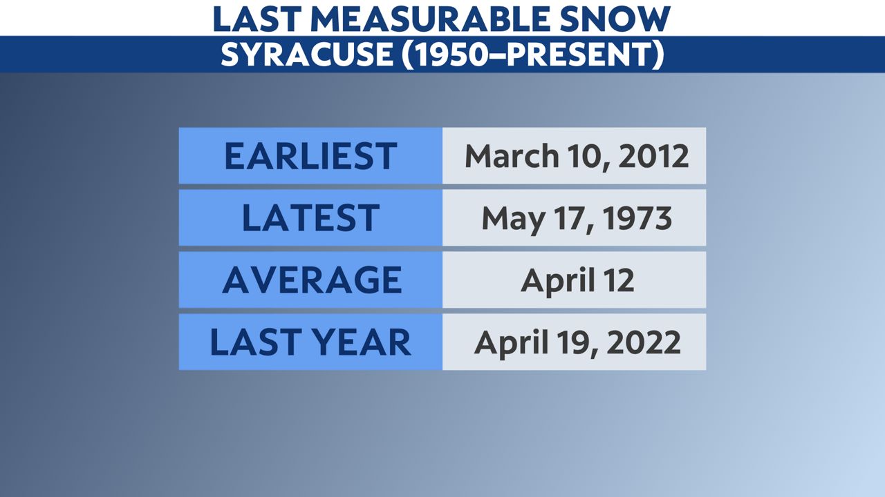
Looking at the data going back to 1950 here in Syracuse, the average date of our last measurable snowfall is April 12. Keep in mind, measurable snowfall is defined as one-tenth of an inch of snow (0.1").
Last year, despite also running well below average in terms of snowfall, our last measurable snow came later than normal on April 19.
We all know that this can occur much later, though, and it certainly has.
The latest measurable snow on record in Syracuse happened on May 17, 1973. Just over an inch of snow fell that day, just one day after hitting a high of 67 degrees!
We are already beyond the ability to set the record for the earliest final snowfall of the season, however. That occurred on March 10, 2012.

Even though it's likely that we will not catch up to average snowfall this season here in Syracuse, history shows us it's not a great idea to take the snow brush out of your car just yet.
Our team of meteorologists dives deep into the science of weather and breaks down timely weather data and information. To view more weather and climate stories, check out our weather blogs section.


