Our snowfall deficit continues here in central New York.
As of the end of the day on Sunday, Syracuse has only picked up on 39.9 inches of snow so far this season.
On average, for this point in the season, we pick up on 95.4 inches of snow.
That’s a 55.5-inch deficit.
Looking at just meteorological winter—the months of December, January and February for statistical purposes—we have picked up 36.2 inches, a 49.2-inch deficit.
Now that we are nearing the end of February—also the end of meteorological winter—you are probably wondering if there is any big chance for snow on the horizon.
We are already tracking our next big storm system for late Wednesday and Thursday, which at this point looks to bring us more in the way of a wintry mix as opposed to just snow.
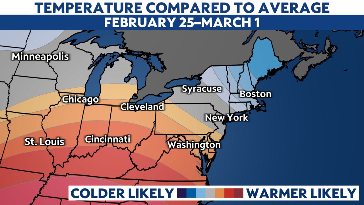
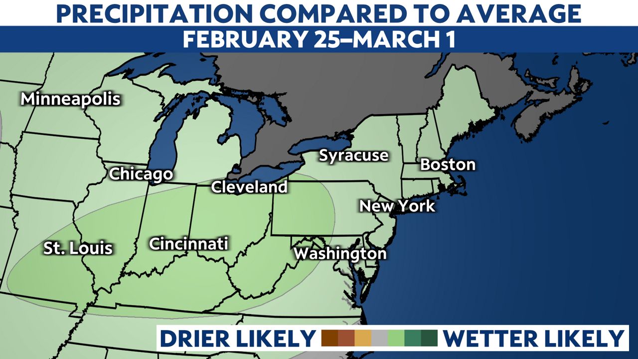
Looking at the Climate Prediction Center outlook through the end of the month, it looks like near-average temperatures and precipitation can be expected.


Keep in mind, average temperatures here in Syracuse are now on the rise above the freezing mark.
It’s hard to imagine any big gains for seasonal snowfall in Syracuse in the short-term, but we all know that there can always be a late-season surprise to help boost those numbers.
We are in the middle of one of the least snowy meteorological winters on record in Syracuse.

For statistical purposes, we classify meteorological winter as the months of December, January and February.
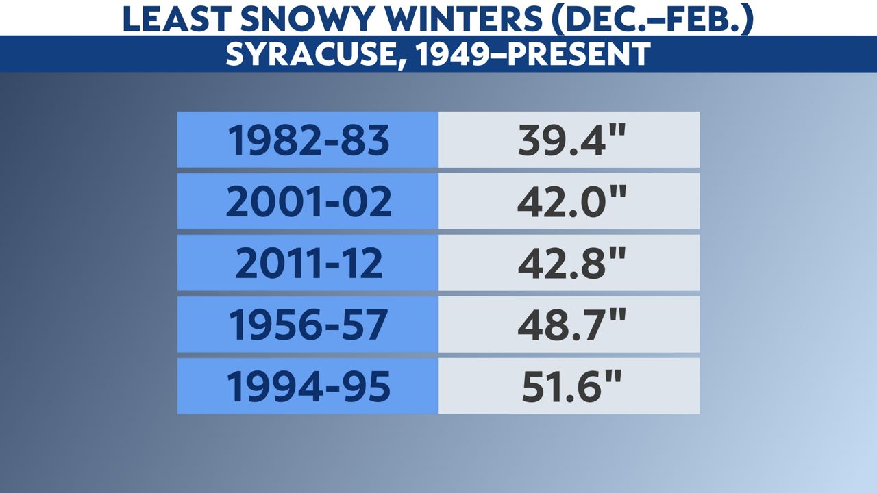
If winter ended on Sunday, the 2022-23 season would indeed be the least snowy on record.
While it’s hard to imagine not surpassing the snow total from 1982-83 by the end of the month, it’s almost a certainty that this winter will go down in the history books as being a “winter that wasn’t.”
Our team of meteorologists dives deep into the science of weather and breaks down timely weather data and information. To view more weather and climate stories, check out our weather blogs section.


