


We all know the term ‘January thaw,’ but it definitely feels like this month has taken that concept to an extreme.
It has been an unseasonably mild start to 2023 here in Syracuse.
We have had one day with a high in the 50s, six days with highs in the 40s, six days with highs in the 30s, and only two days with a high in the 20s so far this month.
To put this in perspective, the average high starts at 33 on Jan. 1 and ends up at 31 by the end of the month.
Only two days so far this year has been below average in terms of high temperature. The rest have been unseasonably warm.
There have also been some pretty mild nights recently.
There have only been three lows this month in the teens, while six have been in the 20s, five in the 30s, and even one in the 40s.
Consider the fact that the average low begins the month at 19 degrees, dropping to 15 by the end of the month.
Only two nights have been below average temperature-wise so far this year.
Looking at our weather history, we know the average temperature for the month of January as a whole (the average of all the daily highs and lows) comes out to 24.1 degrees.
As of the end of the day on Saturday, the average temperature stood at 33.8 degrees.
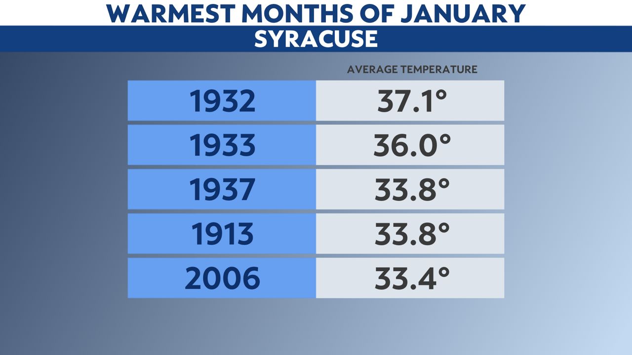
If the month had ended at that point, it would be the third-warmest January on record in Syracuse.
Looking ahead, our odds of above-average temperatures remain elevated right toward the end of the month per the latest Climate Prediction Center outlook.
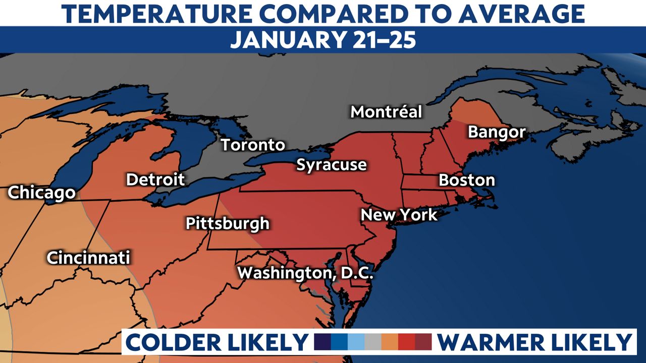
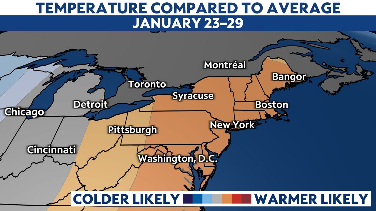
If the current trend continues, January 2023 may indeed be one of the warmest—if not the warmest—January on record in the Salt City.
Our team of meteorologists dives deep into the science of weather and breaks down timely weather data and information. To view more weather and climate stories, check out our weather blogs section.