


Here in Syracuse, August made its arrival known, bringing hot and humid conditions to Central New York.
From Aug. 1 to Aug. 8, the coolest high temperature we reached here in the Salt City was 82 degrees.
Four of the first eight days of the month we got into the 90s for daytime highs.
We managed to achieve an official heat wave as well, with a high of 90 degrees or higher on Aug. 6, 7 and 8.
Remember, a heat wave in this part of the country is a stretch of three or more days of 90-degree warmth or greater.
But enough about the daytime highs. How about those nighttime lows?
If you were thinking it had been a remarkable stretch of uncomfortable nights, you would be correct.
In fact, it was almost record-tying.
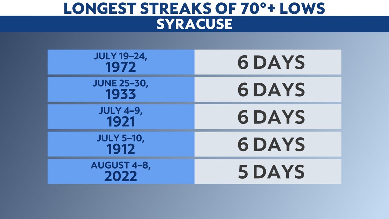
The longest amount of consecutive nights we have ever had on record with a low that doesn’t drop below 70 degrees in Syracuse is six.
This occurred in 1912, 1921, 1933 and 1972.
The low temperatures from Aug. 4–8, 2022, did not get below 70, making this one of the longest stretches of warm nights in recorded weather history here.
Last summer, we had two stretches of nighttime warmth just like this; one in June and the other in August.
Before 2021, you have to go all the way back to 1952 for a five-day stretch of 70+ degree low temperatures.
Take a deep breath before opening those energy bills for the month of August, as your fans and air conditioners were probably working overtime to keep you cool during the recent hot days and extraordinarily stuffy nights.
Our team of meteorologists dive deep into the science of weather and break down timely weather data and information. To view more weather and climate stories, check out our weather blogs section.