High heat and humidity sticks around for several days and you may be wondering if there is any relief in sight?
What You Need To Know
- A Heat Advisory is up in our valleys until 8 p.m. today and will continue for the Hudson Valley through tomorrow
- Hot temperatures and high humidity can quickly lead to heat illnesses like heat exhaustion and heat stroke
- It is best to reschedule strenuous activities to the early morning or evening
- Take extra precautions in the high heat again tomorrow and be on the look out for severe thunderstorms
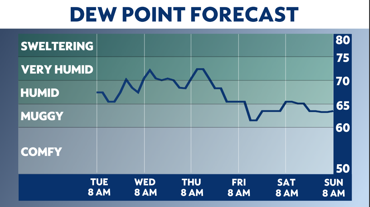
We are in a persistent southwest flow of hot temperatures and humid air. We can expect highs in the 90s with dew points in the 60s and 70s, pushing the heat index near 100 degrees.
While the air is hot and feels thick, not only making us uncomfortable all across our region, it’s the valley locations of eastern New York and in New York City that will become the most oppressive.
The Mohawk and Hudson River valleys are where a Heat Advisory is in effect today.
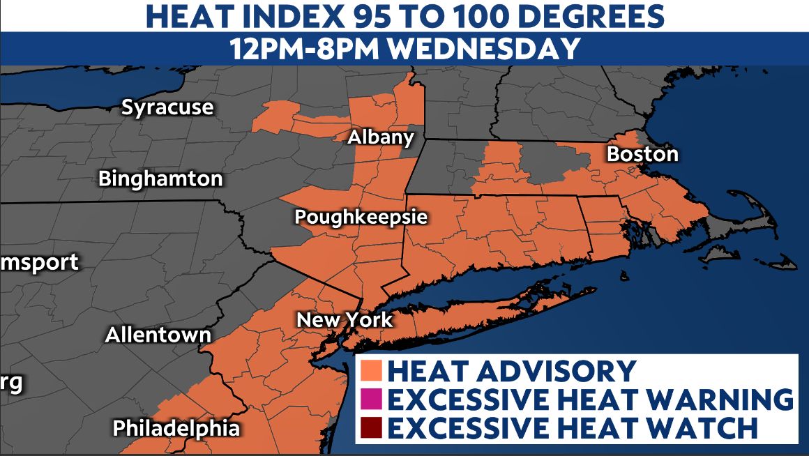
The Hudson Valley and NYC will be under a Heat Advisory again on Thursday from noon until 8 p.m.
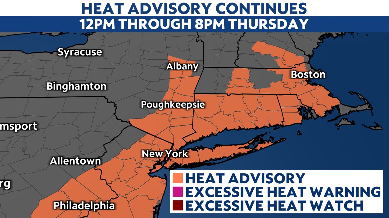
Starting at noon today, our heat index values could range between 95 to 100 degrees in the upstate valleys or as high as 102 degrees in the New York City area.
According to the NWS, “a Heat Advisory is issued when heat and humidity will make it feel like it is 95 to 99 degrees for two or more consecutive days or 100 to 104 degrees for any length of time.”
Hot temperatures and high humidity may cause heat illnesses to occur, so here are some tips on how to stay cool on these sweltering summer days.
Those without air conditioning in the New York City area will have access to cooling stations open for city residents. For more information, you can call 3 1 1 to identify cooling center locations and get ‘Beat the Heat’ safety tips.
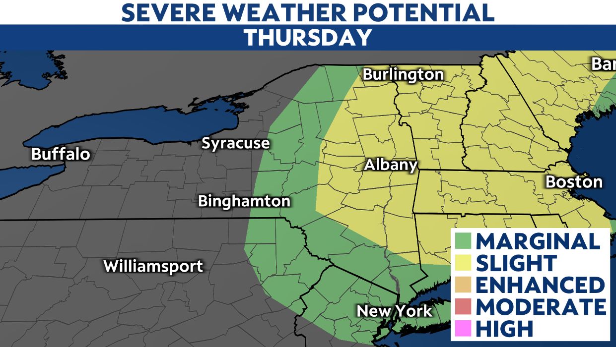
While we bask under hazy sunshine with hardly a south breeze to make a difference, it’s tomorrow’s weather that turns a bit more active.
Eastern New York is in a Slight Risk (2 out of 5) for severe thunderstorms.
While there could be a passing downpour or rumble early on, storms from midday through the afternoon we’ll be keeping a close eye on for severe potential.
An unstable air mass is primed for pop up storm activity as a disturbance slips across the region into the afternoon.
While not widespread, any storms that develop might come through in repeated clusters, possibly forming a bow echo that can indicate strong, damaging winds in excess of 58 miles-per-hour, hail of one inch in diameter or larger and locally torrential rainfall.
While we’ll continue to run above average, we may catch a break in the high heat and humidity come Friday into the weekend.
And remember to bring in your pets, make sure they have plenty of water and never leave them in your car!


