We have had a hot and humid stretch of weather all week, and those conditions won't let up until this weekend.
We have seen some showers and storms this week but not a lot of severe weather, but that changes this afternoon.
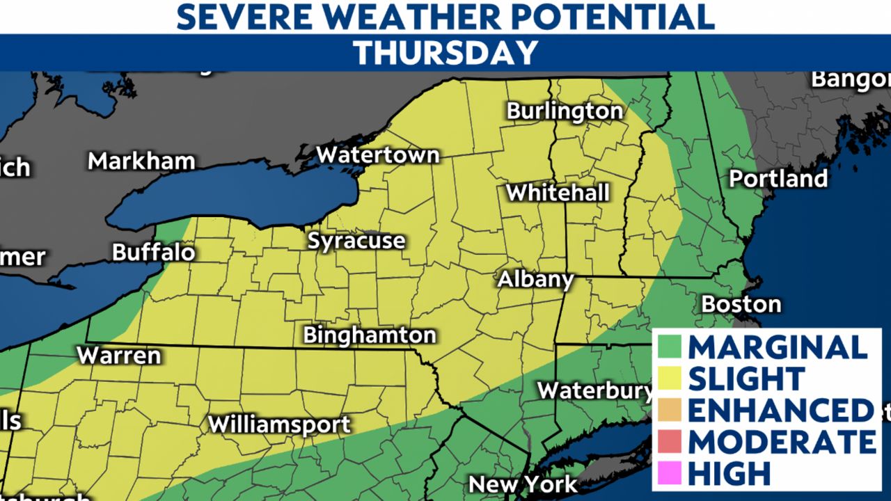
The Storm Prediction Center has all of upstate New York under a slight risk for severe weather, which is the highest it has been all week.

We know when it's hot and humid that showers and storms are possible, as these features make the atmosphere unstable and more favorable for storms. There are other ingredients needed for storms, including a trigger or lift.
We have upper atmospheric energy that will help stir up showers and storms this afternoon, which is why we need to be weather aware.
Looking at severe weather parameters in the atmosphere gives us an idea of what kind of severe weather we could see Thursday.
The atmosphere is holding a large amount of moisture, so that indicates that heavy downpours are possible and can lead to quick pooling and ponding of water.
With this moisture in place, storms that become strong enough with a strong updraft could produce large hail.
There is a lot of convective available potential energy (CAPE) in the air which is what powers these storms. We do see a few features that may cap this energy or, in other words, not allow storms to tap into it that well and therefore making organized severe storms less likely.
With that said, today's severe weather will not be widespread but more disorganized and hit-or-miss.
Be weather aware today by watching Weather on the 1's and staying connected 24/7 with our Spectrum News 1 app.


