We're about a week in to the month of November and in true Upstate New York fashion, we've already had our first taste of winter weather.
Last week, you probably noticed the winter weather advisories and winter storm watches scrolling at the bottom of your TV.
Like many, you might have found yourself wondering, "what's the difference between the two?"
While these scrolls provide our viewers with quick information regarding affected counties and timing, it fails in passing along important details such as accumulations and impacts.
Three commonly issued winter weather alerts are a winter storm watch, winter storm warning, and winter weather advisory.
All three of these alerts pertain to not only snow but also sleet, freezing rain/ice, blowing snow, or any combination of the aforementioned.
In order for the National Weather Service to issue an alert, certain criteria must be met.
An advisory is issued when expected snowfall meets or exceeds 4 inches in a 12 hour period or less.
If a forecast calls for 3 to 6 inches of snow (or any range, for that matter), the mid-point of that snowfall range is used to determine if the advisory threshold is met. In this case, 3 to 6 inches would prompt an advisory.
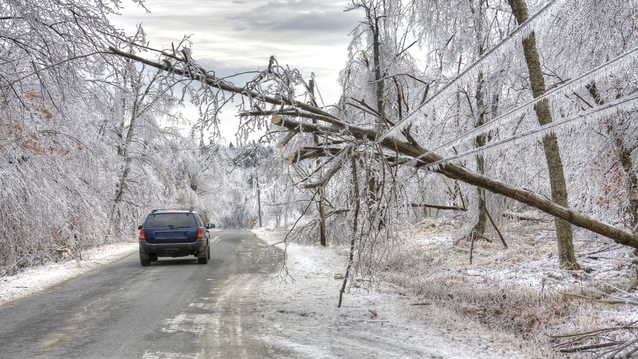
An advisory can also be issued for less than 1/2 inch of ice.
Under this alert, a weather event is either imminent or there is very high confidence it will occur.
A warning is issued when expected snowfall meets or exceeds seven inches in a 12-hour period or less or nine inches in 24 hours. The mid-point rule for a snowfall range applies.
A warning can also be issued for at least 1/2 inch of ice.
Under this alert, a weather event is either imminent or there is very high confidence it will occur.
A watch differs in that it is typically issued two to three days before an anticipated event. While a winter storm is possible with the potential to meet winter storm warning criteria, there is less confidence.
It is assumed that with more certainty toward the event, a winter storm watch will turn into a winter storm warning. However, it's not uncommon for a winter storm watch to turn into a winter weather advisory if the expected severity of the event lessens.
Essentially, a watch is issued to let the public know that it's something meteorologists are watching but it may or may not pan out.
It should be noted that the thresholds distinguishing watches, advisories and warnings are unique to where we live and vary across the country.
In the heart of the winter season, two inches of snow around here is par for the course and only worth a brief mention.
That same two inches of snow, though, is enough for a winter storm warning in Georgia!
The criteria have been developed with an understanding of how adept a region is in handling winter weather.
So the next time you tune in to Weather on the 1s and see the list of alerts scroll at the bottom of the screen, hopefully you'll have a better understanding of what they mean and what to expect for the next round of winter weather that is surely headed our way.