Temperatures have turned cooler in recent days which may have you wondering just how quickly temperatures drop heading into winter and when the first flakes could be flying.
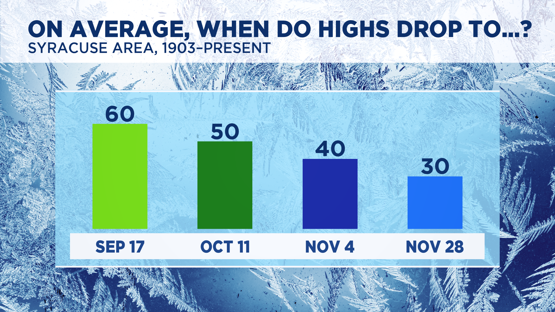
Our typical first day with a high of 60 degrees or cooler is September 17. This year we hit 60 on September 19, almost on schedule with the average.
Highs in Syracuse drop to at least 50 degrees on October 11 on average, using data going back to 1903.
By November 4, we see our first 40-degree day with the first day featuring a high of 30 degrees or colder being recorded on November 28 on average.

We all know colder times are ahead, but how about snowfall? Let’s take a look at some stats that may guide us in seeing when the first flakes could fly this year.
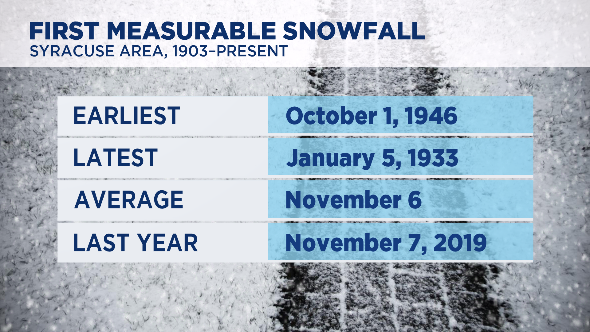
Believe it or not, the earliest measurable snowfall (at least 0.1 inches) took place on October 1 back in 1946 here in Syracuse.
The latest in the winter season we have ever seen at least one tenth of an inch of snow is January 5! This took place back in 1933.
Given these extremes and data going back over 100 years, on average, our first measurable snow falls on November 6, so we could still be about a month out from seeing flakes.
Looking at last year’s snowfall numbers, it took until November 7 to see measurable snow; very close to average.

With a summer that didn’t seem to stop producing historical records or near-records for stretches of warmth, we will see how things play out in terms of how cold and snowy the upcoming winter is.
For now, though, go enjoy a trip to the apple orchard and pumpkin patch. We deserve that before dealing with snow, right?


