
Location, location, location: We always talk about it when it comes to weather, and especially winter weather. That will be no different this year.
When we put our winter weather outlook together, we like to look at teleconnections and previous years that line up similarly. There are many teleconnections, but we use three in particular in our winter weather outlook.
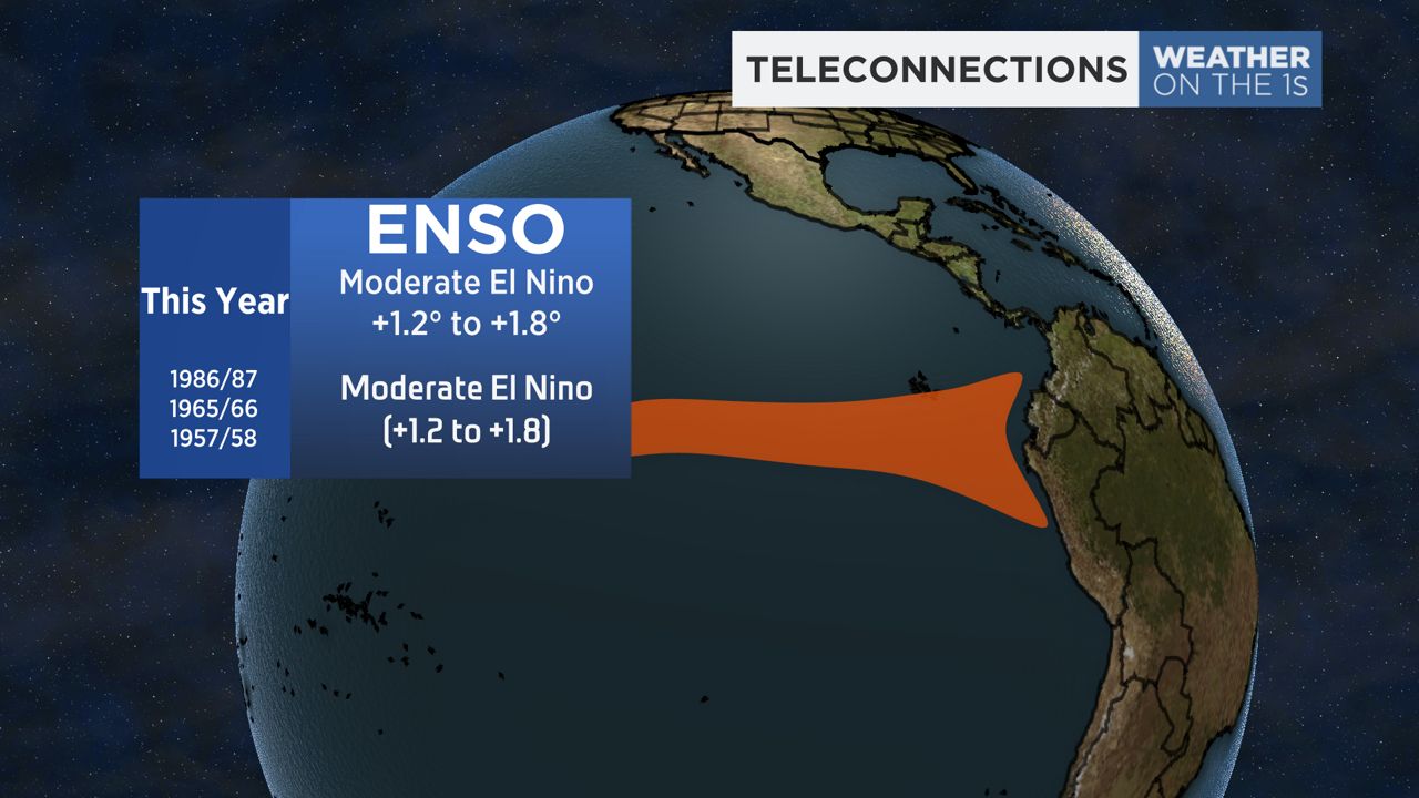
The first teleconnection is ENSO, which stands for El Niño-Southern Oscillation. This tells us whether surface water temperatures along the equatorial Pacific are running above or below average.
If they're above average, it’s called El Niño; if they're below average, it's La Niña. We’d been in La Nina the past few years, but this year we’re expecting a moderate to strong El Niño.
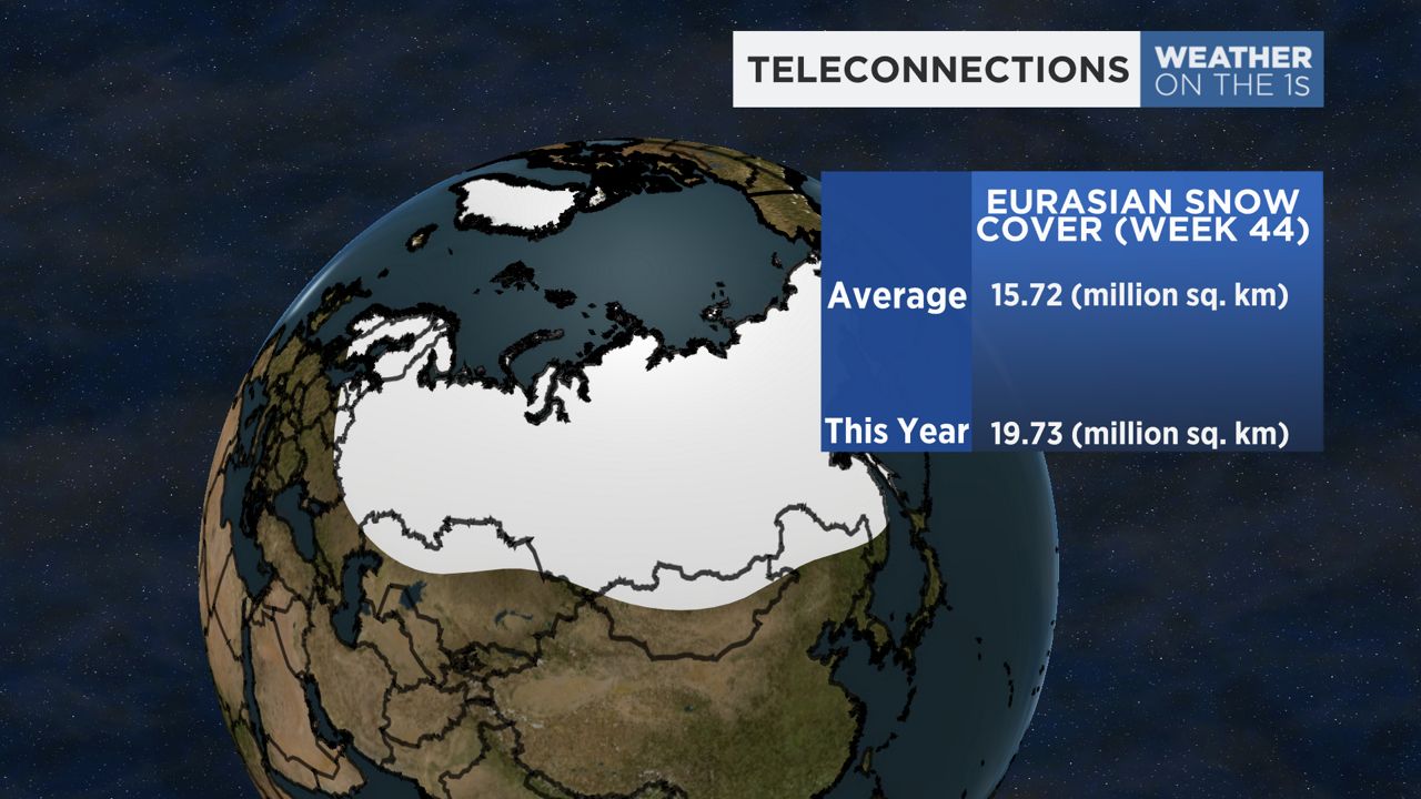
The second teleconnection is how Eurasian snow cover is building into the winter months. More snow means greater chances of developing deep and truly arctic air masses.
At week 44 of the year, we typically see 15.72 million square kilometers (6.07 million square miles) of snow cover across Eurasia. This year, they have 19.73 million square kilometers (7.62 million square miles, about twice the size of the U.S.), which obviously is well above average.
This means greater chances to build deep arctic air masses. Whether those air masses make their way toward us is the question.
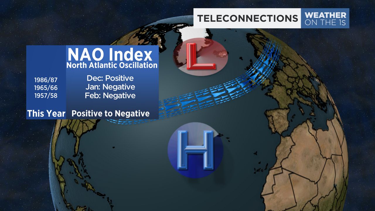
The final teleconnection is the North Atlantic Oscillation, also known as the NAO. This index changes daily, but has a general pattern. This index accounts for two semi-stationary areas of pressure in the Atlantic. They are the Azores high and the Icelandic low.
If those areas of pressure are stronger than average, we’re in a positive phase of the NAO; if they're weaker than average, it’s a negative NAO. When this goes negative, we see more of a blocking pattern and greater chances for cold air intrusions.
This year, we expect more of a positive NAO to start meteorological winter, but go more negative by January and February.
With all this in account, we expect temperatures to trend warmer than average in December, but near to below average starting in January and especially into February.
The combo of a juiced-up subtropical jet stream thanks to El Niño, and a more negative NAO, will bring better chances for coastal storms and nor’easters. We expect above average-snowfall for areas of central and eastern NY because of this.
While a couple decent lake-effect events are likely, as a whole we think the lake snowbelts will finish with below-average snow, including around Buffalo. Keep in mind, some of the snowbelts average well over 200 inches of snow, so even 170 inches of snow would be below average.
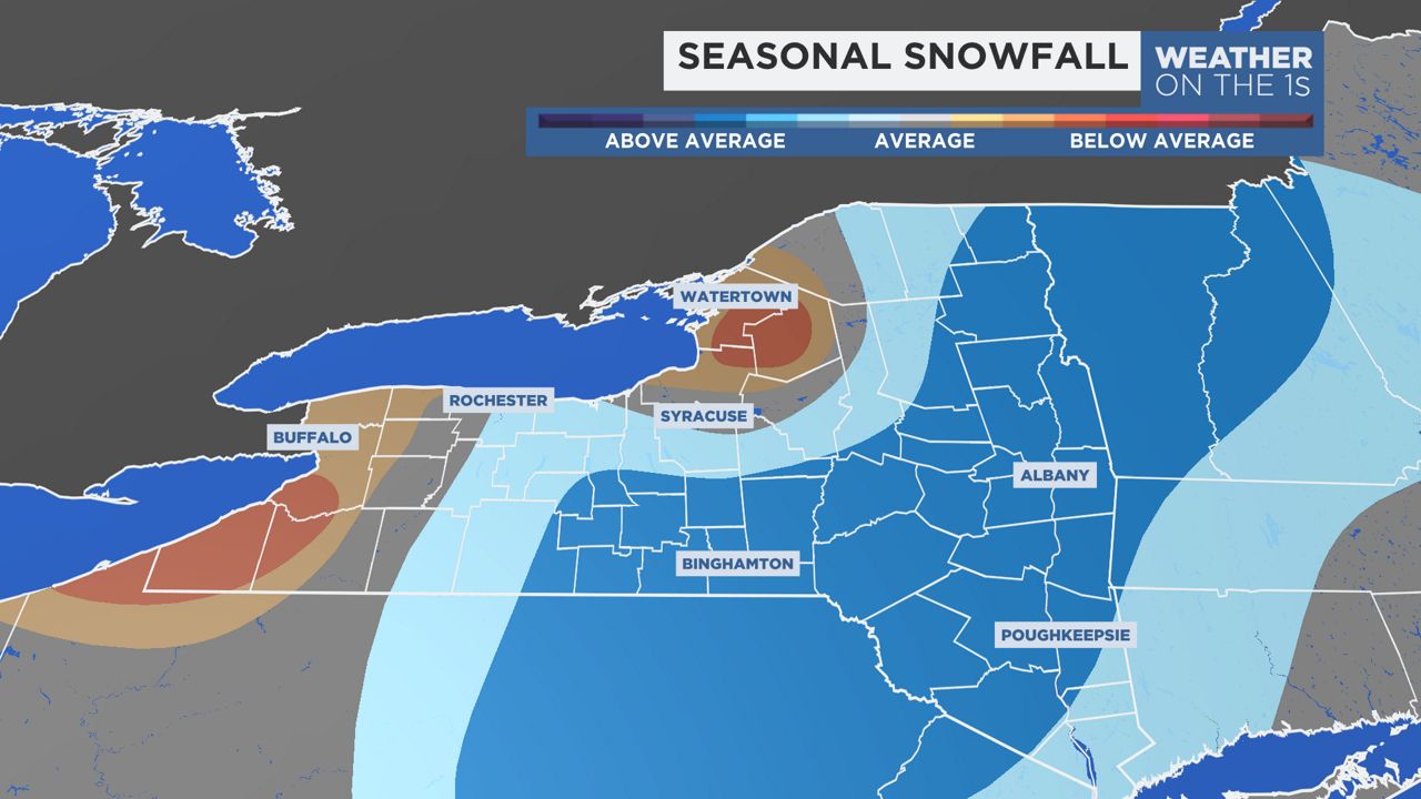
Remember, a seasonal outlook doesn’t forecast individual events, but a general trend for the winter. Even in Buffalo last year, if you remove the two historic events, it was a fairly benign winter season, much like the other Upstate cities.
Everyone will see cold and snow. The question, as always, is how much.
Our team of meteorologists dives deep into the science of weather and breaks down timely weather data and information. To view more weather and climate stories, check out our weather blogs section.