
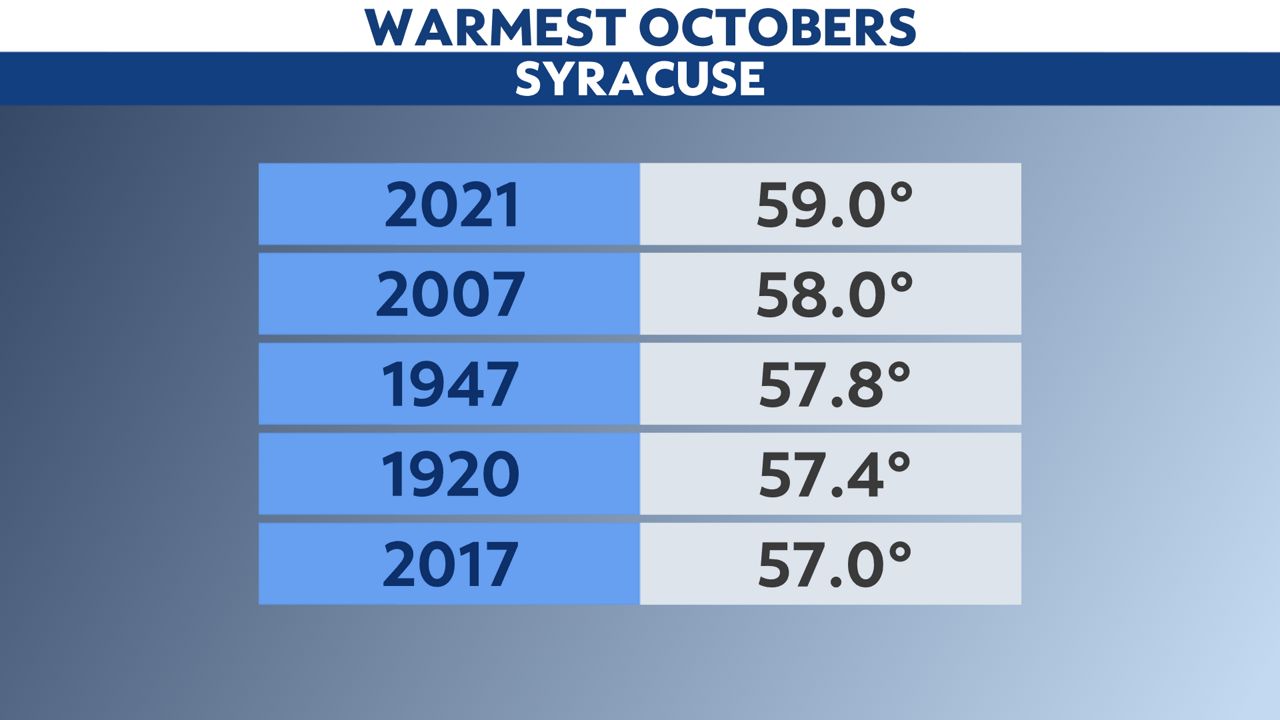
October 2021 ranked the warmest on record here in Syracuse.
In the midst of an already warm year, this fact may not come as a surprise.
Not only was this past October the warmest on record, but it beat out the old holder of that title by a full degree—a remarkable feat in the context of climate statistics.
So, how did we get there?
We spent 14 days in the 70s, which is an outstanding number considering that the average highs for the month start in the mid-60s and end in the mid-50s.
Additionally, more than half of the month saw days with low temperatures staying above average as well. Two days reported lows in the 60s, with another 15 days seeing lows in the 50s. To put it in perspective, average lows for the month typically start in the mid-40s and end in the upper 30s.
Syracuse not only saw temperatures exceed expectations in October, but it also reported a considerable amount of precipitation, too. It ranked the third wettest on record.
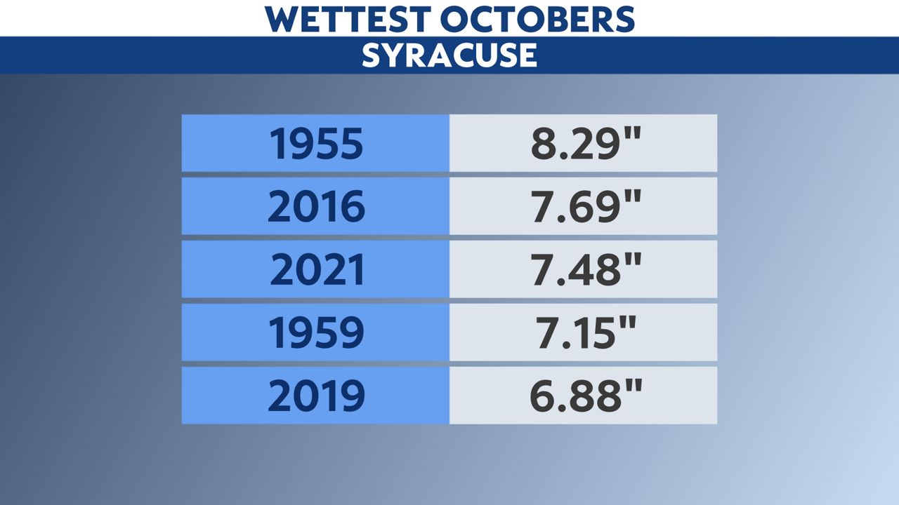
On average, Syracuse picks up 3.89 inches of precipitation during the month of October. This year, we received almost double that: a whopping 7.48 inches of rain. The highest 24-hour total was 2.36 inches, occurring from October 25 to 26.
There were only nine completely dry days the entire month.
As we continue to break new ground in terms of climate milestones this year, all eyes are now on November's weather. We will soon see if this fall as a whole is one for the record books in just a few weeks' time.