
What a month of weather we have had this May across Central New York. From snow and many days of frost advisories and freeze warnings to quickly developing heat and humidity, this region is certainly living up to its famously repeated maxim: If you don't like the weather, wait five minutes and it will change.
Earlier this month, we set a new record for cold temperatures in Syracuse. For the first time on record dating back to 1903, there were five consecutive days with low temperatures at or below 32 degrees. You have to go all the way back to 1978 and then 1947 to find four-day stretches with temperatures like this.
After the cold start, and even some very late-season snowflakes, temperatures have rebounded in a big way over the last few weeks.
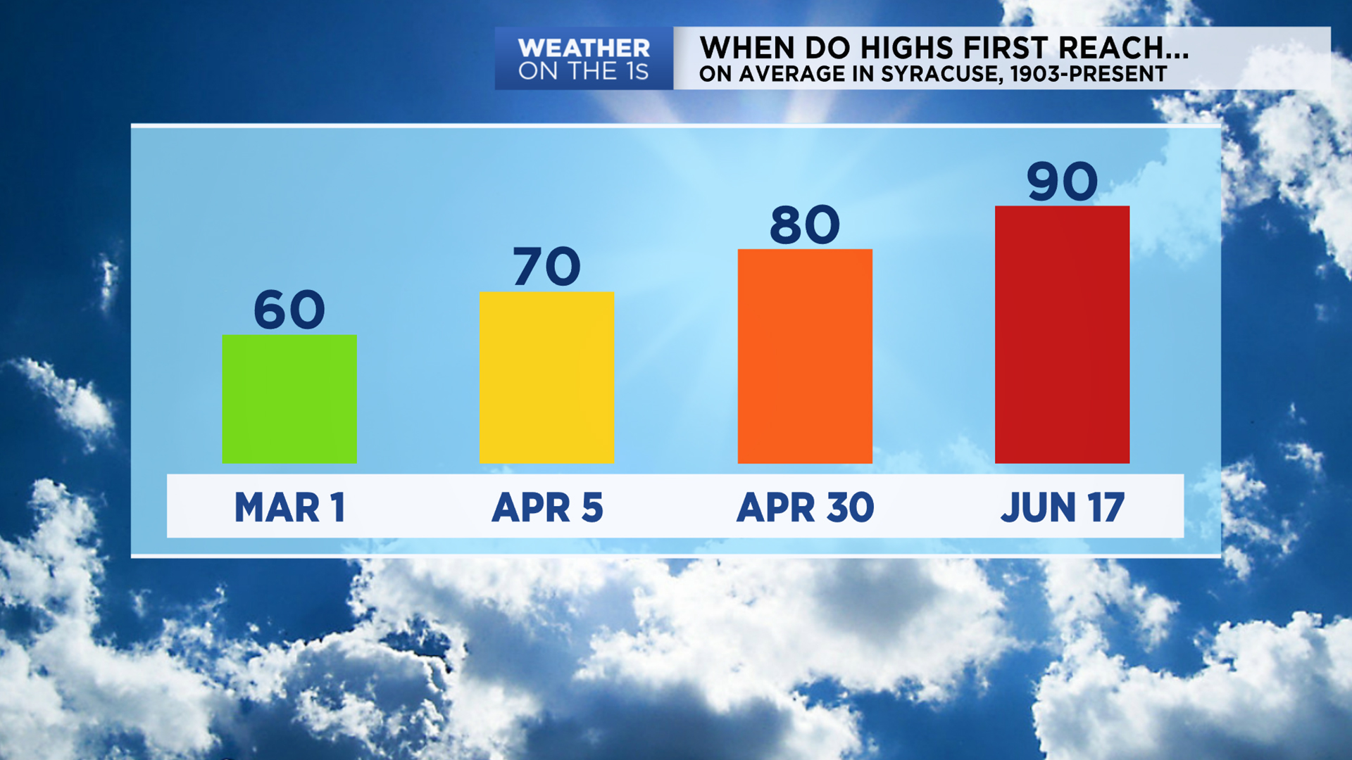
On average, Syracuse sees its first 80+ degree day on April 30. This year, we had to wait a little longer for that kind of heat, all the way until May 15, in fact. Sometimes it can take longer to make it to 80 in any given year. The latest first 80-degree day we have recorded was June 27, 1916.
The heat quickly escalated, and by May 26, we had our first 90+ degree day of the year, with the high topping out at 93 degrees. This also broke the previous record for this day, which was 90 degrees, set in 2011. We usually don't reach 90 for the first time until June 17 on average, given records dating back to 1903.
We have managed a high of 90 sooner than this year, though. Back in 2012, the first 90+ degree day of the year was on April 16.
It looks like some much cooler weather is returning to the forecast through the weekend, giving us a break from this early dose of summery warmth and humidity, only for it to inevitably return sooner rather than later.
)