


A Winter Storm Warning is in effect for all of Western New York through Friday morning/afternoon depending on where you live.
The combination of falling temperatures and increasing snowfall rates will cause extremely slippery roads through the Friday morning commute.
Snowfall rates will be near an inch per hour at times and there will be some blowing and drifting snow. This will reduce visibility, adding another layer of difficulty to the already messy drive.
While four-wheel drive is good for plowing through deep snow, there will be a layer of ice underneath. Use caution, leave space between you and the car in front of you and allow plenty of extra time to get where you need to be.
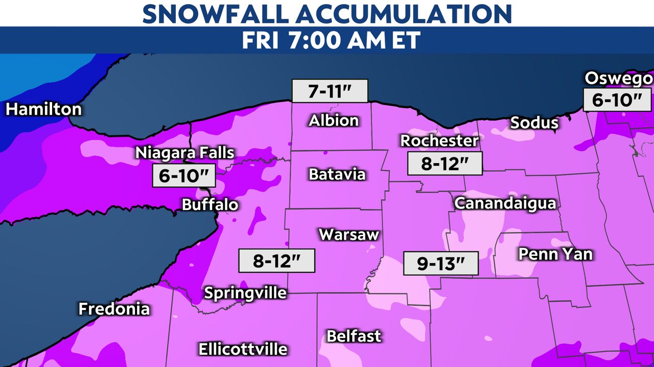
Total snowfall accumulations by 7 a.m. Friday are noted below. Be careful shoveling as there will be a heavy bottom layer. This isn't light lake-effect snow. You will need to scoop, bend, lift and throw.
While the heavy falling will be gone by Friday morning, light snow and localized lake snow will occur. An additional 1-3 inches is expected Friday, with some locally higher amounts near Lake Ontario.
Keep checking in with us for the latest updates and information.
Your local forecast | Send us your weather photos | Sign up for weather notifications