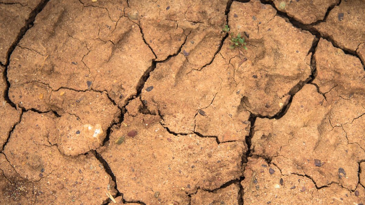
The past couple of weeks across eastern New York and western New England have been very hot, and super dry leaving many waterways running low and resulting in water use restrictions for some communities.
This also has led to dry, burnt lawns and thirsty gardens.
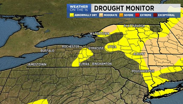
The Drought Monitor map is created by members of the National Drought Mitigation Center (MDMC), the National Oceanic and Atmospheric Administration (NOAA), and the U.S. Department of Agriculture (USDA).
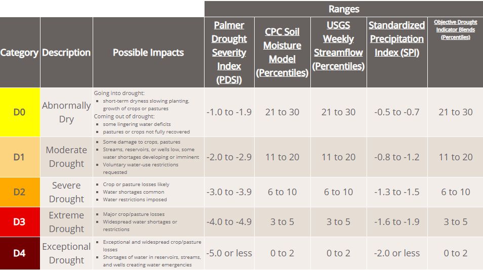
The map is released every Thursday morning and uses four levels of classification to show drought severity.
Unlike most of the weather maps we show on TV or online, the Drought Monitor is not a forecast, but an assessment of drought conditions from the week prior.
Federal, state, and local agencies use the Drought Monitor to:
- Issue public health advisories
- Efficient water supply monitoring
- Fire precaution levels
- Marketing decisions
- Grazing allotments
- Federal agricultural disaster relief, loans, and tax deferral
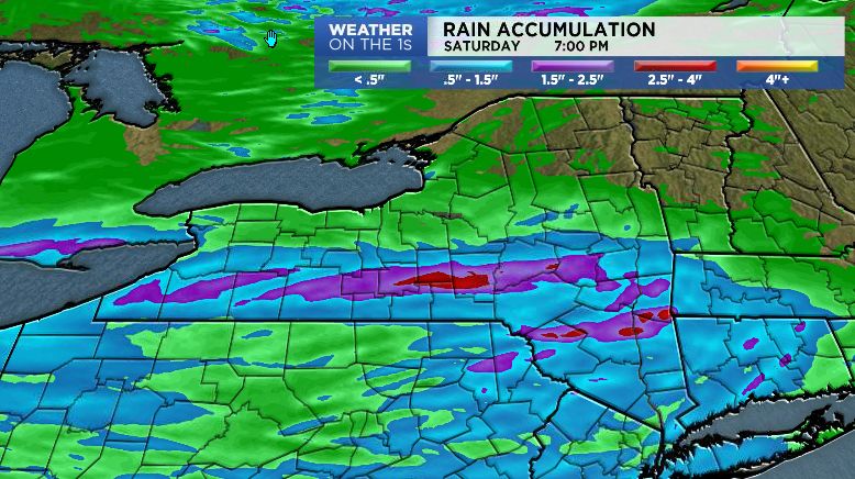
While most of us don’t like to see rain over the weekend, showers and thunderstorms expected on Saturday will certainly be beneficial with eastern areas of New York State currently falling into the abnormally dry category of the Drought Monitor.