Lots of North Carolina snow fans are hungry for snow. After a rather dismal winter last year (really, the past couple of winters have not been much to write home about in some areas), folks are growing impatient. And with each day that passes here in January, the sun angle starts to get a little higher, and the days start to get a little longer.
So is there any hope ahead?
I believe we are heading into a more favorable period for at least the chances for wintry precipitation. I don't think it is an ideal setup, but I think it's one we can work with if you want to get some snow chances around here.
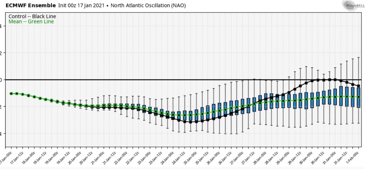
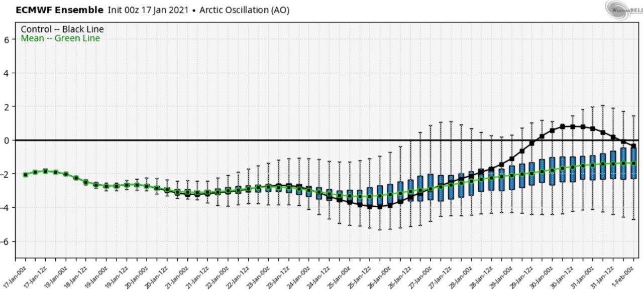
Let's start in the Atlantic. A couple of key factors that are indicative of the overall weather pattern (called teleconnections) are the Arctic Oscillation (AO) and the North Atlantic Oscillation (NAO). While there are exceptions, the NAO and AO being in the "negative phase" is more conducive for wintry precip chances compared to the positive phases.
When the AO is negative, that generally indicates there is a lot of blocking in the high latitudes, which favors large dips in the pattern, or troughs, forming and delivering arctic air southward. And when the NAO is negative, it generally indicates upper level ridging over Greenland and troughing in the eastern U.S. If those patterns lock in and aren't transient, it often creates a favorable track for storm systems in our neck of the woods.
Over the past few winters, it seems it has been easier to catch fairy dust from a passing unicorn that it has been to get any type of sustained negative-phase NAO and AO. However, that is what will likely continue to see through the end of January.
Below is the European model depiction of the NAO and AO moving forward:
So, it appears the Atlantic Ocean side of things is generally favorable for wintry precip chances. What about the Pacific?
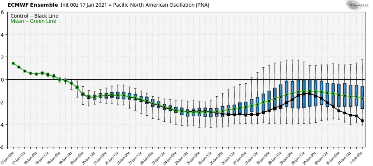
This is where it gets more convoluted. If you really want to lock in a sustained, arctic cold pattern in the eastern U.S., you would look for the negative AO and NAO discussed above in combination with a positive phase of the Pacific-North American Oscillation (PNA). A positive phase of the PNA generally indicates upper level ridging near the west coast and up toward Alaska, and subsequently, troughing and cold air in the eastern US.
Moving forward, it appears the PNA is wanting to go into the negative phase, which usually indicates troughing near the West Coast.
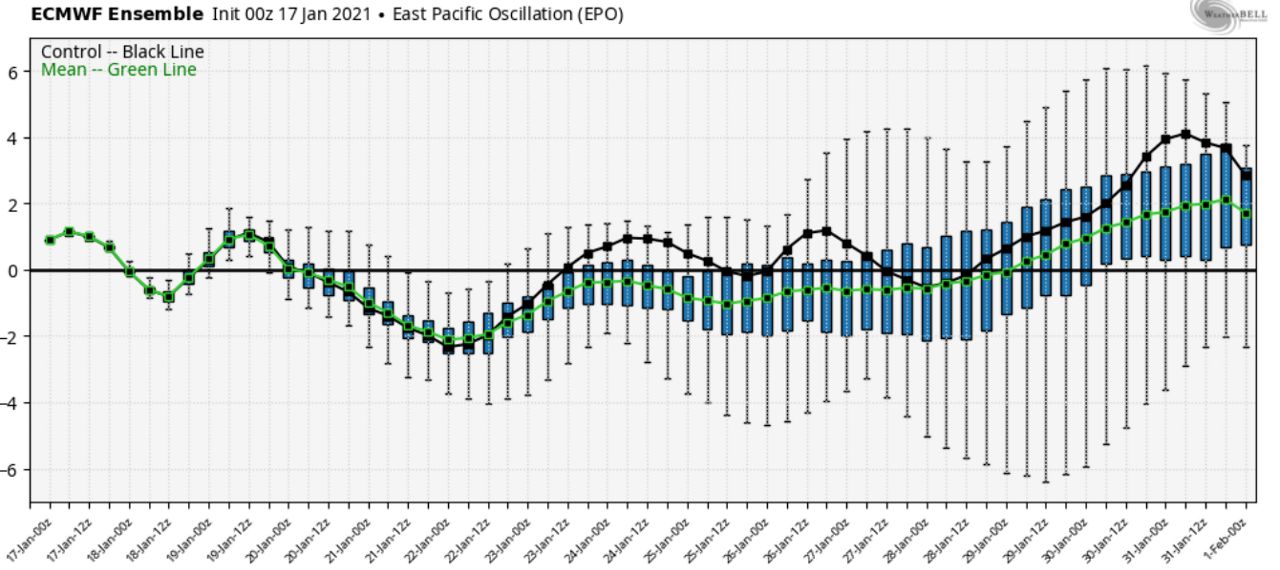
One final oscillation to look at, and one that has been very important over the past few winters, is the East Pacific Oscillation (EPO). Increasingly, it seems the EPO is very important to the weather pattern across the Lower 48. When the EPO is positive (as it has been quite often in recent winters), the weather pattern tends to flood much of North America with mild, Pacific air. However, when the EPO is negative, the result is usually a ridge in the eastern Pacific pushing that milder Pacific air up into Alaska and a tendency to push some of that high-latitude arctic air southward into the Lower 48.
The EPO will be spending some time in the neutral to potentially negative phase through the end of the month.
So what are we left with? While it appears we will tend to have a trough somewhere near the west coast (PNA), the other oscillations are generally favorable for the potential for winter fun and games.
At this point, I think the net result will be much of the final week of January being pretty cold around here, and there will likely be a generally west-to-east storm track across the Lower 48.
For N.C. snow fans, we need to hope that the negative AO and NAO pattern and high-latitude blocking pattern will suppress the storm track far enough to the south to give us a shot. And I will also note that with the AO and NAO in the negative phase, that give us more of a shot to get a big, arctic high pressure locked into place in the Northeast in a favorable position for cold air damming, which so frequently leads to winter weather chances around much of western and central N.C.
Here are a couple of snapshots from the European model showing the upper level pattern and the resulting temperature deviations from normal at 850 millibars, which is a few thousand feet above the ground. These are often good indicators of the type of airmass in place.
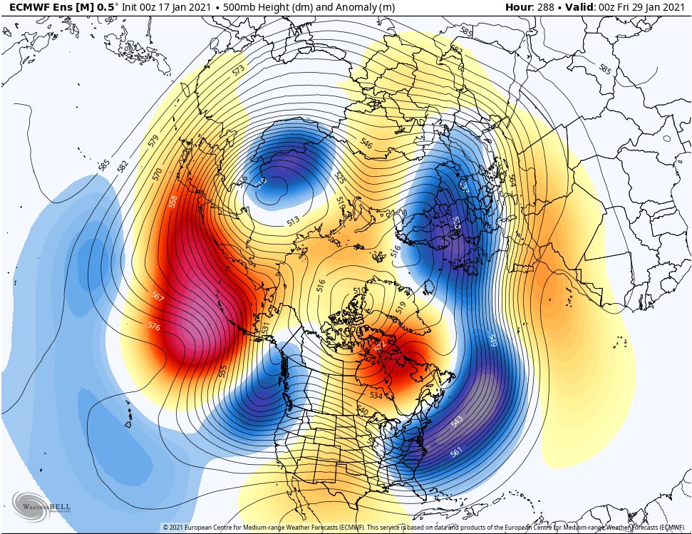
Notice the ridging extending up into Greenland and eastern Canada, and also notice the trough just off the west coast.
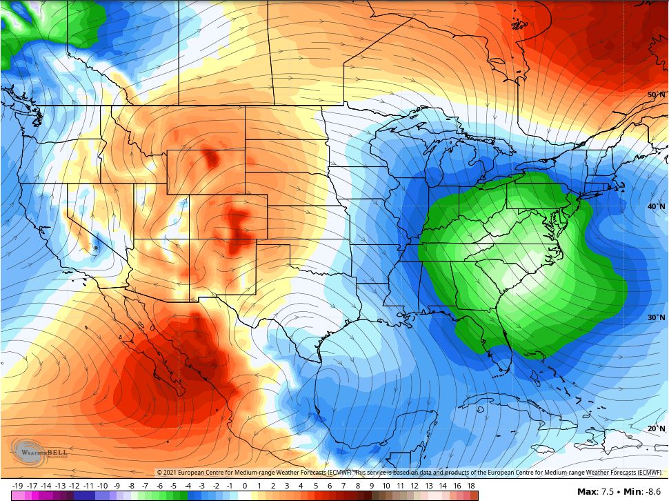
There's lots of cold air at this time (January 29) across the eastern U.S.
So, at this point, I feel the window of opportunity is open for roughly the last week of Jaunary to produce some fun and games. We will see. It's a chaotic and complex pattern, and storm systems could just pop up with rather short notice on the modeling. It's fun to watch and see what transpires.