


Here's some weather honesty for you to start the week -- the forecast for this upcoming weekend is too uncertain for anyone to make an accurate prediction more than 3 to 5 days in advance.
We are certain that after a wet start to the week with warmer than normal temperatures through midweek, much colder air will arrive for the end of this week. Most of North Carolina will see highs only in the 30s and 40s Friday.
As the cold air arrives, there are signs light precipitation may fall across parts of the state late Thursday night into early Friday morning. It would be cold enough for that precipitation to fall as light snow in the Piedmont and western North Carolina. Amounts would likely be light with limited impacts on the region. It is important to note that not all computer models show the precipitation during this time period.
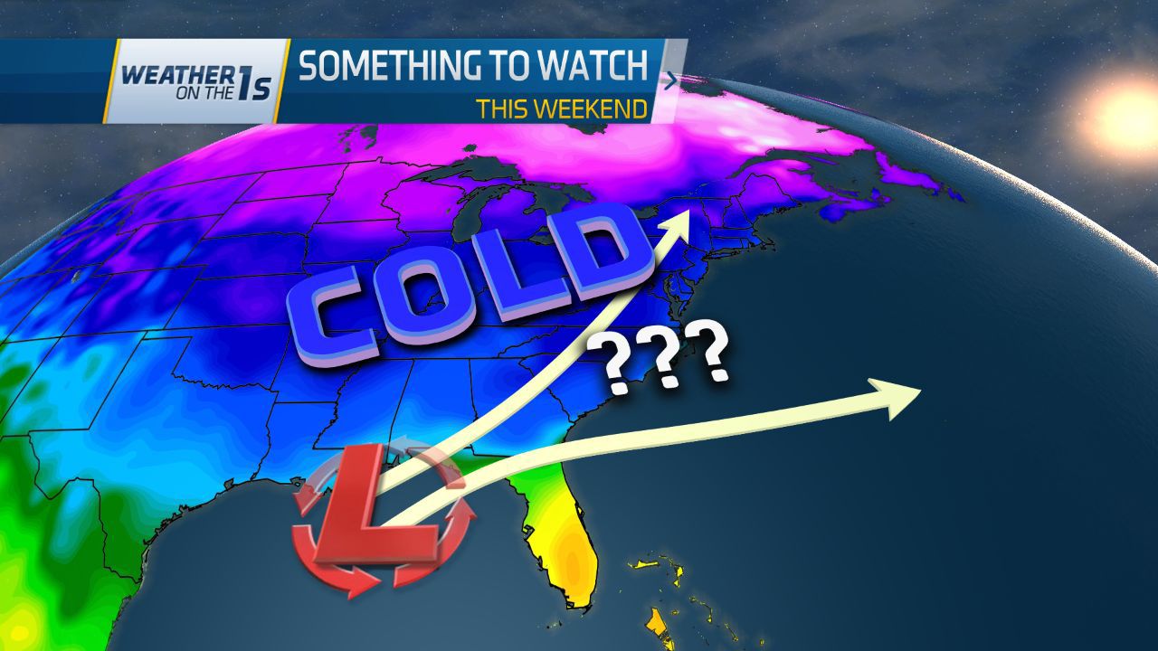
Some computer models have shown another system with more precipitation arriving sometime around Saturday (January 7). Cold air would be in place over the state at that point. However, the two main computer models we use to forecast weather several days in advance have not been very consistent in the track of this system, the strength of the low pressure, the timing, and how much (if any) precipitation it would produce in the state. Those two models - the American (GFS) model and the European model disagree with each other on all four factors.
If you follow forecasts from weather apps from national sources, you will see the forecast for Friday through Sunday change up to several times a day this week. Some of those forecasts are almost solely based on those computer models which could show a completely different forecast on each model run.
The ingredients that will come together in our atmosphere to effect our weather by this weekend have not yet developed or are still far away from the United States. Until those form and come closer to us, no one can be certain about the weekend forecast.
This is the type of weather pattern that can produce snow in North Carolina, but the weekend system could also easily take a path that just produces just rain or take a path that produces no precipitation at all.
For now, don't trust any source that is definitely calling for snow more than 3 to 5 days in advance. Sure, it's possible, but there are other possibilities as well. The science of meteorology is just not strong enough to definitely call for wintry precipitation in our part of the country several days in advance.
For reliable and responsible weather information this week from a team of meteorologists experienced in forecasting North Carolina weather, stay with Weather on the 1s on Time Warner Cable News. We'll continue to follow the latest weather data, and this weekend's forecast should become much clearer over the coming days.