


Temperatures have been above normal across North Carolina for almost two weeks now. There are now signs that this heat wave will finally break down this weekend.
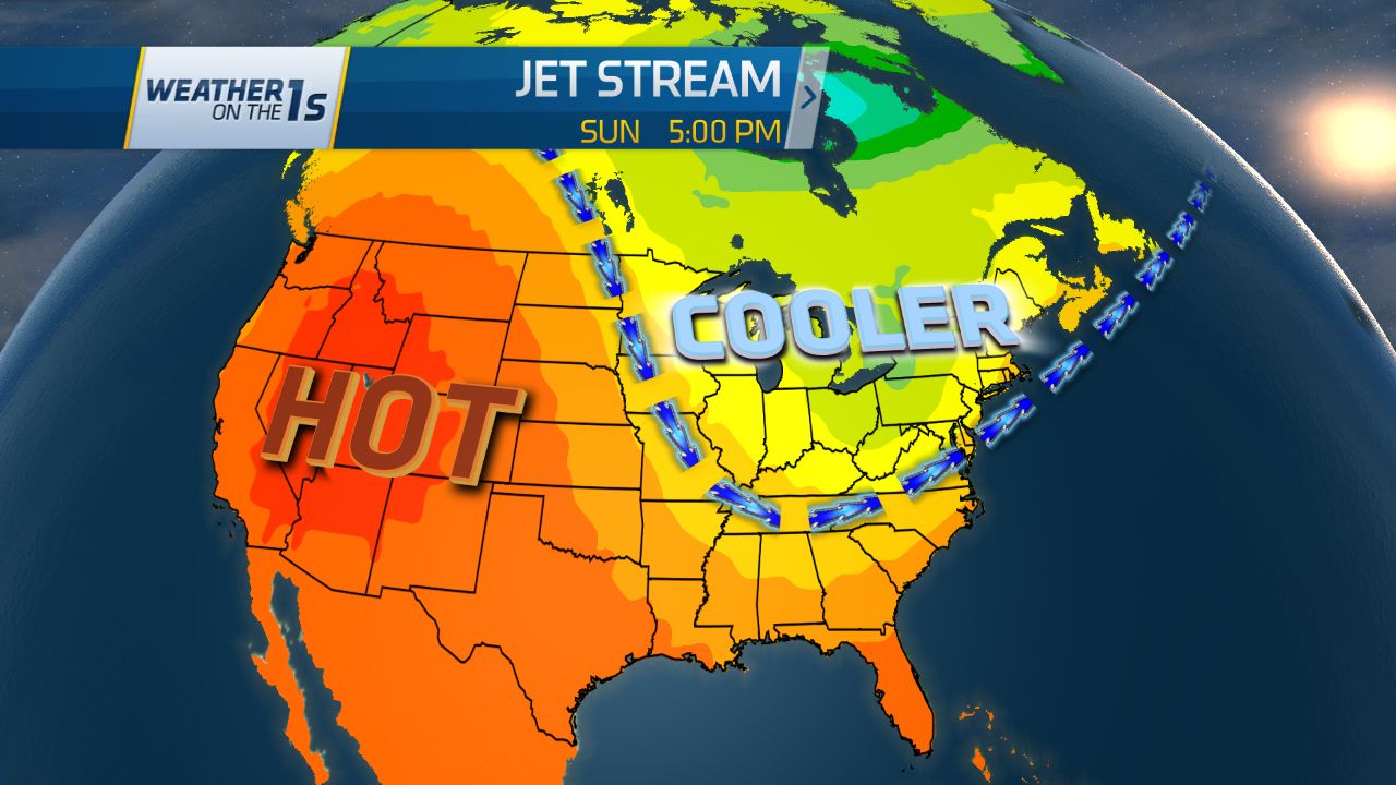
To examine the large scale weather pattern across the country, we must look high into the atmosphere to the level where most jet aircraft fly. The jet stream for the last week or two has been well to the north keeping most of the southeast including North Carolina hot. The image at the top of this article shows the jet stream forecast for this weekend. You will notice the jet moving far to the north across the western half of North America. This "ridge" will result in hot weather across the western United States. In the eastern half of the country, you will notice a dip in the jet stream, or "trough." This will bring cooler air from the north into much of the eastern U.S. including North Carolina.
Cooler air in late June is all relative, of course. Temperatures will return closer to normal to just below normal for late June. Average high temperatures in late June for most of the state outside of the mountains are in the upper 80s to near 90. Highs temperatures in the mid to upper 80s are forecast for much of the state this weekend.

We will not feel this "cooler" air until the weekend though. Highs will remain well into the 90s through the rest of the work week. As the cooler air approaches, look for increasing chances for afternoon and evening showers and storms. A few may pop up Wednesday and Thursday afternoon. However, the highest chances for late day and evening storms will come Friday and Saturday.
Beyond the weekend, it does not appear that the extreme will return for at least the next week or so. The six to ten day temperature outlook from the Climate Prediction Center shows the likelihood for cooler than normal conditions for much of the eastern U.S.

With the cooler than normal outlook, there could still be a day or two next week with highs near to just a little above normal. Highs may stay in the mid 80s to low 90s for much of next week.
Enjoy the "cooler weather" while you can. The long range outlook for July through September still shows above normal temperatures for most of summer.
More weather resources from twcnews.com:
- 7-day forecast for Raleigh, Durham, and Fayetteville
- 7-day forecast for Charlotte
- 7-day forecast for Greensboro, Winston-Salem, and High Point
- 7-day forecast for Wilmington and Jacksonville
- Follow Meteorologist Lee Ringer on Facebook
- Follow @LeeRingerWx on Twitter