WILMINGTON, N.C. -- Thursday and Friday's weather will be dominated by high pressure, which will give us a couple days of sunshine and lower dewpoints with highs in the mid to upper 80s.
Storm chance gradaully increase heading into Labor Day weekend as the cold front that passed through late Wednesday stalls to the south, allowing for disturbances to ride along it. This will up our storm chance Saturday into Labor Day.
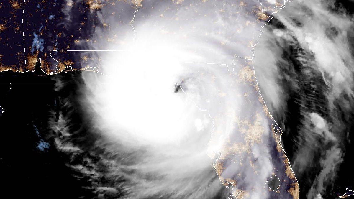
In the meantime, Hurricane Dorian will begin approaching the Southeast coast where it is set to continue to strenghten. Models are beginning to hone in on the potential for a Florida landfall, but after that the track is fairly uncertain. A turn to the north and inland into the Southeast United States -- including the Carolinas -- is something we're going to have to watch out for. Stay tuned!
)