


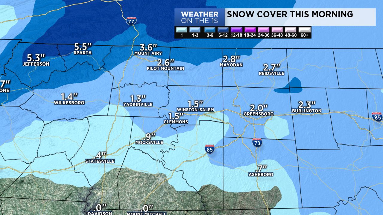
Our snow event behaved about as expected yesterday. This was an event where it is tough to tell you actual snow totals because melting was occurring almost constantly, cutting into the amounts on the ground. But most of the area picked up at least a slushy inch or two with higher totals near the Virginia border and foothill areas. Above is a map estimating snow on the ground before daybreak this morning.
Today will be chilly, but highs will warm well into the 40s, allowing for considerable melting when combined with a March sun angle. It will also be a bit breezy at times. Lows will then head into the mid and upper 20s tonight.
Our Wednesday will feature a partly cloudy sky, and I can't rule out a few snow flurries. Otherwise, it will be a chilly day with highs only in the low to mid 40s.
Thursday and Friday will be much milder with highs close to 60.
Some small shower chances arrive for the weekend, especially Saturday. However, at this point, I am not terribly impressed with the overall rain chances, and I have kept them low for now.