A weather disturbance combined with instability from a cold front produced “training” thunderstorms, leading to flash flooding across the St. Louis metro region.
Thunderstorms were forecasted for the morning hours and around daybreak a complex of storms brought heavy rain to the St. Louis area, but the more intense storms were on the Illinois side of the river, dropping heavy rain from Belleville to Nashville, Ill. Storms on the Missouri side were not expected to become widespread during the morning, leaving room for instability to enhance later in the day.
However, that’s not what happened. The cold front that was progged to move through the region during the late afternoon and evening hours began advancing south around 11 a.m. The complex to the east began back-building storms.
This lead to “training” thunderstorms or storms that moved over the same region, resulting in heavy rain falling in a short amount of time. Parts of St. Charles and St. Louis counties received 1.8 to 2 inches of rain in a mere 45 minutes.

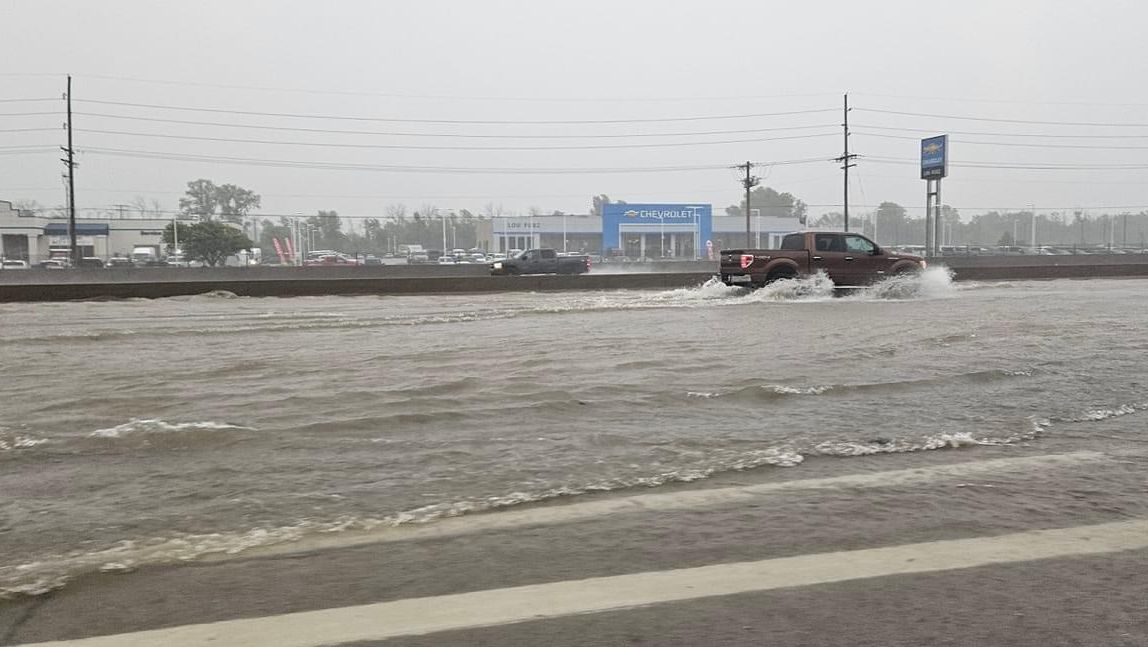
The drains and creeks did not have time to catch up to the heavy rain. This led to flash flooding on numerous streets and highways.
A dam in Washington County overtopped, causing evacuations in Nashville, Ill.
Interstate 70 by Mid Rivers in St. Peters had standing water on it and a few miles west, the road had to be shut down between TR Hughes and Highway 370 for a portion of the day.
Several roads in Eureka, Mo. were closed because of standing water, and Interstate-44 and Highway 141 both had water on them, major thoroughfares for St. Louis commuters.
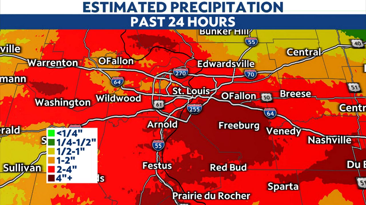
Parts of the Metro East saw two rounds of rain, the early morning heavy rain and the second push when the front crossed. Totals ranged from nearly four inches in St. Charles at the airport to almost seven inches in Shiloh, Ill.

Belleville, Ill. was in the five to six range of rain. So much rain fell so quickly that folks at the Belleville Area Humane Society did not have time to evacuate their residents.
Other parts of the region had already swollen creeks and streams from the remnants of Beryl last week and heavy thunderstorms the week before. The Dardenne Creek in St. Peters toppled its banks and spread into subdivisions. Yards that backed up to the creek looked more like lakes.

Our team of meteorologists dives deep into the science of weather and breaks down timely weather data and information. To view more weather and climate stories, check out our weather blogs section.
)