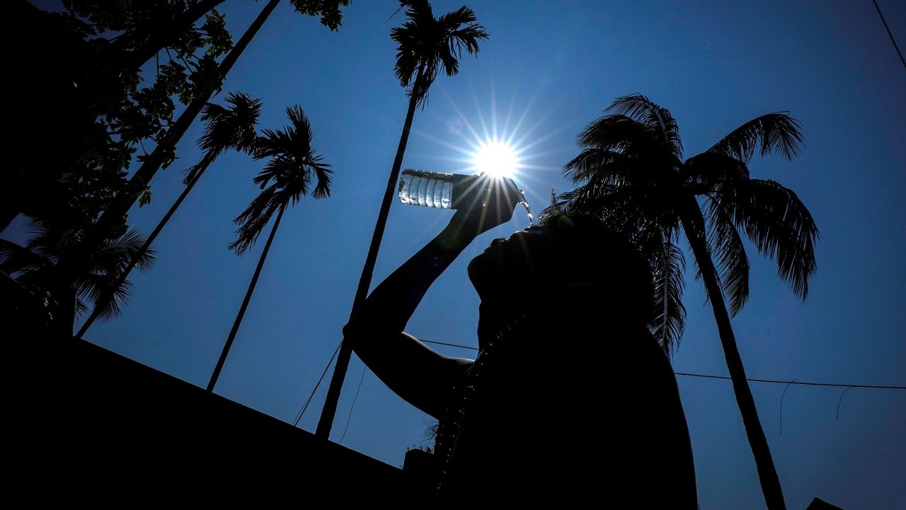
Now that we are nearly a month into summer, the heat, the humidity and even the storm chances each day become almost expected. But what we are not seeing, compared to spring, is the threat of tornadoes.
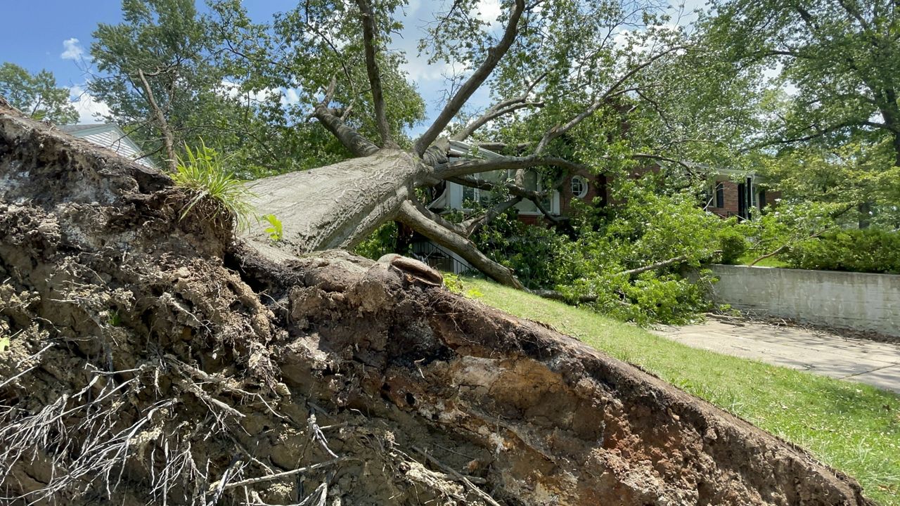
When severe wind damage occurs from a thunderstorm, many assume a tornado caused it. While tornadoes often cause damage to homes and other structures, they are not always the culprit and in the middle part of the country and the south, summer is not when we see tornadic thunderstorms.
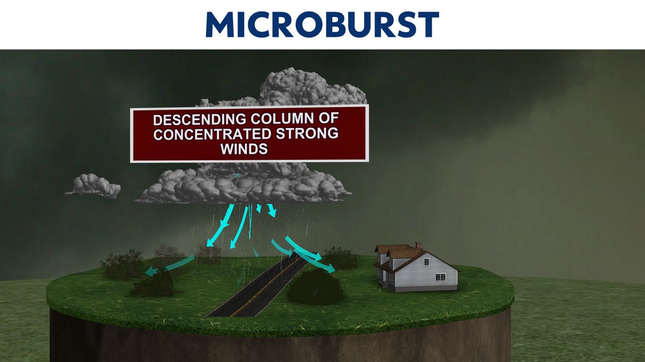
Often, wind damage produced from a thunderstorm is from a common phenomenon called a microburst. It is for this reason people should take a severe thunderstorm warning as seriously as a tornado warning.
Thunderstorms are complex, with winds that feed up into the storm known as an updraft and winds that descend from the storm down to the ground known as downbursts.
When conditions are right, these downbursts can be impressive, reaching speeds over 60 mph.
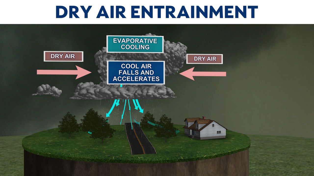
As for how they form, conditions have to be ideal. St. Louis National Weather Service Meteorologist Alex Elmore explains, “We typically look for a lot of fuel for thunderstorms (instability), weak wind shear through the depth of the atmosphere, and drier air near the surface beneath storms.”
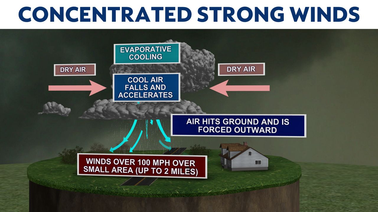
As precipitation falls from the storm and encounters the dry air, water droplets evaporate. This evaporation causes the air to cool and become heavier, which causes the downward column of air to accelerate toward the ground.
Another factor called "water loading" also contributes to the acceleration.
When cooled air with raindrops and hail fall, they gather more and more precipitation, which adds more weight and helps increase the speed of the descending column of air.
When this column of air hits the ground, it spreads out in different directions, and it’s during this time when the winds produced by a microburst can reach up to 100 mph.
During a severe thunderstorm, regardless of whether the threat is a tornado or strong winds associated with a microburst, people should take the same precautions and stay away from windows. They should also move to the interior portion of their home on the lowest level.
Damage is damage regardless of whether it is “straight-line winds” or “twisting winds” from a tornado. Both can be deadly.
“Given the conditions needed for microbursts, summer is typically when Missouri see them,” says Elmore.
Adding, “During summer, the jet stream typically stays well to the north, causing wind shear to be weak. The heat and humidity also lead to a lot of fuel for thunderstorms during the afternoon and evenings.”
Our team of meteorologists dives deep into the science of weather and breaks down timely weather data and information. To view more weather and climate stories, check out our weather blogs section.