


January has started with active weather. It seems like we've seen one storm after the next lately, and this most recent one is dumping frigid air in behind it.
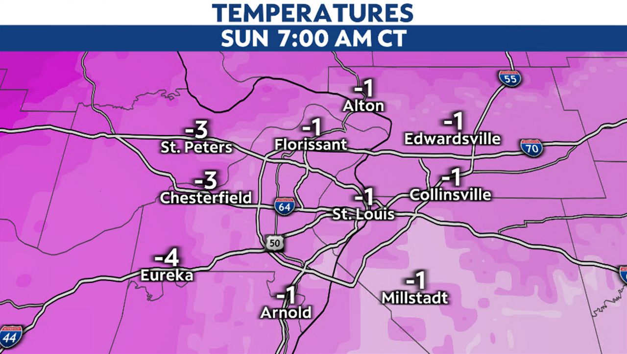
Temperatures Friday night dropped into the teens, but by Saturday night into Sunday morning, lows will be below zero.
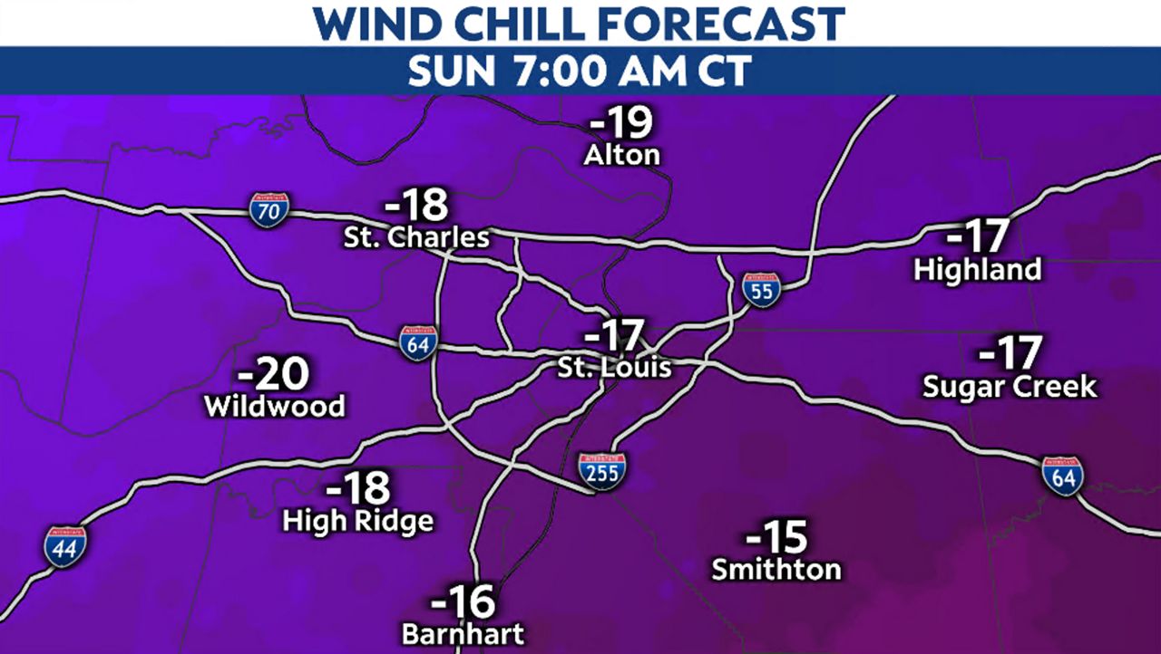
And these are just the actual temperatures, not what it will feel like. Wind chills will drop as low as -15 to -20 degrees, making it dangerous to be outside exposed for even a short time. It won’t take long for frostbite to occur. Learn the signs here.
The cold sticks around through early next week, with temperatures rising to near freezing by Wednesday. Here are some tips to prepare your house for the extreme cold.
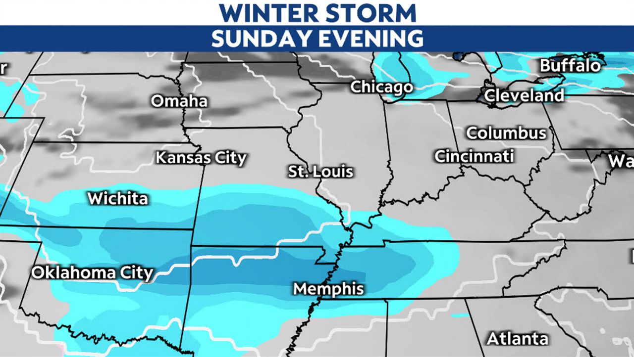
Cold air will be in place as another storm system heads our way from Sunday afternoon into Monday morning. As previously mentioned, the path the disturbance takes determines how much snow our region will see.
Recent model data has a weaker storm tracking to our south. While a few snowflakes aren't out of the question Sunday evening, it doesn't look to be a big snowmaker in the metro.
Our team of meteorologists dives deep into the science of weather and breaks down timely weather data and information. To view more weather and climate stories, check out our weather blogs section.